Property Record
5000 State Highway 31 Hwy W, Tyler, TX 75709
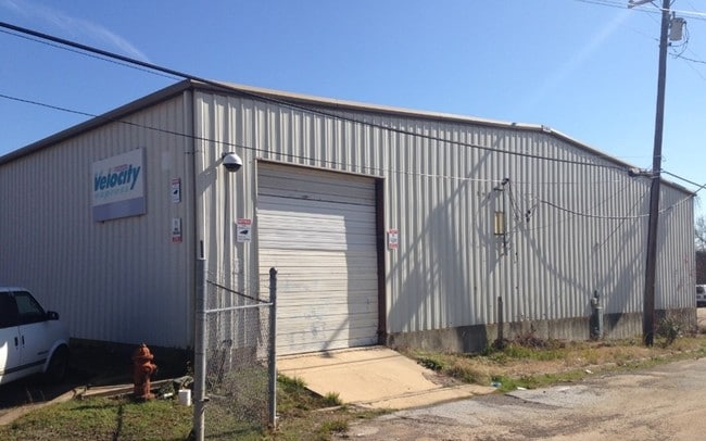

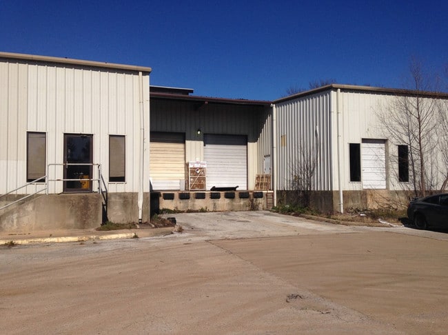
Property Detail
5000 State Highway 31 Hwy W
1-00000-0643-04-011030
ABST A0643 G MYERSTRACT 11C (AKA NCB 909 LT 14)
Warehouse
SMITH
M1
Texas
B and X Area of moderate flood hazard, usually the area between the limits of the 100-year and 500-year floods.
14
2025
4.12 AC
2025
Tyler
001602
Other Market Areas
16,800 SF
Tyler, TX
NEARBY LISTINGS FOR SALE OR LEASE
DEMOGRAPHICS near 5000 State Highway 31 Hwy W
1 mile
3 mile
5 mile
2025 Total Population
1,147
28,776
80,688
2030 Population
1,222
30,366
84,922
Pop Growth 2025-2030
+ 6.54%
+ 5.53%
+ 5.25%
Average Age
39
37
38
2025 Total Households
451
10,502
30,269
HH Growth 2025-2030
+ 5.99%
+ 5.03%
+ 4.68%
Median Household Inc
$66,136
$57,310
$58,768
Avg Household Size
2.60
2.60
2.50
2025 Avg HH Vehicles
2.00
2.00
2.00
Median Home Value
$169,421
$145,892
$190,217
Median Year Built
1978
1970
1972
Nearby Places
Map Layers
Map Styles
 Street
 Aerial
Layers
 Traffic
 Biking
Places
Listings with unknown addresses are not visible on the map
- Restaurants
- Banks
- Shops
- Fitness
- Groceries
PUBLIC TRANSPORTATION
AIRPORT
Tyler Pounds Regional
Drive
Walk
Distance
Tyler Pounds Regional
13 min
5.5 mi
SALE & LEASE HISTORY
LISTING DATE
SALE/LEASE

Sep 25, 2016
For Lease
Jan 12, 2018
For Sale
Nearby Properties
Address
Land Use
TOTAL SIZE
Lot Size
Zoning
Address
Land Use
TOTAL SIZE
Lot Size
Zoning
278 SF
22.07 AC
PMF
Address
Land Use
TOTAL SIZE
Lot Size
Zoning
24.83 AC
Address
Land Use
TOTAL SIZE
Lot Size
Zoning
39.16 AC
C2
Address
Land Use
TOTAL SIZE
Lot Size
Zoning
31.74 AC
Address
Land Use
TOTAL SIZE
Lot Size
Zoning
71,337 SF
15.70 AC
M1
Address
Land Use
TOTAL SIZE
Lot Size
Zoning
53,412 SF
11.17 AC
PMF
Address
Land Use
TOTAL SIZE
Lot Size
Zoning
Address
Land Use
TOTAL SIZE
Lot Size
Zoning
187.64 AC
R1A
Address
Land Use
TOTAL SIZE
Lot Size
Zoning
311.96 AC
Address
Land Use
TOTAL SIZE
Lot Size
Zoning
126.94 AC
Address
Land Use
TOTAL SIZE
Lot Size
Zoning
3,806 SF
18.86 AC
RMF
Address
Land Use
TOTAL SIZE
Lot Size
Zoning
63 AC
R1A
Address
Land Use
TOTAL SIZE
Lot Size
Zoning
22.85 AC
Address
Land Use
TOTAL SIZE
Lot Size
Zoning
722 SF
14 AC
RMF
Address
Land Use
TOTAL SIZE
Lot Size
Zoning
14.16 AC
Address
Land Use
TOTAL SIZE
Lot Size
Zoning
5 AC
R1B
Address
Land Use
TOTAL SIZE
Lot Size
Zoning
45,114 SF
30.60 AC
Address
Land Use
TOTAL SIZE
Lot Size
Zoning
80,070 SF
9.04 AC
Address
Land Use
TOTAL SIZE
Lot Size
Zoning
205,196 SF
25.19 AC
C2
Address
Land Use
TOTAL SIZE
Lot Size
Zoning
85,804 SF
8.69 AC
M1
Address
Land Use
TOTAL SIZE
Lot Size
Zoning
14.02 AC
R2
Address
Land Use
TOTAL SIZE
Lot Size
Zoning
25.57 AC
Address
Land Use
TOTAL SIZE
Lot Size
Zoning
60,956 SF
8.31 AC
M1
Address
Land Use
TOTAL SIZE
Lot Size
Zoning
300,000 SF
27.95 AC
M1
Address
Land Use
TOTAL SIZE
Lot Size
Zoning
60,328 SF
8 AC
M1
Address
Land Use
TOTAL SIZE
Lot Size
Zoning
74,661 SF
7.09 AC
RMF
Address
Land Use
TOTAL SIZE
Lot Size
Zoning
3,490 SF
12.92 AC
RMF
Address
Land Use
TOTAL SIZE
Lot Size
Zoning
968 SF
13.97 AC
M1
Address
Land Use
TOTAL SIZE
Lot Size
Zoning
51,000 SF
52.09 AC
Address
Land Use
TOTAL SIZE
Lot Size
Zoning
171,588 SF
16.21 AC
The World's #1 Commercial Real Estate Marketplace
Connect with us
© 2026 CoStar Group
The information above has been obtained from sources believed reliable. While we do not doubt its accuracy we have not verified it and make no guarantee, warranty or representation about it. It is your responsibility to independently confirm its accuracy and completeness. Any projections, opinions, assumptions, or estimates used are for example only and do not represent the current or future performance of the property. The value of this transaction to you depends on tax and other factors which should be evaluated by your tax, financial, and legal advisors. You and your advisors should conduct a careful, independent investigation of the property to determine to your satisfaction the suitability of the property for your needs.