Property Record
50000 Ecorse Rd, Van Buren Township, MI 48111


NEARBY LISTINGS FOR SALE OR LEASE
-
-
View all Van Buren Township listings for sale on LoopNet.com
Property Detail
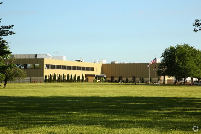
50000 Ecorse Rd
Detroit-Warren-Dearborn, MI
Supervisors Van Buren
83-024-99-0006-702
*06Q1A2- -Y2B2* PT OF SW 1/4 AND SE 1/4 SEC 06 T3S R8E DESC AS BEG S89 35 29W 1372.54 FT FROM SE COR OF SEC 06 - - TH S89 35 29W 1317.35 FT- TH S86 20 14W 257.6 FT- TH N00 25 37W 1960.94 FT- TH N77 35 51E 249.52 FT- TH N77 39 30E 1360.94 FT- TH S00 2
Industrialgeneral
Wayne
X
Michigan
26161C0293E
0006
2025
75.26 AC
2025
Airport District
983100
Detroit
949,540 SF
DEMOGRAPHICS near 50000 Ecorse Rd
1 Mile
3 Mile
5 Mile
2024 Total Population
2,492
38,130
126,718
2029 Population
2,462
37,636
124,032
Pop Growth 2024-2029
(1.20%)
(1.30%)
(2.12%)
Average Age
37
39
38
2024 Total Households
1,039
15,591
50,962
HH Growth 2024-2029
(1.25%)
(1.46%)
(2.16%)
Median Household Inc
$50,875
$58,226
$69,588
Avg Household Size
2.40
2.40
2.40
2024 Avg HH Vehicles
2.00
2.00
2.00
Median Home Value
$164,534
$184,431
$234,497
Median Year Built
1988
1984
1983
Nearby Places
Map Layers
Map Styles
 Street
 Aerial
- Restaurants
- Banks
- Shops
- Fitness
- Groceries
PUBLIC TRANSPORTATION
AIRPORT
Detroit Metro Wayne County
DRIVE
WALK
Distance
Detroit Metro Wayne County
25 min
14.4 mi
Windsor International
DRIVE
WALK
Distance
Windsor International
63 min
41.5 mi
Freight Ports
DRIVE
WALK
Distance
70 min
54.8 mi
Nearby Properties
Address
Land Use
TOTAL SIZE
Lot Size
Zoning
Address
Land Use
TOTAL SIZE
Lot Size
Zoning
277.73 AC
Address
Land Use
TOTAL SIZE
Lot Size
Zoning
347,606 SF
71.56 AC
M2 GEN
Address
Land Use
TOTAL SIZE
Lot Size
Zoning
387,834 SF
71.56 AC
M2 GEN
Address
Land Use
TOTAL SIZE
Lot Size
Zoning
182,952 SF
82.77 AC
Address
Land Use
TOTAL SIZE
Lot Size
Zoning
524,171 SF
42.18 AC
M2 GEN
Address
Land Use
TOTAL SIZE
Lot Size
Zoning
136,775 SF
15.54 AC
C-3
Address
Land Use
TOTAL SIZE
Lot Size
Zoning
30.77 AC
P-C
Address
Land Use
TOTAL SIZE
Lot Size
Zoning
450,840 SF
32.59 AC
Address
Land Use
TOTAL SIZE
Lot Size
Zoning
206,958 SF
8.33 AC
AP
Address
Land Use
TOTAL SIZE
Lot Size
Zoning
198,549 SF
13.43 AC
RM MULT
Address
Land Use
TOTAL SIZE
Lot Size
Zoning
6,192 SF
19.02 AC
BA
Address
Land Use
TOTAL SIZE
Lot Size
Zoning
196,044 SF
18.67 AC
RM MULT
Address
Land Use
TOTAL SIZE
Lot Size
Zoning
59,692 SF
M1 LIG
Address
Land Use
TOTAL SIZE
Lot Size
Zoning
132,528 SF
5.91 AC
C2 EXT
Address
Land Use
TOTAL SIZE
Lot Size
Zoning
85,612 SF
17.66 AC
R-1
Address
Land Use
TOTAL SIZE
Lot Size
Zoning
199,776 SF
39.34 AC
C2 EXT
Address
Land Use
TOTAL SIZE
Lot Size
Zoning
137,893 SF
16.21 AC
C2 EXT
Address
Land Use
TOTAL SIZE
Lot Size
Zoning
191,446 SF
22.76 AC
C2 EXT
Address
Land Use
TOTAL SIZE
Lot Size
Zoning
231,105 SF
23.86 AC
LI-2
Address
Land Use
TOTAL SIZE
Lot Size
Zoning
198,304 SF
23.96 AC
C2 EXT
Address
Land Use
TOTAL SIZE
Lot Size
Zoning
889,111 SF
78.78 AC
Address
Land Use
TOTAL SIZE
Lot Size
Zoning
159,983 SF
4.85 AC
G-1
Address
Land Use
TOTAL SIZE
Lot Size
Zoning
160,283 SF
10.12 AC
LI-2
Address
Land Use
TOTAL SIZE
Lot Size
Zoning
19,008 SF
9.68 AC
Address
Land Use
TOTAL SIZE
Lot Size
Zoning
89,242 SF
3.65 AC
LI-2
Address
Land Use
TOTAL SIZE
Lot Size
Zoning
165,635 SF
28.01 AC
M2 GEN
Address
Land Use
TOTAL SIZE
Lot Size
Zoning
28,000 SF
23.30 AC
Address
Land Use
TOTAL SIZE
Lot Size
Zoning
142,666 SF
7.39 AC
G-1
Address
Land Use
TOTAL SIZE
Lot Size
Zoning
126,711 SF
12.74 AC
The World's #1 Commercial Real Estate Marketplace
Connect with us
© 2026 CoStar Group
The information above has been obtained from sources believed reliable. While we do not doubt its accuracy we have not verified it and make no guarantee, warranty or representation about it. It is your responsibility to independently confirm its accuracy and completeness. Any projections, opinions, assumptions, or estimates used are for example only and do not represent the current or future performance of the property. The value of this transaction to you depends on tax and other factors which should be evaluated by your tax, financial, and legal advisors. You and your advisors should conduct a careful, independent investigation of the property to determine to your satisfaction the suitability of the property for your needs.