Property Record
5001 Voges Rd, Madison, WI 53718
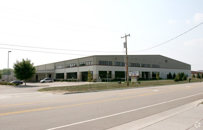


Property Detail
5001 Voges Rd
0710-274-0099-5
CERTIFIED SURVEY MAP NO 9781 AS RECORDED IN DANE COUNTY REGISTER OF DEEDS IN VOL 56 PAGE 267 OF CERTIFIED SURVEYS, LOT 1.
Commercialnec
DANE
W
Wisconsin
C and X Area of minimal flood hazard, usually depicted on FIRMs as above the 500-year flood level.
1
2025
8.80 AC
2025
Southeast Madison
010501
Milwaukee/Madison
111,000 SF
Madison, WI
NEARBY LISTINGS FOR SALE OR LEASE
DEMOGRAPHICS near 5001 Voges Rd
1 mile
3 mile
5 mile
2025 Total Population
2,298
32,997
89,657
2030 Population
2,405
34,107
93,306
Pop Growth 2025-2030
+ 4.66%
+ 3.36%
+ 4.07%
Average Age
36
42
40
2025 Total Households
964
14,136
40,916
HH Growth 2025-2030
+ 4.98%
+ 3.68%
+ 4.43%
Median Household Inc
$109,467
$91,150
$84,464
Avg Household Size
2.30
2.30
2.10
2025 Avg HH Vehicles
2.00
2.00
2.00
Median Home Value
$341,540
$358,182
$358,598
Median Year Built
2007
1977
1975
Nearby Places
Map Layers
Map Styles
 Street
 Aerial
Layers
 Traffic
 Biking
Places
Listings with unknown addresses are not visible on the map
- Restaurants
- Banks
- Shops
- Fitness
- Groceries
PUBLIC TRANSPORTATION
AIRPORT
Dane County Regional/Truax Field
Drive
Walk
Distance
Dane County Regional/Truax Field
15 min
9.0 mi
Freight Ports
Port Milwaukee
Drive
Walk
Distance
Port Milwaukee
93 min
79.7 mi
Nearby Properties
Address
Land Use
TOTAL SIZE
Lot Size
Zoning
Address
Land Use
TOTAL SIZE
Lot Size
Zoning
168,685 SF
14.05 AC
IL
Address
Land Use
TOTAL SIZE
Lot Size
Zoning
13.40 AC
Address
Land Use
TOTAL SIZE
Lot Size
Zoning
2.03 AC
Address
Land Use
TOTAL SIZE
Lot Size
Zoning
3.59 AC
Address
Land Use
TOTAL SIZE
Lot Size
Zoning
156,054 SF
9.40 AC
SE
Address
Land Use
TOTAL SIZE
Lot Size
Zoning
2.38 AC
Address
Land Use
TOTAL SIZE
Lot Size
Zoning
21.92 AC
Address
Land Use
TOTAL SIZE
Lot Size
Zoning
5.53 AC
Address
Land Use
TOTAL SIZE
Lot Size
Zoning
272,519 SF
16.40 AC
IL
Address
Land Use
TOTAL SIZE
Lot Size
Zoning
3.49 AC
Address
Land Use
TOTAL SIZE
Lot Size
Zoning
149,897 SF
17.72 AC
IL
Address
Land Use
TOTAL SIZE
Lot Size
Zoning
6,868 SF
18.35 AC
IL
Address
Land Use
TOTAL SIZE
Lot Size
Zoning
202,800 SF
13.05 AC
WP-31
Address
Land Use
TOTAL SIZE
Lot Size
Zoning
131,874 SF
8.98 AC
IL
Address
Land Use
TOTAL SIZE
Lot Size
Zoning
202,323 SF
10.45 AC
IL
Address
Land Use
TOTAL SIZE
Lot Size
Zoning
281,400 SF
15.01 AC
IL
Address
Land Use
TOTAL SIZE
Lot Size
Zoning
86,633 SF
6.25 AC
TR-P
Address
Land Use
TOTAL SIZE
Lot Size
Zoning
94,440 SF
4.42 AC
SE
Address
Land Use
TOTAL SIZE
Lot Size
Zoning
79,554 SF
6.59 AC
TR-P
Address
Land Use
TOTAL SIZE
Lot Size
Zoning
110,792 SF
5.25 AC
SR-V2
Address
Land Use
TOTAL SIZE
Lot Size
Zoning
106,792 SF
3.79 AC
SR-V2
Address
Land Use
TOTAL SIZE
Lot Size
Zoning
105,120 SF
3.20 AC
SR-V2
Address
Land Use
TOTAL SIZE
Lot Size
Zoning
113,341 SF
11.66 AC
IL
Address
Land Use
TOTAL SIZE
Lot Size
Zoning
2.44 AC
Address
Land Use
TOTAL SIZE
Lot Size
Zoning
14.34 AC
IL
Address
Land Use
TOTAL SIZE
Lot Size
Zoning
3.13 AC
Address
Land Use
TOTAL SIZE
Lot Size
Zoning
9.89 AC
Address
Land Use
TOTAL SIZE
Lot Size
Zoning
11.76 AC
Address
Land Use
TOTAL SIZE
Lot Size
Zoning
115,804 SF
6.06 AC
SR-V2
Address
Land Use
TOTAL SIZE
Lot Size
Zoning
221,410 SF
19.70 AC
IL
The World's #1 Commercial Real Estate Marketplace
Connect with us
© 2026 CoStar Group
The information above has been obtained from sources believed reliable. While we do not doubt its accuracy we have not verified it and make no guarantee, warranty or representation about it. It is your responsibility to independently confirm its accuracy and completeness. Any projections, opinions, assumptions, or estimates used are for example only and do not represent the current or future performance of the property. The value of this transaction to you depends on tax and other factors which should be evaluated by your tax, financial, and legal advisors. You and your advisors should conduct a careful, independent investigation of the property to determine to your satisfaction the suitability of the property for your needs.