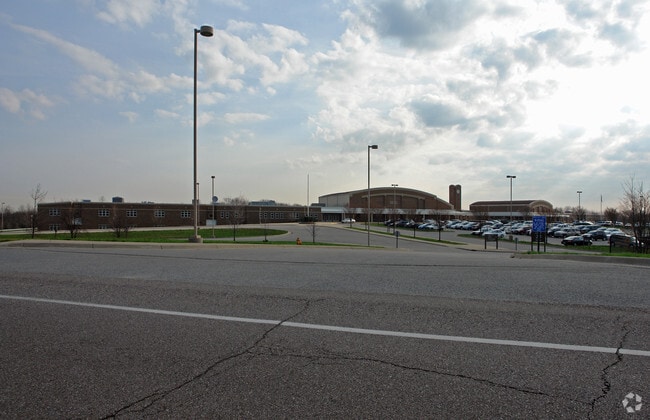
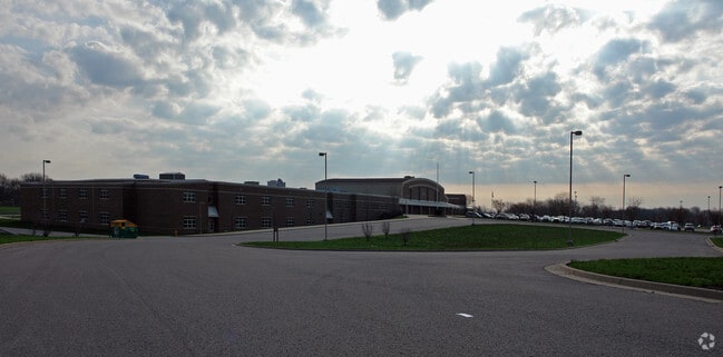
Property Record
5002 Madison Pike, Independence, KY 41051

NEARBY LISTINGS FOR SALE OR LEASE
-
-
View all Independence listings for sale on LoopNet.com
Property Detail
5002 Madison Pike
046-00-00-013.00
50.66 ACS ES MADISON PK W PELLY RD
Publicschool
Kenton
X
Kentucky
21015C0250D
50.66 AC
0
Outlying N Kentucky
2025
Cincinnati/Dayton
063606
Cincinnati, OH-KY-IN
DEMOGRAPHICS near 5002 Madison Pike
1 Mile
3 Mile
5 Mile
2024 Total Population
4,274
39,411
87,399
2029 Population
4,365
40,250
89,661
Pop Growth 2024-2029
+ 2.13%
+ 2.13%
+ 2.59%
Average Age
37
37
38
2024 Total Households
1,375
13,440
31,402
HH Growth 2024-2029
+ 2.18%
+ 2.08%
+ 2.55%
Median Household Inc
$104,118
$97,179
$82,752
Avg Household Size
3.10
2.90
2.70
2024 Avg HH Vehicles
2.00
2.00
2.00
Median Home Value
$221,786
$237,094
$217,887
Median Year Built
2000
1996
1989
Nearby Places
Map Layers
Map Styles
 Street
 Aerial
- Restaurants
- Banks
- Shops
- Fitness
- Groceries
PUBLIC TRANSPORTATION
AIRPORT
Cincinnati/Northern Kentucky International
DRIVE
WALK
Distance
Cincinnati/Northern Kentucky International
27 min
14.7 mi
Freight Ports
Port of Toledo
DRIVE
WALK
Distance
Port of Toledo
258 min
217.7 mi
Nearby Properties
Address
Land Use
TOTAL SIZE
Lot Size
Zoning
Address
Land Use
TOTAL SIZE
Lot Size
Zoning
28.50 AC
Address
Land Use
TOTAL SIZE
Lot Size
Zoning
39.05 AC
Address
Land Use
TOTAL SIZE
Lot Size
Zoning
123,480 SF
11.96 AC
Address
Land Use
TOTAL SIZE
Lot Size
Zoning
Address
Land Use
TOTAL SIZE
Lot Size
Zoning
13.27 AC
Address
Land Use
TOTAL SIZE
Lot Size
Zoning
65.43 AC
Address
Land Use
TOTAL SIZE
Lot Size
Zoning
Address
Land Use
TOTAL SIZE
Lot Size
Zoning
11.15 AC
Address
Land Use
TOTAL SIZE
Lot Size
Zoning
25.04 AC
Address
Land Use
TOTAL SIZE
Lot Size
Zoning
Address
Land Use
TOTAL SIZE
Lot Size
Zoning
11.33 AC
Address
Land Use
TOTAL SIZE
Lot Size
Zoning
15.65 AC
Address
Land Use
TOTAL SIZE
Lot Size
Zoning
105,205 SF
6.71 AC
Address
Land Use
TOTAL SIZE
Lot Size
Zoning
10.08 AC
Address
Land Use
TOTAL SIZE
Lot Size
Zoning
11.73 AC
Address
Land Use
TOTAL SIZE
Lot Size
Zoning
Address
Land Use
TOTAL SIZE
Lot Size
Zoning
26,000 SF
6.86 AC
Address
Land Use
TOTAL SIZE
Lot Size
Zoning
Address
Land Use
TOTAL SIZE
Lot Size
Zoning
12,520 SF
3.06 AC
Address
Land Use
TOTAL SIZE
Lot Size
Zoning
1,200 SF
8.05 AC
Address
Land Use
TOTAL SIZE
Lot Size
Zoning
14,820 SF
2.11 AC
Address
Land Use
TOTAL SIZE
Lot Size
Zoning
181.49 AC
Address
Land Use
TOTAL SIZE
Lot Size
Zoning
100.04 AC
Address
Land Use
TOTAL SIZE
Lot Size
Zoning
30,986 SF
5.05 AC
Address
Land Use
TOTAL SIZE
Lot Size
Zoning
24.12 AC
Address
Land Use
TOTAL SIZE
Lot Size
Zoning
26,252 SF
2.98 AC
Address
Land Use
TOTAL SIZE
Lot Size
Zoning
Address
Land Use
TOTAL SIZE
Lot Size
Zoning
8,228 SF
2.46 AC
Address
Land Use
TOTAL SIZE
Lot Size
Zoning
5,270 SF
1.68 AC
The World's #1 Commercial Real Estate Marketplace
Connect with us
© 2026 CoStar Group
The information above has been obtained from sources believed reliable. While we do not doubt its accuracy we have not verified it and make no guarantee, warranty or representation about it. It is your responsibility to independently confirm its accuracy and completeness. Any projections, opinions, assumptions, or estimates used are for example only and do not represent the current or future performance of the property. The value of this transaction to you depends on tax and other factors which should be evaluated by your tax, financial, and legal advisors. You and your advisors should conduct a careful, independent investigation of the property to determine to your satisfaction the suitability of the property for your needs.