Property Record
50048 29 Palms Hwy, Morongo Valley, CA 92256


NEARBY LISTINGS FOR SALE OR LEASE
-
-
View all Morongo Valley listings for sale on LoopNet.com
Property Detail
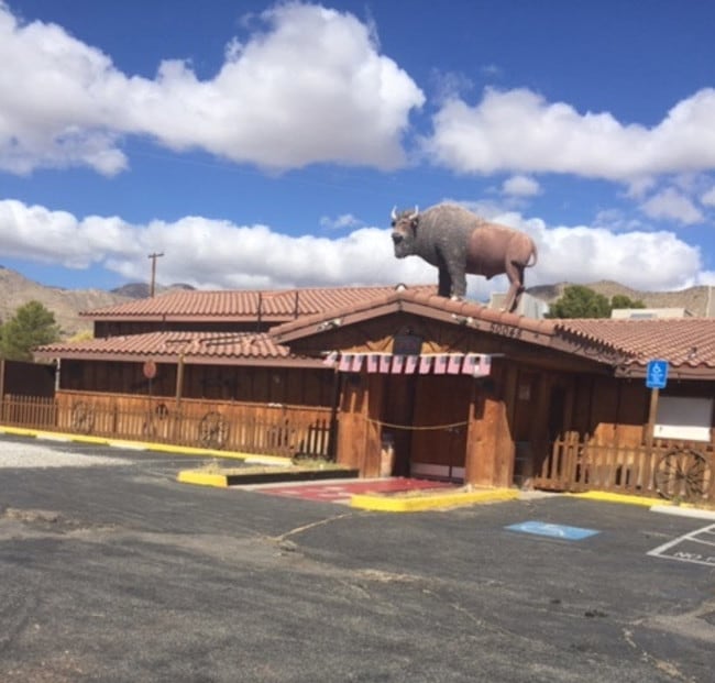
50048 29 Palms Hwy
0583-281-13
PTN SE 1/4 NW 1/4 SEC 28 TP 1S R 4E COM AT SE COR SD SE 1/4 NW 1/4 SD PT BEING CENTER SD SEC TH N 0 DEG 52 MIN 25 SECONDS W 393 FT TH S 89 DEG 24 MIN 54 SECONDS W 229.97 FT M/L TO A PT N 89 DEG 24 MIN 54 SECONDS E 1074.73 FT FROM W LI SD SE 1/4 NW 1/
Bartavern
San Bernardino
A
California
06065C0215G
1.20 AC
2024
Twentynine Palms
2025
Inland Empire (California)
010417
Riverside-San Bernardino-Ontario, CA
7,340 SF
DEMOGRAPHICS near 50048 29 Palms Hwy
1 Mile
3 Mile
5 Mile
2024 Total Population
1,153
3,116
4,061
2029 Population
1,178
3,186
4,177
Pop Growth 2024-2029
+ 2.17%
+ 2.25%
+ 2.86%
Average Age
45
46
46
2024 Total Households
528
1,436
1,854
HH Growth 2024-2029
+ 2.08%
+ 2.30%
+ 2.75%
Median Household Inc
$50,672
$50,114
$51,256
Avg Household Size
2.20
2.10
2.10
2024 Avg HH Vehicles
2.00
2.00
2.00
Median Home Value
$199,999
$217,857
$258,291
Median Year Built
1977
1974
1974
Nearby Places
Map Layers
Map Styles
 Street
 Aerial
- Restaurants
- Banks
- Shops
- Fitness
- Groceries
PUBLIC TRANSPORTATION
AIRPORT
Palm Springs International
DRIVE
WALK
Distance
Palm Springs International
28 min
21.0 mi
SALE & LEASE HISTORY
LISTING DATE
SALE/LEASE

Oct 15, 2021
For Sale
Oct 01, 2019
For Sale
Nov 14, 2018
For Sale
Feb 19, 2019
For Sale
Nearby Properties
Address
Land Use
TOTAL SIZE
Lot Size
Zoning
Address
Land Use
TOTAL SIZE
Lot Size
Zoning
Address
Land Use
TOTAL SIZE
Lot Size
Zoning
9,100 SF
2.12 AC
Address
Land Use
TOTAL SIZE
Lot Size
Zoning
8,472 SF
1.09 AC
Address
Land Use
TOTAL SIZE
Lot Size
Zoning
Address
Land Use
TOTAL SIZE
Lot Size
Zoning
7,934 SF
1.55 AC
MVCG
Address
Land Use
TOTAL SIZE
Lot Size
Zoning
2,072 SF
0.67 AC
MVCG
Address
Land Use
TOTAL SIZE
Lot Size
Zoning
2,950 SF
1.64 AC
MVCG
Address
Land Use
TOTAL SIZE
Lot Size
Zoning
8,680 SF
0.70 AC
MVRM
Address
Land Use
TOTAL SIZE
Lot Size
Zoning
3,228 SF
0.21 AC
MVCG
Address
Land Use
TOTAL SIZE
Lot Size
Zoning
4,440 SF
0.46 AC
MVCG
Address
Land Use
TOTAL SIZE
Lot Size
Zoning
5,640 SF
4.06 AC
MVRS10M
Address
Land Use
TOTAL SIZE
Lot Size
Zoning
7,920 SF
1.88 AC
MVRS14M
Address
Land Use
TOTAL SIZE
Lot Size
Zoning
5,923 SF
1.16 AC
MVCG
Address
Land Use
TOTAL SIZE
Lot Size
Zoning
0.16 AC
MVCG
Address
Land Use
TOTAL SIZE
Lot Size
Zoning
7,864 SF
0.29 AC
MVCS
Address
Land Use
TOTAL SIZE
Lot Size
Zoning
27.50 AC
MVRL
Address
Land Use
TOTAL SIZE
Lot Size
Zoning
1,248 SF
0.31 AC
MVCG
Address
Land Use
TOTAL SIZE
Lot Size
Zoning
2,269 SF
2.54 AC
MVCG
Address
Land Use
TOTAL SIZE
Lot Size
Zoning
1,058 SF
0.35 AC
MVCG
Address
Land Use
TOTAL SIZE
Lot Size
Zoning
1,361 SF
0.45 AC
MVCG
Address
Land Use
TOTAL SIZE
Lot Size
Zoning
4,644 SF
0.39 AC
MVRM
Address
Land Use
TOTAL SIZE
Lot Size
Zoning
0.47 AC
MVRS10M
Address
Land Use
TOTAL SIZE
Lot Size
Zoning
2,846 SF
0.23 AC
MVCG
Address
Land Use
TOTAL SIZE
Lot Size
Zoning
1,672 SF
0.16 AC
R1C1
Address
Land Use
TOTAL SIZE
Lot Size
Zoning
10 AC
MVRL
Address
Land Use
TOTAL SIZE
Lot Size
Zoning
2,244 SF
1.03 AC
MVCG
Address
Land Use
TOTAL SIZE
Lot Size
Zoning
40 AC
MVRS10M
Address
Land Use
TOTAL SIZE
Lot Size
Zoning
2,869 SF
1.06 AC
MVRM
Address
Land Use
TOTAL SIZE
Lot Size
Zoning
4,680 SF
0.17 AC
MVCS
The World's #1 Commercial Real Estate Marketplace
Connect with us
© 2026 CoStar Group
The information above has been obtained from sources believed reliable. While we do not doubt its accuracy we have not verified it and make no guarantee, warranty or representation about it. It is your responsibility to independently confirm its accuracy and completeness. Any projections, opinions, assumptions, or estimates used are for example only and do not represent the current or future performance of the property. The value of this transaction to you depends on tax and other factors which should be evaluated by your tax, financial, and legal advisors. You and your advisors should conduct a careful, independent investigation of the property to determine to your satisfaction the suitability of the property for your needs.