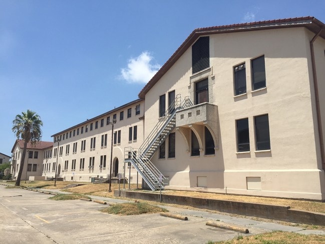
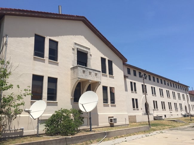
Property Record
5005 Avenue U, Galveston, TX 77551
NEARBY LISTINGS FOR SALE OR LEASE
Property Detail
5005 Avenue U
Houston-The Woodlands-Sugar Land, TX
Menard, M B Survey
0628-0092-0000-000
ABST 628 PAGE 101 M MENARD SUR TR 92 3.037 ACRS
Commercialnec
Galveston
AO
Texas
48167C0439G
92
2024
3.04 AC
2025
Southeast Outlier
724101
Houston
41,200 SF
DEMOGRAPHICS near 5005 Avenue U
1 Mile
3 Mile
5 Mile
2024 Total Population
10,984
46,554
59,084
2029 Population
11,646
49,780
63,465
Pop Growth 2024-2029
+ 6.03%
+ 6.93%
+ 7.41%
Average Age
42
42
42
2024 Total Households
4,697
19,831
25,919
HH Growth 2024-2029
+ 6.39%
+ 7.39%
+ 8.01%
Median Household Inc
$53,904
$50,205
$51,628
Avg Household Size
2.20
2.20
2.10
2024 Avg HH Vehicles
2.00
1.00
1.00
Median Home Value
$234,176
$258,866
$273,273
Median Year Built
1959
1966
1970
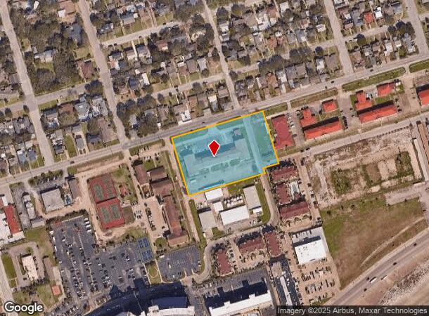
Nearby Places
Map Layers
Map Styles
 Street
 Aerial
- Restaurants
- Banks
- Shops
- Fitness
- Groceries
SALE & LEASE HISTORY
LISTING DATE
SALE/LEASE

Sep 23, 2016
For Sale
Nearby Properties
Address
Land Use
TOTAL SIZE
Lot Size
Zoning
Address
Land Use
TOTAL SIZE
Lot Size
Zoning
566,062 SF
40.20 AC
Address
Land Use
TOTAL SIZE
Lot Size
Zoning
1,459,569 SF
11.51 AC
MF1
Address
Land Use
TOTAL SIZE
Lot Size
Zoning
161,300 SF
Address
Land Use
TOTAL SIZE
Lot Size
Zoning
678,840 SF
3.54 AC
R
Address
Land Use
TOTAL SIZE
Lot Size
Zoning
226,301 SF
5.93 AC
I
Address
Land Use
TOTAL SIZE
Lot Size
Zoning
157,959 SF
1.79 AC
Address
Land Use
TOTAL SIZE
Lot Size
Zoning
382,106 SF
24.02 AC
PD
Address
Land Use
TOTAL SIZE
Lot Size
Zoning
228,895 SF
11.41 AC
R
Address
Land Use
TOTAL SIZE
Lot Size
Zoning
153,637 SF
4.52 AC
R
Address
Land Use
TOTAL SIZE
Lot Size
Zoning
169,384 SF
709.59 AC
PD
Address
Land Use
TOTAL SIZE
Lot Size
Zoning
169,052 SF
4.18 AC
R
Address
Land Use
TOTAL SIZE
Lot Size
Zoning
182,000 SF
41.90 AC
Address
Land Use
TOTAL SIZE
Lot Size
Zoning
Address
Land Use
TOTAL SIZE
Lot Size
Zoning
165,091 SF
Address
Land Use
TOTAL SIZE
Lot Size
Zoning
176,242 SF
2.03 AC
MF2
Address
Land Use
TOTAL SIZE
Lot Size
Zoning
450,048 SF
Address
Land Use
TOTAL SIZE
Lot Size
Zoning
144,000 SF
Address
Land Use
TOTAL SIZE
Lot Size
Zoning
128,906 SF
Address
Land Use
TOTAL SIZE
Lot Size
Zoning
88,994 SF
3.03 AC
R
Address
Land Use
TOTAL SIZE
Lot Size
Zoning
193,003 SF
7.08 AC
C
Address
Land Use
TOTAL SIZE
Lot Size
Zoning
397,664 SF
1.79 AC
CB
Address
Land Use
TOTAL SIZE
Lot Size
Zoning
60,550 SF
1.79 AC
Address
Land Use
TOTAL SIZE
Lot Size
Zoning
119,996 SF
2.86 AC
Address
Land Use
TOTAL SIZE
Lot Size
Zoning
174,713 SF
6.54 AC
C
Address
Land Use
TOTAL SIZE
Lot Size
Zoning
169,404 SF
7.50 AC
R
Address
Land Use
TOTAL SIZE
Lot Size
Zoning
216,000 SF
0.65 AC
CB
Address
Land Use
TOTAL SIZE
Lot Size
Zoning
80,908 SF
0.70 AC
Address
Land Use
TOTAL SIZE
Lot Size
Zoning
122,709 SF
2.27 AC
CB
Address
Land Use
TOTAL SIZE
Lot Size
Zoning
153,210 SF
13.27 AC
R
Address
Land Use
TOTAL SIZE
Lot Size
Zoning
48,957 SF
2.28 AC
The World's #1 Commercial Real Estate Marketplace
Connect with us
© 2025 CoStar Group
The information above has been obtained from sources believed reliable. While we do not doubt its accuracy we have not verified it and make no guarantee, warranty or representation about it. It is your responsibility to independently confirm its accuracy and completeness. Any projections, opinions, assumptions, or estimates used are for example only and do not represent the current or future performance of the property. The value of this transaction to you depends on tax and other factors which should be evaluated by your tax, financial, and legal advisors. You and your advisors should conduct a careful, independent investigation of the property to determine to your satisfaction the suitability of the property for your needs.