Property Record
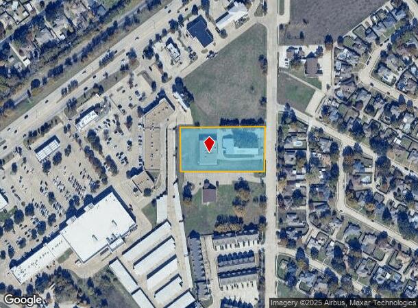
5005 Ben Davis Rd, Sachse, TX 75048

NEARBY LISTINGS FOR SALE OR LEASE
Property Detail
5005 Ben Davis Rd
65132414010030000
Elizabeth Sachse
Religious
ELIZABETH SACHSE ABST 1324 PG 140 TR 3 ACS 2.00 INT201600088642 DD04042016 CO-DC 1324140100300 2CK13241401
X
Dallas
48113C0230K
Texas
0
2 AC
2025
Garland
018151
Dallas/Ft Worth
3,800 SF
Dallas-Fort Worth-Arlington, TX
DEMOGRAPHICS near 5005 Ben Davis Rd
1 Mile
3 Mile
5 Mile
2024 Total Population
8,479
81,332
261,627
2029 Population
8,305
87,484
283,676
Pop Growth 2024-2029
(2.05%)
+ 7.56%
+ 8.43%
Average Age
40
39
38
2024 Total Households
2,851
27,022
86,525
HH Growth 2024-2029
(2.39%)
+ 7.23%
+ 8.12%
Median Household Inc
$114,473
$105,609
$91,666
Avg Household Size
2.90
3.00
3.00
2024 Avg HH Vehicles
3.00
2.00
2.00
Median Home Value
$286,308
$316,854
$292,132
Median Year Built
1997
1998
1995
Nearby Places
Map Layers
Map Styles
 Street
 Aerial
- Restaurants
- Banks
- Shops
- Fitness
- Groceries
PUBLIC TRANSPORTATION
AIRPORT
Dallas Love Field
DRIVE
WALK
Distance
Dallas Love Field
37 min
27.9 mi
Dallas-Fort Worth International
DRIVE
WALK
Distance
Dallas-Fort Worth International
43 min
36.0 mi
Freight Ports
Port of Shreveport
DRIVE
WALK
Distance
Port of Shreveport
220 min
197.9 mi
Nearby Properties
Address
Land Use
TOTAL SIZE
Lot Size
Zoning
Address
Land Use
TOTAL SIZE
Lot Size
Zoning
650,164 SF
66.57 AC
Z02
Address
Land Use
TOTAL SIZE
Lot Size
Zoning
350,553 SF
18.71 AC
MF-M
Address
Land Use
TOTAL SIZE
Lot Size
Zoning
328,843 SF
11.70 AC
Z239
Address
Land Use
TOTAL SIZE
Lot Size
Zoning
361,965 SF
11.12 AC
Z06
Address
Land Use
TOTAL SIZE
Lot Size
Zoning
231,434 SF
11.27 AC
Z06
Address
Land Use
TOTAL SIZE
Lot Size
Zoning
367,458 SF
13.42 AC
Address
Land Use
TOTAL SIZE
Lot Size
Zoning
310,382 SF
11.78 AC
Z148
Address
Land Use
TOTAL SIZE
Lot Size
Zoning
181,200 SF
15.11 AC
Address
Land Use
TOTAL SIZE
Lot Size
Zoning
320,801 SF
10.14 AC
Z236
Address
Land Use
TOTAL SIZE
Lot Size
Zoning
250,602 SF
4.99 AC
Z01
Address
Land Use
TOTAL SIZE
Lot Size
Zoning
285,392 SF
19.44 AC
MF-M
Address
Land Use
TOTAL SIZE
Lot Size
Zoning
423,253 SF
30.26 AC
Z239
Address
Land Use
TOTAL SIZE
Lot Size
Zoning
385,735 SF
13.13 AC
Address
Land Use
TOTAL SIZE
Lot Size
Zoning
261,164 SF
32.58 AC
Address
Land Use
TOTAL SIZE
Lot Size
Zoning
342,658 SF
4.94 AC
Z239
Address
Land Use
TOTAL SIZE
Lot Size
Zoning
366,600 SF
8.09 AC
Z06
Address
Land Use
TOTAL SIZE
Lot Size
Zoning
331,684 SF
9.80 AC
Z148
Address
Land Use
TOTAL SIZE
Lot Size
Zoning
403,206 SF
4 AC
Z239
Address
Land Use
TOTAL SIZE
Lot Size
Zoning
232,771 SF
15.69 AC
Z160
Address
Land Use
TOTAL SIZE
Lot Size
Zoning
245,596 SF
14.24 AC
Z160
Address
Land Use
TOTAL SIZE
Lot Size
Zoning
117,500 SF
16.71 AC
Z239
Address
Land Use
TOTAL SIZE
Lot Size
Zoning
65,595 SF
19.22 AC
Z239
Address
Land Use
TOTAL SIZE
Lot Size
Zoning
286,659 SF
9.94 AC
Z236
Address
Land Use
TOTAL SIZE
Lot Size
Zoning
259,280 SF
5.15 AC
Z01
Address
Land Use
TOTAL SIZE
Lot Size
Zoning
228,536 SF
10.54 AC
MF-M
Address
Land Use
TOTAL SIZE
Lot Size
Zoning
198,488 SF
10.17 AC
Z239
Address
Land Use
TOTAL SIZE
Lot Size
Zoning
60,593 SF
35.93 AC
Z06
Address
Land Use
TOTAL SIZE
Lot Size
Zoning
473,201 SF
13.32 AC
Address
Land Use
TOTAL SIZE
Lot Size
Zoning
163,965 SF
12.09 AC
Z239
Address
Land Use
TOTAL SIZE
Lot Size
Zoning
180,320 SF
10.66 AC
Z160
The World's #1 Commercial Real Estate Marketplace
Connect with us
© 2025 CoStar Group
The information above has been obtained from sources believed reliable. While we do not doubt its accuracy we have not verified it and make no guarantee, warranty or representation about it. It is your responsibility to independently confirm its accuracy and completeness. Any projections, opinions, assumptions, or estimates used are for example only and do not represent the current or future performance of the property. The value of this transaction to you depends on tax and other factors which should be evaluated by your tax, financial, and legal advisors. You and your advisors should conduct a careful, independent investigation of the property to determine to your satisfaction the suitability of the property for your needs.