Property Record
5005 Camino Tassajara, Danville, CA 94506


Current Lease Availabilities
NEARBY LISTINGS FOR SALE OR LEASE
Property Detail
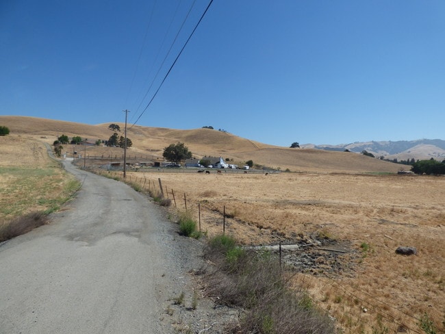
5005 Camino Tassajara
220-100-015-1
Map Of Subdivision Ms 17 74
Pasture
SUBDIVISION M S 17 74
X
Contra Costa
06001C0165G
California
2025
11.56 AC
2025
Danville/Alamo
355112
East Bay/Oakland
2,574 SF
Oakland-Hayward-Berkeley, CA
DEMOGRAPHICS near 5005 Camino Tassajara
1 Mile
3 Mile
5 Mile
2024 Total Population
3,257
25,535
77,241
2029 Population
3,217
25,285
76,345
Pop Growth 2024-2029
(1.23%)
(0.98%)
(1.16%)
Average Age
40
40
39
2024 Total Households
956
7,758
24,868
HH Growth 2024-2029
(1.57%)
(1.06%)
(1.21%)
Median Household Inc
$235,567
$235,935
$213,339
Avg Household Size
3.30
3.20
3.10
2024 Avg HH Vehicles
2.00
2.00
2.00
Median Home Value
$1,144,194
$1,132,979
$1,123,837
Median Year Built
2008
2000
1999
Nearby Places
Map Layers
Map Styles
 Street
 Aerial
- Restaurants
- Banks
- Shops
- Fitness
- Groceries
PUBLIC TRANSPORTATION
AIRPORT
Metro Oakland International
DRIVE
WALK
Distance
Metro Oakland International
39 min
28.5 mi
Freight Ports
Port of Oakland
DRIVE
WALK
Distance
Port of Oakland
44 min
30.7 mi
Nearby Properties
Address
Land Use
TOTAL SIZE
Lot Size
Zoning
Address
Land Use
TOTAL SIZE
Lot Size
Zoning
54.05 AC
Address
Land Use
TOTAL SIZE
Lot Size
Zoning
287,046 SF
11.90 AC
Address
Land Use
TOTAL SIZE
Lot Size
Zoning
15.07 AC
P1
Address
Land Use
TOTAL SIZE
Lot Size
Zoning
11.02 AC
Address
Land Use
TOTAL SIZE
Lot Size
Zoning
56,669 SF
11.25 AC
Address
Land Use
TOTAL SIZE
Lot Size
Zoning
63,202 SF
2.72 AC
P1
Address
Land Use
TOTAL SIZE
Lot Size
Zoning
109,047 SF
3.71 AC
P1
Address
Land Use
TOTAL SIZE
Lot Size
Zoning
32,667 SF
3.40 AC
P1
Address
Land Use
TOTAL SIZE
Lot Size
Zoning
104,679 SF
3.81 AC
Address
Land Use
TOTAL SIZE
Lot Size
Zoning
10.44 AC
Address
Land Use
TOTAL SIZE
Lot Size
Zoning
35,743 SF
163.82 AC
P1
Address
Land Use
TOTAL SIZE
Lot Size
Zoning
767.77 AC
Address
Land Use
TOTAL SIZE
Lot Size
Zoning
67,085 SF
0.84 AC
P1
Address
Land Use
TOTAL SIZE
Lot Size
Zoning
2,011 SF
233.20 AC
A80
Address
Land Use
TOTAL SIZE
Lot Size
Zoning
1.32 AC
P1
Address
Land Use
TOTAL SIZE
Lot Size
Zoning
27,648 SF
0.59 AC
P1
Address
Land Use
TOTAL SIZE
Lot Size
Zoning
26,498 SF
0.59 AC
P1
Address
Land Use
TOTAL SIZE
Lot Size
Zoning
80 AC
A80
Address
Land Use
TOTAL SIZE
Lot Size
Zoning
8,734 SF
46.95 AC
A40
Address
Land Use
TOTAL SIZE
Lot Size
Zoning
126.31 AC
A80
Address
Land Use
TOTAL SIZE
Lot Size
Zoning
22,000 SF
0.48 AC
P1
Address
Land Use
TOTAL SIZE
Lot Size
Zoning
1,716 SF
26.44 AC
Address
Land Use
TOTAL SIZE
Lot Size
Zoning
154.89 AC
A80
Address
Land Use
TOTAL SIZE
Lot Size
Zoning
1,716 SF
81.47 AC
A80
Address
Land Use
TOTAL SIZE
Lot Size
Zoning
6,228 SF
25.78 AC
A20
Address
Land Use
TOTAL SIZE
Lot Size
Zoning
1.68 AC
Address
Land Use
TOTAL SIZE
Lot Size
Zoning
46,133 SF
0.88 AC
P1
Address
Land Use
TOTAL SIZE
Lot Size
Zoning
8,167 SF
1.34 AC
P1
Address
Land Use
TOTAL SIZE
Lot Size
Zoning
28,558 SF
0.54 AC
P1
Address
Land Use
TOTAL SIZE
Lot Size
Zoning
67,560 SF
5.21 AC
The World's #1 Commercial Real Estate Marketplace
Connect with us
© 2026 CoStar Group
The information above has been obtained from sources believed reliable. While we do not doubt its accuracy we have not verified it and make no guarantee, warranty or representation about it. It is your responsibility to independently confirm its accuracy and completeness. Any projections, opinions, assumptions, or estimates used are for example only and do not represent the current or future performance of the property. The value of this transaction to you depends on tax and other factors which should be evaluated by your tax, financial, and legal advisors. You and your advisors should conduct a careful, independent investigation of the property to determine to your satisfaction the suitability of the property for your needs.