Property Record
5005 Sterling Way, Milton, FL 32571
NEARBY LISTINGS FOR SALE OR LEASE
-
-
View all Milton listings for sale on LoopNet.com
Property Detail
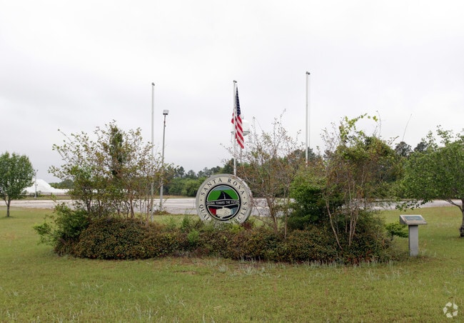
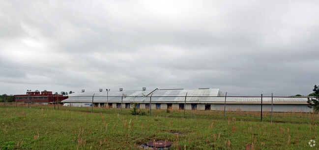
5005 Sterling Way
28-1N-29-0000-00100-0000
Avalon Park (Post And Search Mall & Offi
Heavyindustrial
THAT PORT OF THE FOLLOWING DES PROP LYING IN SEC 29: BEG NE CORN SEC 29 THN N1*2935E 41. 33 FT THN S88*5205E 1277.45 FT THN S1*2647W 80 FT THN S 14*0644 E 1638.64 FT THN S83* 0636E 1377.84 FT THN S7*30 40W 499.17 FT THN S90*0W 800 FT THN S 300 FT THN
X
Santa Rosa
12113C0428G
Florida
2024
16.46 AC
2025
Avalon Beach/Milton
0108093045
Pensacola
615,804 SF
Pensacola-Ferry Pass-Brent, FL
DEMOGRAPHICS near 5005 Sterling Way
1 Mile
3 Mile
5 Mile
2024 Total Population
1,802
19,302
44,676
2029 Population
2,122
22,174
51,162
Pop Growth 2024-2029
+ 17.76%
+ 14.88%
+ 14.52%
Average Age
37
39
39
2024 Total Households
699
7,350
16,839
HH Growth 2024-2029
+ 18.03%
+ 15.21%
+ 14.82%
Median Household Inc
$70,208
$81,590
$74,467
Avg Household Size
2.60
2.60
2.60
2024 Avg HH Vehicles
2.00
2.00
2.00
Median Home Value
$232,465
$215,711
$230,375
Median Year Built
2010
1996
1994
Nearby Places
Map Layers
Map Styles
 Street
 Aerial
- Restaurants
- Banks
- Shops
- Fitness
- Groceries
PUBLIC TRANSPORTATION
AIRPORT
Pensacola International
DRIVE
WALK
Distance
Pensacola International
31 min
17.1 mi
Freight Ports
Port of Mobile
DRIVE
WALK
Distance
Port of Mobile
80 min
67.1 mi
Nearby Properties
Address
Land Use
TOTAL SIZE
Lot Size
Zoning
Address
Land Use
TOTAL SIZE
Lot Size
Zoning
374,114 SF
27.61 AC
R2
Address
Land Use
TOTAL SIZE
Lot Size
Zoning
118,887 SF
19.24 AC
HCD
Address
Land Use
TOTAL SIZE
Lot Size
Zoning
130,379 SF
18.18 AC
HCD
Address
Land Use
TOTAL SIZE
Lot Size
Zoning
79,708 SF
9.62 AC
HCD
Address
Land Use
TOTAL SIZE
Lot Size
Zoning
232,988 SF
24.57 AC
HCD
Address
Land Use
TOTAL SIZE
Lot Size
Zoning
154,042 SF
10.36 AC
HCD
Address
Land Use
TOTAL SIZE
Lot Size
Zoning
130,603 SF
14.30 AC
R2
Address
Land Use
TOTAL SIZE
Lot Size
Zoning
151,084 SF
19.01 AC
HCD
Address
Land Use
TOTAL SIZE
Lot Size
Zoning
199,775 SF
8.83 AC
HCD
Address
Land Use
TOTAL SIZE
Lot Size
Zoning
113,899 SF
3.05 AC
HCD
Address
Land Use
TOTAL SIZE
Lot Size
Zoning
81,150 SF
4.86 AC
HCD
Address
Land Use
TOTAL SIZE
Lot Size
Zoning
115,095 SF
7.44 AC
HCD
Address
Land Use
TOTAL SIZE
Lot Size
Zoning
43,613 SF
3.44 AC
HCD
Address
Land Use
TOTAL SIZE
Lot Size
Zoning
9.61 AC
R1
Address
Land Use
TOTAL SIZE
Lot Size
Zoning
112,196 SF
343.01 AC
HCD
Address
Land Use
TOTAL SIZE
Lot Size
Zoning
37,820 SF
16.98 AC
HCD
Address
Land Use
TOTAL SIZE
Lot Size
Zoning
51,760 SF
5.50 AC
HCD
Address
Land Use
TOTAL SIZE
Lot Size
Zoning
49,275 SF
2.49 AC
HCD
Address
Land Use
TOTAL SIZE
Lot Size
Zoning
22.16 AC
HCD
Address
Land Use
TOTAL SIZE
Lot Size
Zoning
52,334 SF
10 AC
HCD
Address
Land Use
TOTAL SIZE
Lot Size
Zoning
48,285 SF
3.52 AC
HCD
Address
Land Use
TOTAL SIZE
Lot Size
Zoning
9.97 AC
HCD
Address
Land Use
TOTAL SIZE
Lot Size
Zoning
40,026 SF
1.79 AC
HCD
Address
Land Use
TOTAL SIZE
Lot Size
Zoning
40,699 SF
4.76 AC
HCD
Address
Land Use
TOTAL SIZE
Lot Size
Zoning
57,688 SF
7.57 AC
HCD
Address
Land Use
TOTAL SIZE
Lot Size
Zoning
25,326 SF
2.80 AC
HCD
Address
Land Use
TOTAL SIZE
Lot Size
Zoning
63,181 SF
6.61 AC
R2
Address
Land Use
TOTAL SIZE
Lot Size
Zoning
53,304 SF
4.83 AC
R2
Address
Land Use
TOTAL SIZE
Lot Size
Zoning
23,281 SF
2.89 AC
HCD
The World's #1 Commercial Real Estate Marketplace
Connect with us
© 2026 CoStar Group
The information above has been obtained from sources believed reliable. While we do not doubt its accuracy we have not verified it and make no guarantee, warranty or representation about it. It is your responsibility to independently confirm its accuracy and completeness. Any projections, opinions, assumptions, or estimates used are for example only and do not represent the current or future performance of the property. The value of this transaction to you depends on tax and other factors which should be evaluated by your tax, financial, and legal advisors. You and your advisors should conduct a careful, independent investigation of the property to determine to your satisfaction the suitability of the property for your needs.