Property Record
5009 Laura Koppe Rd, Houston, TX 77016


NEARBY LISTINGS FOR SALE OR LEASE
Property Detail
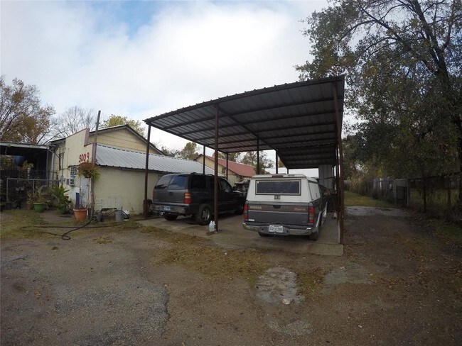
5009 Laura Koppe Rd
Houston-Pasadena-The Woodlands, TX
Buckingham Place Sec 1
0731790000050
LT 5O BUCKINGHAM PLACE SEC 1
Storebuilding
Harris
X
Texas
48201C0680L
5o
2024
0.31 AC
2025
Northeast Near
230600
Houston
2,646 SF
DEMOGRAPHICS near 5009 Laura Koppe Rd
1 Mile
3 Mile
5 Mile
2024 Total Population
11,014
98,002
273,258
2029 Population
11,427
100,854
280,525
Pop Growth 2024-2029
+ 3.75%
+ 2.91%
+ 2.66%
Average Age
38
37
36
2024 Total Households
3,669
31,243
88,649
HH Growth 2024-2029
+ 3.71%
+ 2.95%
+ 2.75%
Median Household Inc
$30,474
$32,979
$36,828
Avg Household Size
2.90
3.00
3.00
2024 Avg HH Vehicles
2.00
2.00
2.00
Median Home Value
$99,393
$99,026
$135,379
Median Year Built
1962
1964
1964
Nearby Places
Map Layers
Map Styles
 Street
 Aerial
- Restaurants
- Banks
- Shops
- Fitness
- Groceries
PUBLIC TRANSPORTATION
COMMUTER RAIL
DRIVE
WALK
Distance
15 min
8.1 mi
AIRPORT
George Bush Intcntl/Houston
DRIVE
WALK
Distance
George Bush Intcntl/Houston
20 min
13.2 mi
William P Hobby
DRIVE
WALK
Distance
William P Hobby
32 min
18.6 mi
Freight Ports
Port of Houston
DRIVE
WALK
Distance
Port of Houston
19 min
10.6 mi
SALE & LEASE HISTORY
LISTING DATE
SALE/LEASE

May 03, 2018
For Sale
Feb 06, 2023
For Sale
Nearby Properties
Address
Land Use
TOTAL SIZE
Lot Size
Zoning
Address
Land Use
TOTAL SIZE
Lot Size
Zoning
545,628 SF
19.41 AC
Address
Land Use
TOTAL SIZE
Lot Size
Zoning
304,925 SF
10.91 AC
Address
Land Use
TOTAL SIZE
Lot Size
Zoning
177,720 SF
14.96 AC
Address
Land Use
TOTAL SIZE
Lot Size
Zoning
91,623 SF
9.09 AC
Address
Land Use
TOTAL SIZE
Lot Size
Zoning
234,016 SF
7.75 AC
Address
Land Use
TOTAL SIZE
Lot Size
Zoning
219,230 SF
9.92 AC
Address
Land Use
TOTAL SIZE
Lot Size
Zoning
55,517 SF
13 AC
Address
Land Use
TOTAL SIZE
Lot Size
Zoning
241,435 SF
13.47 AC
Address
Land Use
TOTAL SIZE
Lot Size
Zoning
130,309 SF
13.28 AC
Address
Land Use
TOTAL SIZE
Lot Size
Zoning
82,951 SF
21.32 AC
Address
Land Use
TOTAL SIZE
Lot Size
Zoning
102,214 SF
11.26 AC
Address
Land Use
TOTAL SIZE
Lot Size
Zoning
186,629 SF
9.75 AC
Address
Land Use
TOTAL SIZE
Lot Size
Zoning
67,380 SF
1.81 AC
Address
Land Use
TOTAL SIZE
Lot Size
Zoning
136,996 SF
29.18 AC
Address
Land Use
TOTAL SIZE
Lot Size
Zoning
66,452 SF
6 AC
Address
Land Use
TOTAL SIZE
Lot Size
Zoning
129,204 SF
7.03 AC
Address
Land Use
TOTAL SIZE
Lot Size
Zoning
288,992 SF
6.56 AC
Address
Land Use
TOTAL SIZE
Lot Size
Zoning
164,377 SF
32.46 AC
Address
Land Use
TOTAL SIZE
Lot Size
Zoning
88,948 SF
6.31 AC
Address
Land Use
TOTAL SIZE
Lot Size
Zoning
182,586 SF
7.63 AC
Address
Land Use
TOTAL SIZE
Lot Size
Zoning
120,288 SF
9.30 AC
Address
Land Use
TOTAL SIZE
Lot Size
Zoning
120,240 SF
4.54 AC
Address
Land Use
TOTAL SIZE
Lot Size
Zoning
68,140 SF
8.49 AC
Address
Land Use
TOTAL SIZE
Lot Size
Zoning
148,266 SF
9.16 AC
Address
Land Use
TOTAL SIZE
Lot Size
Zoning
243,675 SF
14.26 AC
Address
Land Use
TOTAL SIZE
Lot Size
Zoning
81,225 SF
5.03 AC
Address
Land Use
TOTAL SIZE
Lot Size
Zoning
104,553 SF
11.28 AC
Address
Land Use
TOTAL SIZE
Lot Size
Zoning
62,858 SF
11.69 AC
Address
Land Use
TOTAL SIZE
Lot Size
Zoning
142,170 SF
6.99 AC
Address
Land Use
TOTAL SIZE
Lot Size
Zoning
147,294 SF
14.99 AC
The World's #1 Commercial Real Estate Marketplace
Connect with us
© 2026 CoStar Group
The information above has been obtained from sources believed reliable. While we do not doubt its accuracy we have not verified it and make no guarantee, warranty or representation about it. It is your responsibility to independently confirm its accuracy and completeness. Any projections, opinions, assumptions, or estimates used are for example only and do not represent the current or future performance of the property. The value of this transaction to you depends on tax and other factors which should be evaluated by your tax, financial, and legal advisors. You and your advisors should conduct a careful, independent investigation of the property to determine to your satisfaction the suitability of the property for your needs.