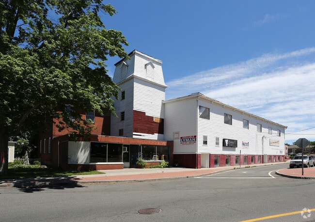
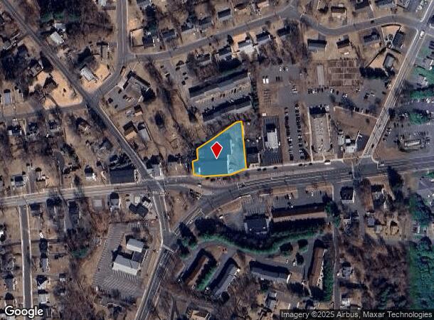
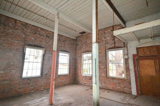
Property Record
501 Middle Tpke E, Manchester, CT 06040
NEARBY LISTINGS FOR SALE OR LEASE
Property Detail
501 Middle Tpke E
MANC-000108-003950-000501
Hartford
Commercialbuilding
Connecticut
X
501
09003C0411F
1.03 AC
2025
Manchester
2025
Hartford
514700
Hartford-West Hartford-East Hartford, CT
33,948 SF
DEMOGRAPHICS near 501 Middle Tpke E
1 Mile
3 Mile
5 Mile
2024 Total Population
10,184
59,600
107,120
2029 Population
10,152
59,350
106,677
Pop Growth 2024-2029
(0.31%)
(0.42%)
(0.41%)
Average Age
42
40
41
2024 Total Households
4,110
25,064
43,970
HH Growth 2024-2029
(0.36%)
(0.47%)
(0.46%)
Median Household Inc
$93,603
$79,858
$86,840
Avg Household Size
2.40
2.30
2.40
2024 Avg HH Vehicles
2.00
2.00
2.00
Median Home Value
$214,940
$218,999
$249,059
Median Year Built
1954
1961
1968
Nearby Places
- Restaurants
- Banks
- Shops
- Fitness
- Groceries
PUBLIC TRANSPORTATION
AIRPORT
Bradley International
DRIVE
WALK
Distance
Bradley International
41 min
22.4 mi
SALE & LEASE HISTORY
LISTING DATE
SALE/LEASE

Sep 11, 2017
For Sale
Jun 13, 2023
For Sale
Feb 16, 2020
For Sale
Nearby Properties
Address
Land Use
TOTAL SIZE
Lot Size
Zoning
Address
Land Use
TOTAL SIZE
Lot Size
Zoning
12.54 AC
Address
Land Use
TOTAL SIZE
Lot Size
Zoning
467,349 SF
13.83 AC
CUD
Address
Land Use
TOTAL SIZE
Lot Size
Zoning
20,384 SF
40 AC
PRD
Address
Land Use
TOTAL SIZE
Lot Size
Zoning
28,608 SF
25.37 AC
CUD
Address
Land Use
TOTAL SIZE
Lot Size
Zoning
43.60 AC
PRD
Address
Land Use
TOTAL SIZE
Lot Size
Zoning
12,068 SF
21.79 AC
CUD
Address
Land Use
TOTAL SIZE
Lot Size
Zoning
29,744 SF
29.50 AC
PRD
Address
Land Use
TOTAL SIZE
Lot Size
Zoning
24.02 AC
COMMER
Address
Land Use
TOTAL SIZE
Lot Size
Zoning
53.59 AC
RA
Address
Land Use
TOTAL SIZE
Lot Size
Zoning
219,479 SF
9.32 AC
H
Address
Land Use
TOTAL SIZE
Lot Size
Zoning
19.60 AC
GB
Address
Land Use
TOTAL SIZE
Lot Size
Zoning
22.12 AC
FBZ
Address
Land Use
TOTAL SIZE
Lot Size
Zoning
68,988 SF
9.17 AC
GB
Address
Land Use
TOTAL SIZE
Lot Size
Zoning
6.38 AC
CBD
Address
Land Use
TOTAL SIZE
Lot Size
Zoning
79,198 SF
10.47 AC
RA
Address
Land Use
TOTAL SIZE
Lot Size
Zoning
195,772 SF
3.17 AC
H
Address
Land Use
TOTAL SIZE
Lot Size
Zoning
13.01 AC
B5
Address
Land Use
TOTAL SIZE
Lot Size
Zoning
7.11 AC
CUD
Address
Land Use
TOTAL SIZE
Lot Size
Zoning
144,679 SF
16.39 AC
CUD
Address
Land Use
TOTAL SIZE
Lot Size
Zoning
72,383 SF
14.10 AC
RR/RB
Address
Land Use
TOTAL SIZE
Lot Size
Zoning
6.80 AC
H
Address
Land Use
TOTAL SIZE
Lot Size
Zoning
16 AC
RA
Address
Land Use
TOTAL SIZE
Lot Size
Zoning
19.72 AC
GB
Address
Land Use
TOTAL SIZE
Lot Size
Zoning
16.18 AC
COMMER
Address
Land Use
TOTAL SIZE
Lot Size
Zoning
116,406 SF
10.64 AC
RA
Address
Land Use
TOTAL SIZE
Lot Size
Zoning
54,012 SF
16.64 AC
RA
Address
Land Use
TOTAL SIZE
Lot Size
Zoning
16.23 AC
CUD
Address
Land Use
TOTAL SIZE
Lot Size
Zoning
249,244 SF
27.23 AC
IND
Address
Land Use
TOTAL SIZE
Lot Size
Zoning
6.76 AC
B5
Address
Land Use
TOTAL SIZE
Lot Size
Zoning
106,866 SF
7.63 AC
GB
The World's #1 Commercial Real Estate Marketplace
Connect with us
© 2025 CoStar Group
The information above has been obtained from sources believed reliable. While we do not doubt its accuracy we have not verified it and make no guarantee, warranty or representation about it. It is your responsibility to independently confirm its accuracy and completeness. Any projections, opinions, assumptions, or estimates used are for example only and do not represent the current or future performance of the property. The value of this transaction to you depends on tax and other factors which should be evaluated by your tax, financial, and legal advisors. You and your advisors should conduct a careful, independent investigation of the property to determine to your satisfaction the suitability of the property for your needs.