Property Record
501 Black Satchel Rd, Charlotte, NC 28216


NEARBY LISTINGS FOR SALE OR LEASE
Property Detail
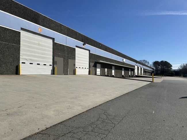
501 Black Satchel Rd
039-321-05
L1 M23-225
Industrialgeneral
Mecklenburg
X
North Carolina
3710453600K
1
2024
10.96 AC
2025
I-85/Beatties Ford Rd
004400
Charlotte
232,212 SF
Charlotte-Concord-Gastonia, NC-SC
DEMOGRAPHICS near 501 Black Satchel Rd
1 Mile
3 Mile
5 Mile
2024 Total Population
4,963
62,510
186,715
2029 Population
5,222
66,234
199,457
Pop Growth 2024-2029
+ 5.22%
+ 5.96%
+ 6.82%
Average Age
36
37
36
2024 Total Households
1,736
22,712
77,447
HH Growth 2024-2029
+ 5.30%
+ 6.05%
+ 7.16%
Median Household Inc
$44,084
$46,840
$60,751
Avg Household Size
2.80
2.60
2.30
2024 Avg HH Vehicles
2.00
2.00
2.00
Median Home Value
$182,886
$183,512
$227,849
Median Year Built
1994
1986
1999
Nearby Places
Map Layers
Map Styles
 Street
 Aerial
- Restaurants
- Banks
- Shops
- Fitness
- Groceries
PUBLIC TRANSPORTATION
COMMUTER RAIL
DRIVE
WALK
Distance
13 min
6.6 mi
AIRPORT
Charlotte/Douglas International
DRIVE
WALK
Distance
Charlotte/Douglas International
21 min
10.3 mi
Concord-Padgett Regional
DRIVE
WALK
Distance
Concord-Padgett Regional
27 min
17.5 mi
SALE & LEASE HISTORY
LISTING DATE
SALE/LEASE

Oct 24, 2023
For Lease
Nearby Properties
Address
Land Use
TOTAL SIZE
Lot Size
Zoning
Address
Land Use
TOTAL SIZE
Lot Size
Zoning
375,318 SF
37.31 AC
B2
Address
Land Use
TOTAL SIZE
Lot Size
Zoning
308,793 SF
47.41 AC
R5
Address
Land Use
TOTAL SIZE
Lot Size
Zoning
311,541 SF
40.41 AC
INST
Address
Land Use
TOTAL SIZE
Lot Size
Zoning
58,666 SF
7.47 AC
Address
Land Use
TOTAL SIZE
Lot Size
Zoning
187,636 SF
16.56 AC
R17MFCD
Address
Land Use
TOTAL SIZE
Lot Size
Zoning
634,939 SF
42.26 AC
I1CD
Address
Land Use
TOTAL SIZE
Lot Size
Zoning
242,699 SF
20.50 AC
R17MF
Address
Land Use
TOTAL SIZE
Lot Size
Zoning
238,075 SF
9.52 AC
Address
Land Use
TOTAL SIZE
Lot Size
Zoning
627,355 SF
45.41 AC
I2
Address
Land Use
TOTAL SIZE
Lot Size
Zoning
351,253 SF
27.85 AC
I-1(CD)
Address
Land Use
TOTAL SIZE
Lot Size
Zoning
174,768 SF
9.28 AC
INST(CD)
Address
Land Use
TOTAL SIZE
Lot Size
Zoning
205,067 SF
9.94 AC
R5
Address
Land Use
TOTAL SIZE
Lot Size
Zoning
346,795 SF
110.06 AC
I2
Address
Land Use
TOTAL SIZE
Lot Size
Zoning
15,869 SF
517.12 AC
R4
Address
Land Use
TOTAL SIZE
Lot Size
Zoning
2,967 SF
9.01 AC
R-17MF
Address
Land Use
TOTAL SIZE
Lot Size
Zoning
401,879 SF
20.57 AC
I-1
Address
Land Use
TOTAL SIZE
Lot Size
Zoning
289,084 SF
16 AC
I-1(CD)
Address
Land Use
TOTAL SIZE
Lot Size
Zoning
237,032 SF
8.57 AC
I2
Address
Land Use
TOTAL SIZE
Lot Size
Zoning
361,253 SF
30.87 AC
I2
Address
Land Use
TOTAL SIZE
Lot Size
Zoning
61,824 SF
10.19 AC
R-5
Address
Land Use
TOTAL SIZE
Lot Size
Zoning
269,210 SF
14.65 AC
I-1(CD)
Address
Land Use
TOTAL SIZE
Lot Size
Zoning
178,210 SF
28.55 AC
R3
Address
Land Use
TOTAL SIZE
Lot Size
Zoning
116,587 SF
12.80 AC
R17MF
Address
Land Use
TOTAL SIZE
Lot Size
Zoning
243,710 SF
14.67 AC
I1CD
Address
Land Use
TOTAL SIZE
Lot Size
Zoning
273,455 SF
43.63 AC
I2
Address
Land Use
TOTAL SIZE
Lot Size
Zoning
239,998 SF
14.51 AC
I1CD
Address
Land Use
TOTAL SIZE
Lot Size
Zoning
189,610 SF
16.23 AC
B2
Address
Land Use
TOTAL SIZE
Lot Size
Zoning
128,040 SF
7.81 AC
R17MF
Address
Land Use
TOTAL SIZE
Lot Size
Zoning
98,671 SF
27.64 AC
R22MF
The World's #1 Commercial Real Estate Marketplace
Connect with us
© 2026 CoStar Group
The information above has been obtained from sources believed reliable. While we do not doubt its accuracy we have not verified it and make no guarantee, warranty or representation about it. It is your responsibility to independently confirm its accuracy and completeness. Any projections, opinions, assumptions, or estimates used are for example only and do not represent the current or future performance of the property. The value of this transaction to you depends on tax and other factors which should be evaluated by your tax, financial, and legal advisors. You and your advisors should conduct a careful, independent investigation of the property to determine to your satisfaction the suitability of the property for your needs.