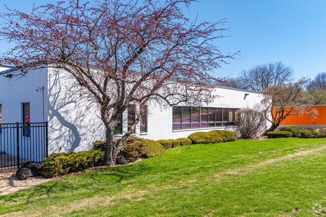
Property Record
501 Conde St, West Chicago, IL 60185


NEARBY LISTINGS FOR SALE OR LEASE
Property Detail
501 Conde St
Chicago-Naperville-Elgin, IL-IN-WI
Jel Sert Factory Plat
04-10-130-014
JEL SERT FACTORY PLAT OF CONSOLIDATION ALL
Industrialgeneral
DuPage
X
Illinois
17043C0039J
1
2024
16.21 AC
2024
Central Kane / DuPage
841504
Chicago
409,705 SF
DEMOGRAPHICS near 501 Conde St
1 Mile
3 Mile
5 Mile
2024 Total Population
12,794
35,644
127,265
2029 Population
12,399
34,278
123,486
Pop Growth 2024-2029
(3.09%)
(3.83%)
(2.97%)
Average Age
38
39
41
2024 Total Households
3,652
11,454
44,270
HH Growth 2024-2029
(3.45%)
(4.36%)
(3.07%)
Median Household Inc
$83,219
$94,947
$104,992
Avg Household Size
3.30
3.00
2.70
2024 Avg HH Vehicles
2.00
2.00
2.00
Median Home Value
$241,061
$283,747
$318,477
Median Year Built
1966
1977
1980
Nearby Places
Map Layers
Map Styles
 Street
 Aerial
- Restaurants
- Banks
- Shops
- Fitness
- Groceries
PUBLIC TRANSPORTATION
COMMUTER RAIL
West Chicago Station (Union Pacific West Line - Northeast Illinois Regional Commuter Railroad (Metra))
DRIVE
WALK
Distance
West Chicago Station (Union Pacific West Line - Northeast Illinois Regional Commuter Railroad (Metra))
2 min
15 min
0.4 mi
Winfield Station (Union Pacific West Line - Northeast Illinois Regional Commuter Railroad (Metra))
DRIVE
WALK
Distance
Winfield Station (Union Pacific West Line - Northeast Illinois Regional Commuter Railroad (Metra))
8 min
2.5 mi
AIRPORT
Chicago O'Hare International
DRIVE
WALK
Distance
Chicago O'Hare International
44 min
26.3 mi
Chicago Midway International
DRIVE
WALK
Distance
Chicago Midway International
50 min
28.8 mi
Freight Ports
Port Milwaukee
DRIVE
WALK
Distance
Port Milwaukee
125 min
98.3 mi
Nearby Properties
Address
Land Use
TOTAL SIZE
Lot Size
Zoning
Address
Land Use
TOTAL SIZE
Lot Size
Zoning
38.68 AC
Address
Land Use
TOTAL SIZE
Lot Size
Zoning
42.27 AC
Address
Land Use
TOTAL SIZE
Lot Size
Zoning
26,302 SF
2.09 AC
C
Address
Land Use
TOTAL SIZE
Lot Size
Zoning
Address
Land Use
TOTAL SIZE
Lot Size
Zoning
26.41 AC
Address
Land Use
TOTAL SIZE
Lot Size
Zoning
28.84 AC
Address
Land Use
TOTAL SIZE
Lot Size
Zoning
277,018 SF
12.36 AC
I
Address
Land Use
TOTAL SIZE
Lot Size
Zoning
242,748 SF
11.65 AC
R
Address
Land Use
TOTAL SIZE
Lot Size
Zoning
13.15 AC
R
Address
Land Use
TOTAL SIZE
Lot Size
Zoning
39.42 AC
Address
Land Use
TOTAL SIZE
Lot Size
Zoning
16.68 AC
I
Address
Land Use
TOTAL SIZE
Lot Size
Zoning
265,550 SF
17.04 AC
Address
Land Use
TOTAL SIZE
Lot Size
Zoning
168,302 SF
13.78 AC
I
Address
Land Use
TOTAL SIZE
Lot Size
Zoning
474,191 SF
29.95 AC
I
Address
Land Use
TOTAL SIZE
Lot Size
Zoning
291,219 SF
12.25 AC
I
Address
Land Use
TOTAL SIZE
Lot Size
Zoning
1,808 SF
0.19 AC
C
Address
Land Use
TOTAL SIZE
Lot Size
Zoning
137,196 SF
8.82 AC
R
Address
Land Use
TOTAL SIZE
Lot Size
Zoning
Address
Land Use
TOTAL SIZE
Lot Size
Zoning
80,180 SF
5.81 AC
R-4
Address
Land Use
TOTAL SIZE
Lot Size
Zoning
83,167 SF
4.46 AC
C
Address
Land Use
TOTAL SIZE
Lot Size
Zoning
181,420 SF
6.69 AC
I
Address
Land Use
TOTAL SIZE
Lot Size
Zoning
249,736 SF
11 AC
I
Address
Land Use
TOTAL SIZE
Lot Size
Zoning
6.55 AC
C
Address
Land Use
TOTAL SIZE
Lot Size
Zoning
108,825 SF
23.42 AC
C
Address
Land Use
TOTAL SIZE
Lot Size
Zoning
225,286 SF
18.87 AC
C
Address
Land Use
TOTAL SIZE
Lot Size
Zoning
14.09 AC
Address
Land Use
TOTAL SIZE
Lot Size
Zoning
153,965 SF
9.22 AC
I
Address
Land Use
TOTAL SIZE
Lot Size
Zoning
76,572 SF
12.88 AC
I
Address
Land Use
TOTAL SIZE
Lot Size
Zoning
227,708 SF
8.17 AC
I
The World's #1 Commercial Real Estate Marketplace
Connect with us
© 2025 CoStar Group
The information above has been obtained from sources believed reliable. While we do not doubt its accuracy we have not verified it and make no guarantee, warranty or representation about it. It is your responsibility to independently confirm its accuracy and completeness. Any projections, opinions, assumptions, or estimates used are for example only and do not represent the current or future performance of the property. The value of this transaction to you depends on tax and other factors which should be evaluated by your tax, financial, and legal advisors. You and your advisors should conduct a careful, independent investigation of the property to determine to your satisfaction the suitability of the property for your needs.