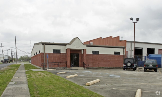
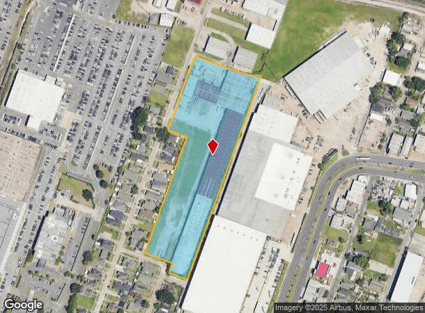
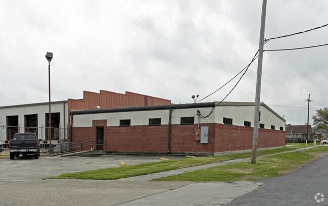
Property Record
501 Coolidge St, New Orleans, LA 70121
NEARBY LISTINGS FOR SALE OR LEASE
Property Detail
501 Coolidge St
New Orleans-Metairie, LA
Hyman Sub
0700000746
MAPS 6680 & 5578 HYMAN SUB
Realpropertynec
Jefferson
X
Louisiana
22051C0185F
22
2024
6.70 AC
2024
Jefferson
024900
New Orleans/Metairie/Kenner
DEMOGRAPHICS near 501 Coolidge St
1 Mile
3 Mile
5 Mile
2024 Total Population
8,114
135,921
346,559
2029 Population
7,830
130,706
334,485
Pop Growth 2024-2029
(3.50%)
(3.84%)
(3.48%)
Average Age
43
41
42
2024 Total Households
3,673
59,632
158,465
HH Growth 2024-2029
(3.70%)
(4.02%)
(3.50%)
Median Household Inc
$52,295
$62,276
$58,762
Avg Household Size
2.10
2.10
2.10
2024 Avg HH Vehicles
1.00
1.00
1.00
Median Home Value
$285,237
$330,386
$331,379
Median Year Built
1955
1958
1959
Nearby Places
Map Layers
Map Styles
 Street
 Aerial
- Restaurants
- Banks
- Shops
- Fitness
- Groceries
PUBLIC TRANSPORTATION
COMMUTER RAIL
New Orleans Union Passenger Terminal (City of New Orleans - Amtrak, Crescent - Amtrak, Sunset Limited - Amtrak)
DRIVE
WALK
Distance
New Orleans Union Passenger Terminal (City of New Orleans - Amtrak, Crescent - Amtrak, Sunset Limited - Amtrak)
12 min
5.8 mi
AIRPORT
Louis Armstrong New Orleans International
DRIVE
WALK
Distance
Louis Armstrong New Orleans International
20 min
11.9 mi
Freight Ports
Port of New Orleans
DRIVE
WALK
Distance
Port of New Orleans
18 min
7.8 mi
Nearby Properties
Address
Land Use
TOTAL SIZE
Lot Size
Zoning
Address
Land Use
TOTAL SIZE
Lot Size
Zoning
80.92 AC
EC
Address
Land Use
TOTAL SIZE
Lot Size
Zoning
22.63 AC
Address
Land Use
TOTAL SIZE
Lot Size
Zoning
50.06 AC
R1A
Address
Land Use
TOTAL SIZE
Lot Size
Zoning
197,182 SF
0.01 AC
OS-R
Address
Land Use
TOTAL SIZE
Lot Size
Zoning
0.14 AC
Address
Land Use
TOTAL SIZE
Lot Size
Zoning
725,677 SF
54.19 AC
EC
Address
Land Use
TOTAL SIZE
Lot Size
Zoning
609,449 SF
2 AC
EC
Address
Land Use
TOTAL SIZE
Lot Size
Zoning
35.06 AC
Address
Land Use
TOTAL SIZE
Lot Size
Zoning
4.31 AC
BC2
Address
Land Use
TOTAL SIZE
Lot Size
Zoning
3.36 AC
EC
Address
Land Use
TOTAL SIZE
Lot Size
Zoning
315,570 SF
4.42 AC
HU-RM2
Address
Land Use
TOTAL SIZE
Lot Size
Zoning
2.20 AC
EC
Address
Land Use
TOTAL SIZE
Lot Size
Zoning
63.72 AC
OS-N
Address
Land Use
TOTAL SIZE
Lot Size
Zoning
0.08 AC
Address
Land Use
TOTAL SIZE
Lot Size
Zoning
Address
Land Use
TOTAL SIZE
Lot Size
Zoning
66.97 AC
LI
Address
Land Use
TOTAL SIZE
Lot Size
Zoning
Address
Land Use
TOTAL SIZE
Lot Size
Zoning
11.29 AC
HU-RD1
Address
Land Use
TOTAL SIZE
Lot Size
Zoning
Address
Land Use
TOTAL SIZE
Lot Size
Zoning
20.13 AC
EC
Address
Land Use
TOTAL SIZE
Lot Size
Zoning
Address
Land Use
TOTAL SIZE
Lot Size
Zoning
25,744 SF
14.18 AC
LI
Address
Land Use
TOTAL SIZE
Lot Size
Zoning
Address
Land Use
TOTAL SIZE
Lot Size
Zoning
9.02 AC
HU-RD2
Address
Land Use
TOTAL SIZE
Lot Size
Zoning
7,468 SF
8.13 AC
HU-RD2
Address
Land Use
TOTAL SIZE
Lot Size
Zoning
39,963 SF
110.36 AC
OS-N
Address
Land Use
TOTAL SIZE
Lot Size
Zoning
96,000 SF
1.85 AC
HU-RD2
Address
Land Use
TOTAL SIZE
Lot Size
Zoning
2.27 AC
HU-RD2
Address
Land Use
TOTAL SIZE
Lot Size
Zoning
Address
Land Use
TOTAL SIZE
Lot Size
Zoning
114,454 SF
3.05 AC
MU-1
The World's #1 Commercial Real Estate Marketplace
Connect with us
© 2025 CoStar Group
The information above has been obtained from sources believed reliable. While we do not doubt its accuracy we have not verified it and make no guarantee, warranty or representation about it. It is your responsibility to independently confirm its accuracy and completeness. Any projections, opinions, assumptions, or estimates used are for example only and do not represent the current or future performance of the property. The value of this transaction to you depends on tax and other factors which should be evaluated by your tax, financial, and legal advisors. You and your advisors should conduct a careful, independent investigation of the property to determine to your satisfaction the suitability of the property for your needs.