Property Record
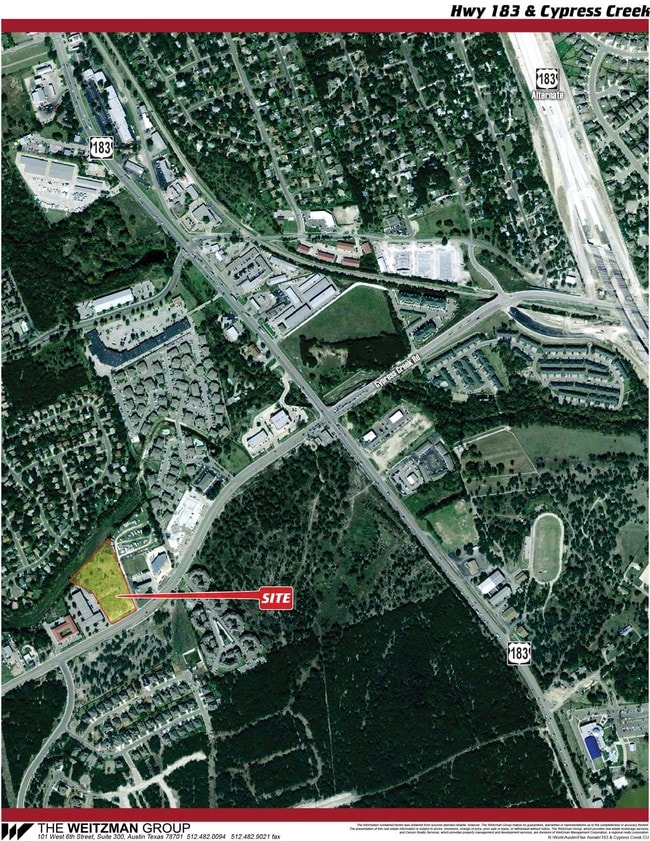
501 Cypress Creek Rd, Cedar Park, TX 78613


Property Detail
501 Cypress Creek Rd
Austin-Round Rock-San Marcos, TX
S7497 - BUTTERCUP CREEK INDUSTRIAL PARK LT 5 RESUB, LOT 5, ACRES 3.47
R032711
WILLIAMSON
Taxexempt
Texas
2-LI
5
B and X Area of moderate flood hazard, usually the area between the limits of the 100-year and 500-year floods.
3.47 AC
2024
Cedar Park
2025
Austin
020336
NEARBY LISTINGS FOR SALE OR LEASE
DEMOGRAPHICS near 501 Cypress Creek Rd
1 mile
3 mile
5 mile
2024 Total Population
11,922
95,617
229,969
2029 Population
13,408
107,274
257,228
Pop Growth 2024-2029
+ 12.46%
+ 12.19%
+ 11.85%
Average Age
38
38
37
2024 Total Households
4,632
37,169
87,015
HH Growth 2024-2029
+ 12.95%
+ 12.92%
+ 12.51%
Median Household Inc
$105,705
$114,416
$122,816
Avg Household Size
2.60
2.50
2.60
2024 Avg HH Vehicles
2.00
2.00
2.00
Median Home Value
$474,719
$489,670
$558,328
Median Year Built
1997
2004
2003
Nearby Places
Map Layers
Map Styles
 Street
 Aerial
Transit
 Traffic
 Biking
Places
Listings with unknown addresses are not visible on the map
- Restaurants
- Banks
- Shops
- Fitness
- Groceries
PUBLIC TRANSPORTATION
AIRPORT
Austin-Bergstrom International
Drive
Walk
Distance
Austin-Bergstrom International
43 min
30.6 mi
Freight Ports
Calhoun Port
Drive
Walk
Distance
Calhoun Port
208 min
174.1 mi
SALE & LEASE HISTORY
LISTING DATE
SALE/LEASE

May 07, 2018
For Sale
Jan 18, 2021
For Sale
Apr 17, 2023
For Sale
Nearby Properties
Address
Land Use
TOTAL SIZE
Lot Size
Zoning
Address
Land Use
TOTAL SIZE
Lot Size
Zoning
535,000 SF
24.46 AC
Address
Land Use
TOTAL SIZE
Lot Size
Zoning
676,868 SF
13.54 AC
3-PD
Address
Land Use
TOTAL SIZE
Lot Size
Zoning
557,037 SF
29.48 AC
Address
Land Use
TOTAL SIZE
Lot Size
Zoning
256,338 SF
26.47 AC
Address
Land Use
TOTAL SIZE
Lot Size
Zoning
338,919 SF
42.88 AC
Address
Land Use
TOTAL SIZE
Lot Size
Zoning
277,152 SF
45.29 AC
Address
Land Use
TOTAL SIZE
Lot Size
Zoning
376,081 SF
8.62 AC
Address
Land Use
TOTAL SIZE
Lot Size
Zoning
363,544 SF
8.54 AC
Address
Land Use
TOTAL SIZE
Lot Size
Zoning
423,057 SF
21.90 AC
4-GRMUCO
Address
Land Use
TOTAL SIZE
Lot Size
Zoning
369,192 SF
78.87 AC
Address
Land Use
TOTAL SIZE
Lot Size
Zoning
385,918 SF
23.61 AC
Address
Land Use
TOTAL SIZE
Lot Size
Zoning
370,331 SF
14.10 AC
Address
Land Use
TOTAL SIZE
Lot Size
Zoning
557,037 SF
32.48 AC
Address
Land Use
TOTAL SIZE
Lot Size
Zoning
468,870 SF
22 AC
4-GRMUCO
Address
Land Use
TOTAL SIZE
Lot Size
Zoning
644,443 SF
7.02 AC
Address
Land Use
TOTAL SIZE
Lot Size
Zoning
320,454 SF
19.56 AC
Address
Land Use
TOTAL SIZE
Lot Size
Zoning
313,727 SF
6.64 AC
Address
Land Use
TOTAL SIZE
Lot Size
Zoning
324,508 SF
24.08 AC
Address
Land Use
TOTAL SIZE
Lot Size
Zoning
197,066 SF
16.10 AC
Address
Land Use
TOTAL SIZE
Lot Size
Zoning
301,811 SF
18.22 AC
Address
Land Use
TOTAL SIZE
Lot Size
Zoning
338,434 SF
40.57 AC
3-PD
Address
Land Use
TOTAL SIZE
Lot Size
Zoning
365,955 SF
22.84 AC
Address
Land Use
TOTAL SIZE
Lot Size
Zoning
272,168 SF
5.12 AC
Address
Land Use
TOTAL SIZE
Lot Size
Zoning
239,754 SF
19.14 AC
3-PUD
Address
Land Use
TOTAL SIZE
Lot Size
Zoning
329,104 SF
19.97 AC
Address
Land Use
TOTAL SIZE
Lot Size
Zoning
395,632 SF
20.25 AC
Address
Land Use
TOTAL SIZE
Lot Size
Zoning
292,606 SF
12.98 AC
Address
Land Use
TOTAL SIZE
Lot Size
Zoning
306,445 SF
23.59 AC
Address
Land Use
TOTAL SIZE
Lot Size
Zoning
275,271 SF
14.14 AC
Address
Land Use
TOTAL SIZE
Lot Size
Zoning
264,559 SF
12.23 AC
The World's #1 Commercial Real Estate Marketplace
Connect with us
© 2026 CoStar Group
The information above has been obtained from sources believed reliable. While we do not doubt its accuracy we have not verified it and make no guarantee, warranty or representation about it. It is your responsibility to independently confirm its accuracy and completeness. Any projections, opinions, assumptions, or estimates used are for example only and do not represent the current or future performance of the property. The value of this transaction to you depends on tax and other factors which should be evaluated by your tax, financial, and legal advisors. You and your advisors should conduct a careful, independent investigation of the property to determine to your satisfaction the suitability of the property for your needs.