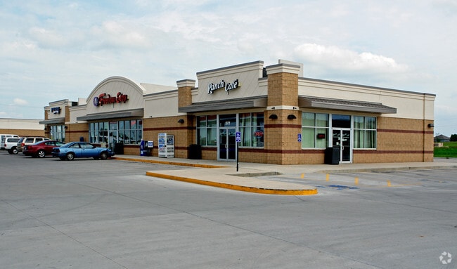
Property Record
501 E Walnut St, Raymore, MO 64083

Property Detail
501 E Walnut St
Kansas City, MO-KS
JOHNSTON IND PARK ADD & RESUR TRACT A
2242488
CASS
Restaurantbuilding
Missouri
B and X Area of moderate flood hazard, usually the area between the limits of the 100-year and 500-year floods.
a
2024
2.68 AC
2025
Cass County
060308
Kansas City
19,279 SF
NEARBY LISTINGS FOR SALE OR LEASE
DEMOGRAPHICS near 501 E Walnut St
1 mile
3 mile
5 mile
2025 Total Population
6,237
27,407
64,810
2030 Population
6,568
28,759
67,718
Pop Growth 2025-2030
+ 5.31%
+ 4.93%
+ 4.49%
Average Age
41
41
40
2025 Total Households
2,379
10,117
24,149
HH Growth 2025-2030
+ 5.46%
+ 5.05%
+ 4.70%
Median Household Inc
$78,691
$96,359
$93,252
Avg Household Size
2.60
2.70
2.60
2025 Avg HH Vehicles
2.00
2.00
2.00
Median Home Value
$262,552
$325,885
$331,131
Median Year Built
1993
2000
1999
Nearby Places
Map Layers
Map Styles
 Street
 Aerial
Transit
 Traffic
 Biking
Places
Listings with unknown addresses are not visible on the map
- Restaurants
- Banks
- Shops
- Fitness
- Groceries
SALE & LEASE HISTORY
LISTING DATE
SALE/LEASE

Sep 23, 2016
For Sale
Jun 29, 2017
For Lease
Nearby Properties
Address
Land Use
TOTAL SIZE
Lot Size
Zoning
Address
Land Use
TOTAL SIZE
Lot Size
Zoning
28.36 AC
Address
Land Use
TOTAL SIZE
Lot Size
Zoning
4,954 SF
23.93 AC
Address
Land Use
TOTAL SIZE
Lot Size
Zoning
15.22 AC
Address
Land Use
TOTAL SIZE
Lot Size
Zoning
3.31 AC
Address
Land Use
TOTAL SIZE
Lot Size
Zoning
2.23 AC
Address
Land Use
TOTAL SIZE
Lot Size
Zoning
50,121 SF
2.98 AC
Address
Land Use
TOTAL SIZE
Lot Size
Zoning
80,456 SF
8.23 AC
Address
Land Use
TOTAL SIZE
Lot Size
Zoning
2.18 AC
Address
Land Use
TOTAL SIZE
Lot Size
Zoning
53,306 SF
6.70 AC
Address
Land Use
TOTAL SIZE
Lot Size
Zoning
181,400 SF
12.23 AC
Address
Land Use
TOTAL SIZE
Lot Size
Zoning
1.94 AC
Address
Land Use
TOTAL SIZE
Lot Size
Zoning
1.76 AC
Address
Land Use
TOTAL SIZE
Lot Size
Zoning
5.46 AC
Address
Land Use
TOTAL SIZE
Lot Size
Zoning
594,769 SF
18.43 AC
Address
Land Use
TOTAL SIZE
Lot Size
Zoning
25,484 SF
2.13 AC
Address
Land Use
TOTAL SIZE
Lot Size
Zoning
611,460 SF
23.70 AC
Address
Land Use
TOTAL SIZE
Lot Size
Zoning
137,544 SF
11.36 AC
Address
Land Use
TOTAL SIZE
Lot Size
Zoning
137,824 SF
13.62 AC
Address
Land Use
TOTAL SIZE
Lot Size
Zoning
Address
Land Use
TOTAL SIZE
Lot Size
Zoning
19,714 SF
8.40 AC
Address
Land Use
TOTAL SIZE
Lot Size
Zoning
Address
Land Use
TOTAL SIZE
Lot Size
Zoning
20,980 SF
3.06 AC
Address
Land Use
TOTAL SIZE
Lot Size
Zoning
14,466 SF
1.44 AC
Address
Land Use
TOTAL SIZE
Lot Size
Zoning
8,800 SF
1.26 AC
Address
Land Use
TOTAL SIZE
Lot Size
Zoning
103,066 SF
4.86 AC
Address
Land Use
TOTAL SIZE
Lot Size
Zoning
15,336 SF
3.06 AC
Address
Land Use
TOTAL SIZE
Lot Size
Zoning
116,250 SF
6.71 AC
Address
Land Use
TOTAL SIZE
Lot Size
Zoning
218,689 SF
10.37 AC
Address
Land Use
TOTAL SIZE
Lot Size
Zoning
8,499 SF
1.65 AC
Address
Land Use
TOTAL SIZE
Lot Size
Zoning
18,946 SF
3.90 AC
The World's #1 Commercial Real Estate Marketplace
Connect with us
© 2026 CoStar Group
The information above has been obtained from sources believed reliable. While we do not doubt its accuracy we have not verified it and make no guarantee, warranty or representation about it. It is your responsibility to independently confirm its accuracy and completeness. Any projections, opinions, assumptions, or estimates used are for example only and do not represent the current or future performance of the property. The value of this transaction to you depends on tax and other factors which should be evaluated by your tax, financial, and legal advisors. You and your advisors should conduct a careful, independent investigation of the property to determine to your satisfaction the suitability of the property for your needs.