Property Record
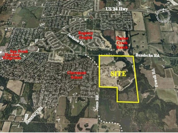
501 N Jones Rd, Independence, MO 64056

NEARBY LISTINGS FOR SALE OR LEASE
Property Detail
501 N Jones Rd
16-700-02-01-00-0-00-000
SEC 33 TWP 50 RNG 31 36 AC N 34 AC OF NE NW & N 2 AC OF NW N W 1/4
Agriculturalland
Jackson
X
Missouri
29095C0302G
36 AC
2024
East Jackson County
2025
Kansas City
011406
Kansas City, MO-KS
DEMOGRAPHICS near 501 N Jones Rd
1 Mile
3 Mile
5 Mile
2024 Total Population
3,491
29,220
69,685
2029 Population
3,440
28,840
68,933
Pop Growth 2024-2029
(1.46%)
(1.30%)
(1.08%)
Average Age
37
39
40
2024 Total Households
1,205
10,919
27,985
HH Growth 2024-2029
(1.58%)
(1.44%)
(1.20%)
Median Household Inc
$73,080
$63,954
$63,107
Avg Household Size
2.80
2.60
2.40
2024 Avg HH Vehicles
2.00
2.00
2.00
Median Home Value
$156,063
$178,004
$179,133
Median Year Built
1975
1975
1972
Nearby Places
Map Layers
Map Styles
 Street
 Aerial
- Restaurants
- Banks
- Shops
- Fitness
- Groceries
PUBLIC TRANSPORTATION
COMMUTER RAIL
Independence Amtrak Station (Lincoln Service Missouri River Runner - Amtrak, Missouri River Runner - Amtrak)
DRIVE
WALK
Distance
Independence Amtrak Station (Lincoln Service Missouri River Runner - Amtrak, Missouri River Runner - Amtrak)
15 min
6.4 mi
AIRPORT
Kansas City International
DRIVE
WALK
Distance
Kansas City International
46 min
30.8 mi
Freight Ports
Tulsa Port Of Catoosa
DRIVE
WALK
Distance
Tulsa Port Of Catoosa
286 min
254.4 mi
Nearby Properties
Address
Land Use
TOTAL SIZE
Lot Size
Zoning
Address
Land Use
TOTAL SIZE
Lot Size
Zoning
250,196 SF
39.50 AC
Address
Land Use
TOTAL SIZE
Lot Size
Zoning
Address
Land Use
TOTAL SIZE
Lot Size
Zoning
287,132 SF
Address
Land Use
TOTAL SIZE
Lot Size
Zoning
193,191 SF
4.14 AC
Address
Land Use
TOTAL SIZE
Lot Size
Zoning
286,547 SF
Address
Land Use
TOTAL SIZE
Lot Size
Zoning
60,949 SF
16.90 AC
Address
Land Use
TOTAL SIZE
Lot Size
Zoning
157,429 SF
36.60 AC
Address
Land Use
TOTAL SIZE
Lot Size
Zoning
56,664 SF
Address
Land Use
TOTAL SIZE
Lot Size
Zoning
111,445 SF
8 AC
Address
Land Use
TOTAL SIZE
Lot Size
Zoning
24,225 SF
Address
Land Use
TOTAL SIZE
Lot Size
Zoning
104,740 SF
7.25 AC
Address
Land Use
TOTAL SIZE
Lot Size
Zoning
158,109 SF
2.77 AC
Address
Land Use
TOTAL SIZE
Lot Size
Zoning
48,330 SF
12.31 AC
Address
Land Use
TOTAL SIZE
Lot Size
Zoning
246,652 SF
5.07 AC
Address
Land Use
TOTAL SIZE
Lot Size
Zoning
46,489 SF
2.07 AC
Address
Land Use
TOTAL SIZE
Lot Size
Zoning
152,806 SF
94.25 AC
Address
Land Use
TOTAL SIZE
Lot Size
Zoning
47,978 SF
10.20 AC
Address
Land Use
TOTAL SIZE
Lot Size
Zoning
4,200,000 SF
0.66 AC
Address
Land Use
TOTAL SIZE
Lot Size
Zoning
62,070 SF
5.35 AC
Address
Land Use
TOTAL SIZE
Lot Size
Zoning
70,053 SF
2.98 AC
Address
Land Use
TOTAL SIZE
Lot Size
Zoning
15,015 SF
1.96 AC
Address
Land Use
TOTAL SIZE
Lot Size
Zoning
138,554 SF
15.62 AC
Address
Land Use
TOTAL SIZE
Lot Size
Zoning
Address
Land Use
TOTAL SIZE
Lot Size
Zoning
111,555 SF
5.54 AC
Address
Land Use
TOTAL SIZE
Lot Size
Zoning
59,939 SF
9.10 AC
Address
Land Use
TOTAL SIZE
Lot Size
Zoning
45,727 SF
9.50 AC
Address
Land Use
TOTAL SIZE
Lot Size
Zoning
38,765 SF
7 AC
Address
Land Use
TOTAL SIZE
Lot Size
Zoning
118.35 AC
Address
Land Use
TOTAL SIZE
Lot Size
Zoning
60,505 SF
128.04 AC
Address
Land Use
TOTAL SIZE
Lot Size
Zoning
5,832 SF
2.37 AC
The World's #1 Commercial Real Estate Marketplace
Connect with us
© 2026 CoStar Group
The information above has been obtained from sources believed reliable. While we do not doubt its accuracy we have not verified it and make no guarantee, warranty or representation about it. It is your responsibility to independently confirm its accuracy and completeness. Any projections, opinions, assumptions, or estimates used are for example only and do not represent the current or future performance of the property. The value of this transaction to you depends on tax and other factors which should be evaluated by your tax, financial, and legal advisors. You and your advisors should conduct a careful, independent investigation of the property to determine to your satisfaction the suitability of the property for your needs.