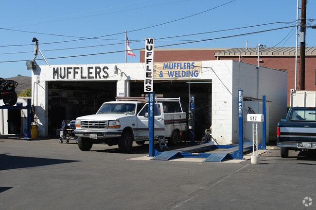
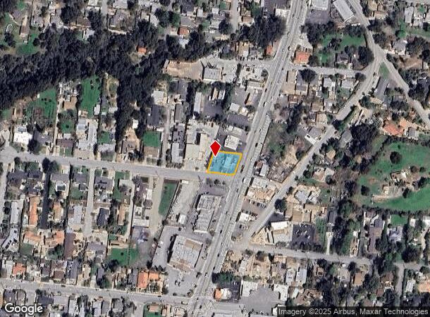
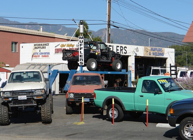
Property Record
501 N Ventura St, Ojai, CA 93023
NEARBY LISTINGS FOR SALE OR LEASE
Property Detail
501 N Ventura St
Oxnard-Thousand Oaks-Ventura, CA
Kunkle Tract #1
061-0-080-110
LOT: 16 REF: 013MR 091
Autorepair
Ventura
X
California
06111C0568F
16
2024
0.25 AC
2025
Ojai/NW County
000903
Los Angeles
1,968 SF
DEMOGRAPHICS near 501 N Ventura St
1 Mile
3 Mile
5 Mile
2024 Total Population
4,404
12,011
22,467
2029 Population
4,331
11,815
22,098
Pop Growth 2024-2029
(1.66%)
(1.63%)
(1.64%)
Average Age
43
45
45
2024 Total Households
1,614
4,557
8,521
HH Growth 2024-2029
(1.80%)
(1.76%)
(1.77%)
Median Household Inc
$98,664
$95,639
$90,189
Avg Household Size
2.70
2.60
2.50
2024 Avg HH Vehicles
3.00
2.00
2.00
Median Home Value
$755,033
$772,795
$763,771
Median Year Built
1963
1965
1966
Nearby Places
- Restaurants
- Banks
- Shops
- Fitness
- Groceries
PUBLIC TRANSPORTATION
COMMUTER RAIL
Ventura Amtrak (Metrolink Ventura County Line - Amtrak, Pacific Surfliner - Amtrak)
DRIVE
WALK
Distance
Ventura Amtrak (Metrolink Ventura County Line - Amtrak, Pacific Surfliner - Amtrak)
15 min
9.2 mi
Freight Ports
The Port of Hueneme
DRIVE
WALK
Distance
The Port of Hueneme
34 min
22.0 mi
Nearby Properties
Address
Land Use
TOTAL SIZE
Lot Size
Zoning
Address
Land Use
TOTAL SIZE
Lot Size
Zoning
37,790 SF
5.13 AC
RPD-10U
Address
Land Use
TOTAL SIZE
Lot Size
Zoning
4,900 SF
11.01 AC
Address
Land Use
TOTAL SIZE
Lot Size
Zoning
1,440 SF
98.32 AC
AE
Address
Land Use
TOTAL SIZE
Lot Size
Zoning
15,668 SF
1.46 AC
CPD
Address
Land Use
TOTAL SIZE
Lot Size
Zoning
36.15 AC
RA20AC
Address
Land Use
TOTAL SIZE
Lot Size
Zoning
0.67 AC
Address
Land Use
TOTAL SIZE
Lot Size
Zoning
2,257 SF
162.04 AC
Address
Land Use
TOTAL SIZE
Lot Size
Zoning
1,170 SF
106.57 AC
Address
Land Use
TOTAL SIZE
Lot Size
Zoning
36.20 AC
AE
Address
Land Use
TOTAL SIZE
Lot Size
Zoning
3,630 SF
45.17 AC
OS-40
Address
Land Use
TOTAL SIZE
Lot Size
Zoning
83.56 AC
Address
Land Use
TOTAL SIZE
Lot Size
Zoning
37,014 SF
1.41 AC
M1
Address
Land Use
TOTAL SIZE
Lot Size
Zoning
434 SF
0.50 AC
CPD
Address
Land Use
TOTAL SIZE
Lot Size
Zoning
1.20 AC
RPD-4U
Address
Land Use
TOTAL SIZE
Lot Size
Zoning
3,024 SF
328.74 AC
AEA-E/
Address
Land Use
TOTAL SIZE
Lot Size
Zoning
1,050 SF
0.77 AC
CPD
Address
Land Use
TOTAL SIZE
Lot Size
Zoning
3,019 SF
11.28 AC
RE2AC
Address
Land Use
TOTAL SIZE
Lot Size
Zoning
4,862 SF
34.23 AC
OS40AC
Address
Land Use
TOTAL SIZE
Lot Size
Zoning
21.90 AC
Address
Land Use
TOTAL SIZE
Lot Size
Zoning
12,951 SF
1.35 AC
CPD
Address
Land Use
TOTAL SIZE
Lot Size
Zoning
28.69 AC
OS40AC
Address
Land Use
TOTAL SIZE
Lot Size
Zoning
3,349 SF
5.24 AC
AE/SRP
Address
Land Use
TOTAL SIZE
Lot Size
Zoning
0.73 AC
RE20
Address
Land Use
TOTAL SIZE
Lot Size
Zoning
86.87 AC
OS40AC
Address
Land Use
TOTAL SIZE
Lot Size
Zoning
2,118 SF
40 AC
Address
Land Use
TOTAL SIZE
Lot Size
Zoning
91.83 AC
AEA-E/
Address
Land Use
TOTAL SIZE
Lot Size
Zoning
792 SF
0.72 AC
R2
Address
Land Use
TOTAL SIZE
Lot Size
Zoning
35.91 AC
Address
Land Use
TOTAL SIZE
Lot Size
Zoning
80.79 AC
OS40AC
Address
Land Use
TOTAL SIZE
Lot Size
Zoning
155.56 AC
The World's #1 Commercial Real Estate Marketplace
Connect with us
© 2025 CoStar Group
The information above has been obtained from sources believed reliable. While we do not doubt its accuracy we have not verified it and make no guarantee, warranty or representation about it. It is your responsibility to independently confirm its accuracy and completeness. Any projections, opinions, assumptions, or estimates used are for example only and do not represent the current or future performance of the property. The value of this transaction to you depends on tax and other factors which should be evaluated by your tax, financial, and legal advisors. You and your advisors should conduct a careful, independent investigation of the property to determine to your satisfaction the suitability of the property for your needs.