Property Record
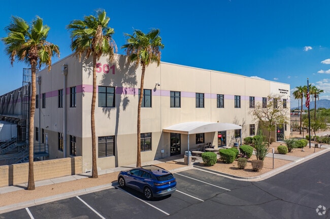
501 S 107Th Ave, Tolleson, AZ 85353


NEARBY LISTINGS FOR SALE OR LEASE
Property Detail
501 S 107Th Ave
101-02-971G
TH POR SW4 SEC 8 DAF COM SW COR SD SEC TH N 633.62F TH E 40F TO POB TH N 605.58F TH E 15F TH N 44D 48M E 57.02F TO A PT TH E 1611.47F TH ELY 28.19F ALG A CUR CON TO SW HAV RAD 60F TH ELY 87.27F ALG A CUR CON TO NW HAV RAD 60F TH S 62D 28M E 132.15F T
Warehouse
Maricopa
AE
Arizona
04013C2160M
37.34 AC
2025
Tolleson
2025
Phoenix
083000
Phoenix-Mesa-Scottsdale, AZ
136,818 SF
DEMOGRAPHICS near 501 S 107Th Ave
1 Mile
3 Mile
5 Mile
2024 Total Population
10,126
97,567
232,630
2029 Population
10,757
105,432
251,713
Pop Growth 2024-2029
+ 6.23%
+ 8.06%
+ 8.20%
Average Age
32
32
33
2024 Total Households
2,637
27,358
67,284
HH Growth 2024-2029
+ 6.33%
+ 8.18%
+ 8.27%
Median Household Inc
$73,654
$78,262
$71,774
Avg Household Size
3.70
3.50
3.30
2024 Avg HH Vehicles
2.00
2.00
2.00
Median Home Value
$283,096
$304,088
$297,312
Median Year Built
2004
2004
2001
Nearby Places
Map Layers
Map Styles
 Street
 Aerial
- Restaurants
- Banks
- Shops
- Fitness
- Groceries
PUBLIC TRANSPORTATION
AIRPORT
Phoenix Sky Harbor International
DRIVE
WALK
Distance
Phoenix Sky Harbor International
30 min
20.0 mi
Nearby Properties
Address
Land Use
TOTAL SIZE
Lot Size
Zoning
Address
Land Use
TOTAL SIZE
Lot Size
Zoning
12.80 AC
Address
Land Use
TOTAL SIZE
Lot Size
Zoning
206.08 AC
PAD
Address
Land Use
TOTAL SIZE
Lot Size
Zoning
Address
Land Use
TOTAL SIZE
Lot Size
Zoning
Address
Land Use
TOTAL SIZE
Lot Size
Zoning
889,089 SF
83.11 AC
I-1
Address
Land Use
TOTAL SIZE
Lot Size
Zoning
134.65 AC
S1
Address
Land Use
TOTAL SIZE
Lot Size
Zoning
177,052 SF
2.69 AC
THEBLVDD
Address
Land Use
TOTAL SIZE
Lot Size
Zoning
728,550 SF
41.98 AC
Address
Land Use
TOTAL SIZE
Lot Size
Zoning
287,294 SF
67.46 AC
PAD
Address
Land Use
TOTAL SIZE
Lot Size
Zoning
301,329 SF
50.60 AC
AG
Address
Land Use
TOTAL SIZE
Lot Size
Zoning
763,410 SF
45.50 AC
Address
Land Use
TOTAL SIZE
Lot Size
Zoning
697,149 SF
37.60 AC
CP/GCP
Address
Land Use
TOTAL SIZE
Lot Size
Zoning
369,413 SF
16.39 AC
THEBLVDD
Address
Land Use
TOTAL SIZE
Lot Size
Zoning
466,868 SF
45.99 AC
I-1
Address
Land Use
TOTAL SIZE
Lot Size
Zoning
432,022 SF
19.33 AC
PAD
Address
Land Use
TOTAL SIZE
Lot Size
Zoning
797,310 SF
36.82 AC
I-1
Address
Land Use
TOTAL SIZE
Lot Size
Zoning
628,480 SF
34.45 AC
PAD
Address
Land Use
TOTAL SIZE
Lot Size
Zoning
660,980 SF
40.15 AC
Address
Land Use
TOTAL SIZE
Lot Size
Zoning
397,132 SF
27.52 AC
I1
Address
Land Use
TOTAL SIZE
Lot Size
Zoning
487,424 SF
30.05 AC
CPGCP
Address
Land Use
TOTAL SIZE
Lot Size
Zoning
370,522 SF
9.45 AC
Address
Land Use
TOTAL SIZE
Lot Size
Zoning
409,088 SF
21.34 AC
PAD
Address
Land Use
TOTAL SIZE
Lot Size
Zoning
630,285 SF
36.02 AC
R-43AG
Address
Land Use
TOTAL SIZE
Lot Size
Zoning
13.45 AC
Address
Land Use
TOTAL SIZE
Lot Size
Zoning
386,100 SF
21.13 AC
I-2
Address
Land Use
TOTAL SIZE
Lot Size
Zoning
327,840 SF
22.20 AC
PAD
Address
Land Use
TOTAL SIZE
Lot Size
Zoning
535,852 SF
31.22 AC
I-1
Address
Land Use
TOTAL SIZE
Lot Size
Zoning
332,075 SF
19.15 AC
C2
Address
Land Use
TOTAL SIZE
Lot Size
Zoning
310,134 SF
64.97 AC
I-1
The World's #1 Commercial Real Estate Marketplace
Connect with us
© 2025 CoStar Group
The information above has been obtained from sources believed reliable. While we do not doubt its accuracy we have not verified it and make no guarantee, warranty or representation about it. It is your responsibility to independently confirm its accuracy and completeness. Any projections, opinions, assumptions, or estimates used are for example only and do not represent the current or future performance of the property. The value of this transaction to you depends on tax and other factors which should be evaluated by your tax, financial, and legal advisors. You and your advisors should conduct a careful, independent investigation of the property to determine to your satisfaction the suitability of the property for your needs.