Property Record
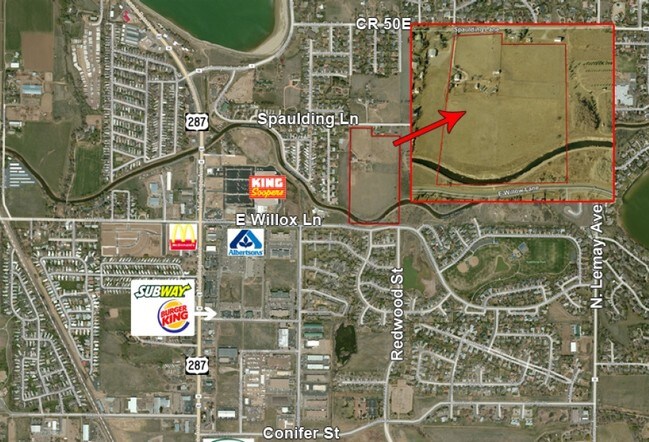
501 Spaulding Ln, Fort Collins, CO 80524

Property Detail
501 Spaulding Ln
98363-00-013
BEG AT S 1/4 COR 36-8-69, TH N 00 21 W 1167.7 FT; TH S 89 35 W 375 FT; TH N 00 21 W 158 FT TO PT ON N LN SE 1/4 OF SW 1/4; TH S 89 35 W 283.57 FT; TH S 00 16 E 1322.86 FT; TH N 89 50 E 660.5 FT TPOB; FTC, LESS 86061144
Farms
Larimer
FA
Colorado
AE The base floodplain where base flood elevations are provided. AE Zones are now used on new format FIRMs instead of A1-A30 Zones.
18.50 AC
2024
Fort Collins/Loveland
2025
Denver
001307
Fort Collins-Loveland, CO
1,548 SF
NEARBY LISTINGS FOR SALE OR LEASE
DEMOGRAPHICS near 501 Spaulding Ln
1 mile
3 mile
5 mile
2025 Total Population
7,475
47,504
127,503
2030 Population
7,789
49,248
132,312
Pop Growth 2025-2030
+ 4.20%
+ 3.67%
+ 3.77%
Average Age
39
36
36
2025 Total Households
2,977
17,973
51,626
HH Growth 2025-2030
+ 4.33%
+ 4.13%
+ 4.27%
Median Household Inc
$70,704
$69,567
$69,719
Avg Household Size
2.40
2.30
2.20
2025 Avg HH Vehicles
2.00
2.00
2.00
Median Home Value
$487,173
$626,760
$580,216
Median Year Built
1989
1984
1986
Nearby Places
Map Layers
Map Styles
 Street
 Aerial
Transit
 Traffic
 Biking
Places
Listings with unknown addresses are not visible on the map
- Restaurants
- Banks
- Shops
- Fitness
- Groceries
SALE & LEASE HISTORY
LISTING DATE
SALE/LEASE

Sep 24, 2016
For Sale
Nearby Properties
Address
Land Use
TOTAL SIZE
Lot Size
Zoning
Address
Land Use
TOTAL SIZE
Lot Size
Zoning
850,000 SF
21.76 AC
E
Address
Land Use
TOTAL SIZE
Lot Size
Zoning
1,096,874 SF
72 AC
CSU
Address
Land Use
TOTAL SIZE
Lot Size
Zoning
333,130 SF
47.74 AC
Address
Land Use
TOTAL SIZE
Lot Size
Zoning
172,211 SF
1.92 AC
D
Address
Land Use
TOTAL SIZE
Lot Size
Zoning
281,945 SF
15.01 AC
NCL
Address
Land Use
TOTAL SIZE
Lot Size
Zoning
155,149 SF
3.67 AC
D
Address
Land Use
TOTAL SIZE
Lot Size
Zoning
290,000 SF
3.67 AC
D
Address
Land Use
TOTAL SIZE
Lot Size
Zoning
191,673 SF
17.39 AC
I
Address
Land Use
TOTAL SIZE
Lot Size
Zoning
211,255 SF
20.73 AC
C
Address
Land Use
TOTAL SIZE
Lot Size
Zoning
400,000 SF
1.31 AC
D
Address
Land Use
TOTAL SIZE
Lot Size
Zoning
87,563 SF
3.15 AC
Address
Land Use
TOTAL SIZE
Lot Size
Zoning
110,700 SF
44.74 AC
FA
Address
Land Use
TOTAL SIZE
Lot Size
Zoning
107,170 SF
14.61 AC
Address
Land Use
TOTAL SIZE
Lot Size
Zoning
116,589 SF
0.87 AC
Address
Land Use
TOTAL SIZE
Lot Size
Zoning
112,289 SF
10.33 AC
CCN
Address
Land Use
TOTAL SIZE
Lot Size
Zoning
61,248 SF
3.67 AC
D
Address
Land Use
TOTAL SIZE
Lot Size
Zoning
242,800 SF
1.82 AC
E
Address
Land Use
TOTAL SIZE
Lot Size
Zoning
47,421 SF
6.40 AC
POL
Address
Land Use
TOTAL SIZE
Lot Size
Zoning
148,194 SF
2.04 AC
Address
Land Use
TOTAL SIZE
Lot Size
Zoning
67,939 SF
0.60 AC
Address
Land Use
TOTAL SIZE
Lot Size
Zoning
352,644 SF
2.58 AC
Address
Land Use
TOTAL SIZE
Lot Size
Zoning
86,564 SF
5.19 AC
D
Address
Land Use
TOTAL SIZE
Lot Size
Zoning
118,056 SF
0.80 AC
Address
Land Use
TOTAL SIZE
Lot Size
Zoning
48,826 SF
8.29 AC
POL
Address
Land Use
TOTAL SIZE
Lot Size
Zoning
57,000 SF
11.80 AC
Address
Land Use
TOTAL SIZE
Lot Size
Zoning
104,866 SF
8.23 AC
Address
Land Use
TOTAL SIZE
Lot Size
Zoning
225,160 SF
5.64 AC
Address
Land Use
TOTAL SIZE
Lot Size
Zoning
301,833 SF
2.22 AC
Address
Land Use
TOTAL SIZE
Lot Size
Zoning
56,994 SF
4.44 AC
I
The World's #1 Commercial Real Estate Marketplace
Connect with us
© 2026 CoStar Group
The information above has been obtained from sources believed reliable. While we do not doubt its accuracy we have not verified it and make no guarantee, warranty or representation about it. It is your responsibility to independently confirm its accuracy and completeness. Any projections, opinions, assumptions, or estimates used are for example only and do not represent the current or future performance of the property. The value of this transaction to you depends on tax and other factors which should be evaluated by your tax, financial, and legal advisors. You and your advisors should conduct a careful, independent investigation of the property to determine to your satisfaction the suitability of the property for your needs.