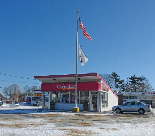
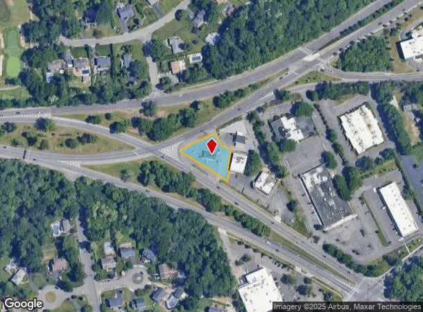
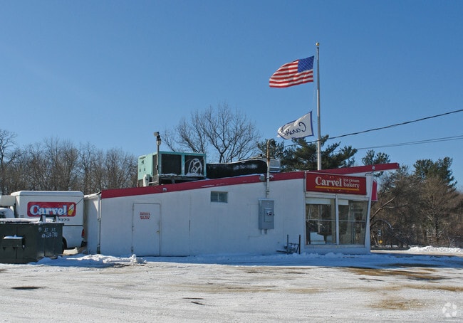
Property Record
501 Veterans Mem Hwy, Hauppauge, NY 11788
NEARBY LISTINGS FOR SALE OR LEASE
Property Detail
501 Veterans Mem Hwy
Nassau County-Suffolk County, NY
N001N00000000
0500-002-00-01-00-007-004
Suffolk
Restaurantdrivein
New York
X
100
36103C0655H
0.51 AC
0
Western Suffolk
2024
Long Island (New York)
145803
DEMOGRAPHICS near 501 Veterans Mem Hwy
1 Mile
3 Mile
5 Mile
2024 Total Population
5,932
81,439
239,555
2029 Population
5,884
79,759
234,088
Pop Growth 2024-2029
(0.81%)
(2.06%)
(2.28%)
Average Age
42
40
40
2024 Total Households
2,066
23,945
70,759
HH Growth 2024-2029
(1.16%)
(2.18%)
(2.37%)
Median Household Inc
$124,829
$120,794
$123,526
Avg Household Size
2.80
3.20
3.20
2024 Avg HH Vehicles
2.00
2.00
2.00
Median Home Value
$669,628
$527,553
$492,302
Median Year Built
1966
1966
1967
Nearby Places
- Restaurants
- Banks
- Shops
- Fitness
- Groceries
PUBLIC TRANSPORTATION
COMMUTER RAIL
Smithtown Station (Port Jefferson Branch - Long Island Rail Road)
DRIVE
WALK
Distance
Smithtown Station (Port Jefferson Branch - Long Island Rail Road)
6 min
3.4 mi
Central Islip Station (Ronkonkoma Branch - Long Island Rail Road)
DRIVE
WALK
Distance
Central Islip Station (Ronkonkoma Branch - Long Island Rail Road)
8 min
4.3 mi
AIRPORT
Long Island MacArthur
DRIVE
WALK
Distance
Long Island MacArthur
14 min
7.9 mi
Freight Ports
Port of New Haven
DRIVE
WALK
Distance
Port of New Haven
127 min
50.8 mi
Nearby Properties
Address
Land Use
TOTAL SIZE
Lot Size
Zoning
Address
Land Use
TOTAL SIZE
Lot Size
Zoning
301 SF
3.70 AC
Address
Land Use
TOTAL SIZE
Lot Size
Zoning
97.50 AC
AAA
Address
Land Use
TOTAL SIZE
Lot Size
Zoning
57.30 AC
AAA
Address
Land Use
TOTAL SIZE
Lot Size
Zoning
22.22 AC
AA
Address
Land Use
TOTAL SIZE
Lot Size
Zoning
8.05 AC
NULL
Address
Land Use
TOTAL SIZE
Lot Size
Zoning
170.87 AC
AAA
Address
Land Use
TOTAL SIZE
Lot Size
Zoning
24.10 AC
A
Address
Land Use
TOTAL SIZE
Lot Size
Zoning
2.79 AC
Address
Land Use
TOTAL SIZE
Lot Size
Zoning
36.66 AC
NULL
Address
Land Use
TOTAL SIZE
Lot Size
Zoning
24.96 AC
Address
Land Use
TOTAL SIZE
Lot Size
Zoning
24.70 AC
AAA
Address
Land Use
TOTAL SIZE
Lot Size
Zoning
13.06 AC
BUS3
Address
Land Use
TOTAL SIZE
Lot Size
Zoning
5,140 SF
23.39 AC
CA
Address
Land Use
TOTAL SIZE
Lot Size
Zoning
15 AC
AA
Address
Land Use
TOTAL SIZE
Lot Size
Zoning
45.56 AC
Address
Land Use
TOTAL SIZE
Lot Size
Zoning
12.84 AC
NULL
Address
Land Use
TOTAL SIZE
Lot Size
Zoning
8.02 AC
NULL
Address
Land Use
TOTAL SIZE
Lot Size
Zoning
10.90 AC
AAA
Address
Land Use
TOTAL SIZE
Lot Size
Zoning
22.84 AC
IND1
Address
Land Use
TOTAL SIZE
Lot Size
Zoning
45.71 AC
NULL
Address
Land Use
TOTAL SIZE
Lot Size
Zoning
10.50 AC
NULL
Address
Land Use
TOTAL SIZE
Lot Size
Zoning
5.32 AC
BUS3
Address
Land Use
TOTAL SIZE
Lot Size
Zoning
6.81 AC
NULL
Address
Land Use
TOTAL SIZE
Lot Size
Zoning
4,624 SF
9.73 AC
A
Address
Land Use
TOTAL SIZE
Lot Size
Zoning
12.80 AC
AAA
Address
Land Use
TOTAL SIZE
Lot Size
Zoning
8.35 AC
IND1
Address
Land Use
TOTAL SIZE
Lot Size
Zoning
32.59 AC
Address
Land Use
TOTAL SIZE
Lot Size
Zoning
3.98 AC
GSE
Address
Land Use
TOTAL SIZE
Lot Size
Zoning
9.90 AC
CA
Address
Land Use
TOTAL SIZE
Lot Size
Zoning
10.30 AC
CA
The World's #1 Commercial Real Estate Marketplace
Connect with us
© 2025 CoStar Group
The information above has been obtained from sources believed reliable. While we do not doubt its accuracy we have not verified it and make no guarantee, warranty or representation about it. It is your responsibility to independently confirm its accuracy and completeness. Any projections, opinions, assumptions, or estimates used are for example only and do not represent the current or future performance of the property. The value of this transaction to you depends on tax and other factors which should be evaluated by your tax, financial, and legal advisors. You and your advisors should conduct a careful, independent investigation of the property to determine to your satisfaction the suitability of the property for your needs.