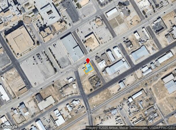
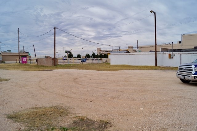
Property Record
501 W 2Nd St, Odessa, TX 79761
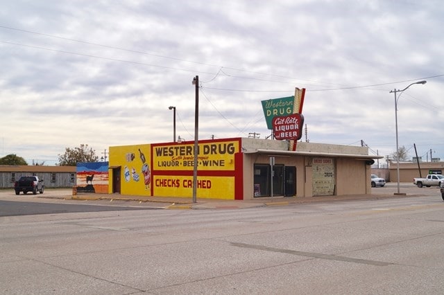
This Property Is For Sale
NEARBY LISTINGS FOR SALE OR LEASE
Property Detail
501 W 2Nd St
Odessa, TX
Original Town
22000-00056-01000
ORIGINAL TOWN BLOCK 1 LOT 13
Commercialnec
Ector
X
Texas
48135C0355E
13
2025
0.16 AC
2025
Midland & Odessa
003100
Other Market Areas
3,265 SF
DEMOGRAPHICS near 501 W 2Nd St
1 Mile
3 Mile
5 Mile
2024 Total Population
9,583
62,236
100,605
2029 Population
9,469
60,943
98,718
Pop Growth 2024-2029
(1.19%)
(2.08%)
(1.88%)
Average Age
36
35
35
2024 Total Households
3,368
21,544
35,731
HH Growth 2024-2029
(1.54%)
(2.44%)
(2.19%)
Median Household Inc
$44,853
$51,125
$54,742
Avg Household Size
2.70
2.80
2.70
2024 Avg HH Vehicles
2.00
2.00
2.00
Median Home Value
$75,726
$119,556
$148,226
Median Year Built
1967
1966
1973
Nearby Places
Map Layers
Map Styles
 Street
 Aerial
- Restaurants
- Banks
- Shops
- Fitness
- Groceries
PUBLIC TRANSPORTATION
AIRPORT
Midland International Air And Space Port
DRIVE
WALK
Distance
Midland International Air And Space Port
19 min
12.4 mi
Freight Ports
Port of Corpus Christi
DRIVE
WALK
Distance
Port of Corpus Christi
502 min
483.7 mi
Nearby Properties
Address
Land Use
TOTAL SIZE
Lot Size
Zoning
Address
Land Use
TOTAL SIZE
Lot Size
Zoning
170,241 SF
16.56 AC
EB6
Address
Land Use
TOTAL SIZE
Lot Size
Zoning
23,000 SF
170.58 AC
ES2
Address
Land Use
TOTAL SIZE
Lot Size
Zoning
22,304 SF
67.42 AC
EB4
Address
Land Use
TOTAL SIZE
Lot Size
Zoning
Address
Land Use
TOTAL SIZE
Lot Size
Zoning
159,239 SF
6.64 AC
EE1
Address
Land Use
TOTAL SIZE
Lot Size
Zoning
57,566 SF
Address
Land Use
TOTAL SIZE
Lot Size
Zoning
117,725 SF
19.23 AC
EE5
Address
Land Use
TOTAL SIZE
Lot Size
Zoning
30,600 SF
4.51 AC
EB6
Address
Land Use
TOTAL SIZE
Lot Size
Zoning
2,268 SF
15.91 AC
EB2
Address
Land Use
TOTAL SIZE
Lot Size
Zoning
232,969 SF
19.81 AC
EB7
Address
Land Use
TOTAL SIZE
Lot Size
Zoning
22,470 SF
2.07 AC
EB6
Address
Land Use
TOTAL SIZE
Lot Size
Zoning
10,644 SF
57.53 AC
Address
Land Use
TOTAL SIZE
Lot Size
Zoning
111,278 SF
28.53 AC
EB6
Address
Land Use
TOTAL SIZE
Lot Size
Zoning
155,744 SF
49.20 AC
EA7
Address
Land Use
TOTAL SIZE
Lot Size
Zoning
99,244 SF
4.66 AC
EE1
Address
Land Use
TOTAL SIZE
Lot Size
Zoning
214,832 SF
10.42 AC
EB5
Address
Land Use
TOTAL SIZE
Lot Size
Zoning
Address
Land Use
TOTAL SIZE
Lot Size
Zoning
109,381 SF
16.74 AC
EB3
Address
Land Use
TOTAL SIZE
Lot Size
Zoning
133,454 SF
25.41 AC
EE2
Address
Land Use
TOTAL SIZE
Lot Size
Zoning
135,155 SF
9.97 AC
ED4
Address
Land Use
TOTAL SIZE
Lot Size
Zoning
68,377 SF
9.69 AC
ES2
Address
Land Use
TOTAL SIZE
Lot Size
Zoning
186,791 SF
20.40 AC
EB3
Address
Land Use
TOTAL SIZE
Lot Size
Zoning
65,175 SF
4.68 AC
EE1
Address
Land Use
TOTAL SIZE
Lot Size
Zoning
146,559 SF
15.96 AC
ED4
Address
Land Use
TOTAL SIZE
Lot Size
Zoning
36,648 SF
86.41 AC
ES1
Address
Land Use
TOTAL SIZE
Lot Size
Zoning
25,560 SF
1.52 AC
EB6
Address
Land Use
TOTAL SIZE
Lot Size
Zoning
11,600 SF
28.47 AC
ES1
Address
Land Use
TOTAL SIZE
Lot Size
Zoning
40,557 SF
2.12 AC
EE1
Address
Land Use
TOTAL SIZE
Lot Size
Zoning
112,000 SF
19.10 AC
ES2
Address
Land Use
TOTAL SIZE
Lot Size
Zoning
16,800 SF
91.80 AC
EA7
The World's #1 Commercial Real Estate Marketplace
Connect with us
© 2025 CoStar Group
The information above has been obtained from sources believed reliable. While we do not doubt its accuracy we have not verified it and make no guarantee, warranty or representation about it. It is your responsibility to independently confirm its accuracy and completeness. Any projections, opinions, assumptions, or estimates used are for example only and do not represent the current or future performance of the property. The value of this transaction to you depends on tax and other factors which should be evaluated by your tax, financial, and legal advisors. You and your advisors should conduct a careful, independent investigation of the property to determine to your satisfaction the suitability of the property for your needs.