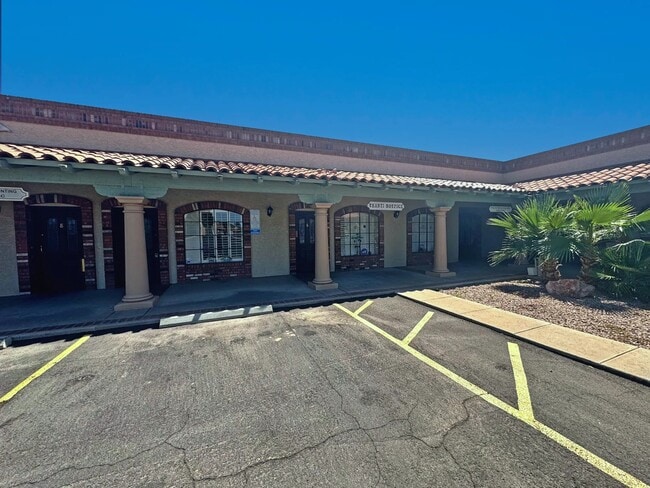
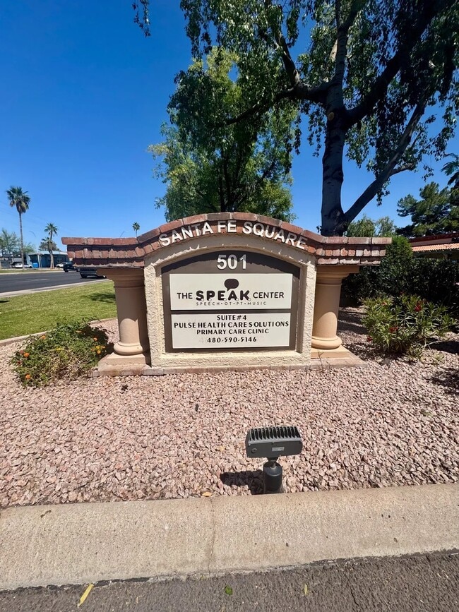
Property Record
501 W Ray Rd, Chandler, AZ 85225
Current Lease Availabilities
NEARBY LISTINGS FOR SALE OR LEASE
Property Detail
501 W Ray Rd
Phoenix-Mesa-Scottsdale, AZ
Roosen Park
302-75-137
ROOSEN PARK MCR 136-12
Commercialnec
Maricopa
X
Arizona
04013C2730M
10
2025
0.16 AC
2025
Chandler
523002
Phoenix
DEMOGRAPHICS near 501 W Ray Rd
1 Mile
3 Mile
5 Mile
2024 Total Population
20,376
143,951
321,008
2029 Population
21,992
155,008
345,575
Pop Growth 2024-2029
+ 7.93%
+ 7.68%
+ 7.65%
Average Age
36
37
38
2024 Total Households
7,231
54,647
121,238
HH Growth 2024-2029
+ 8.16%
+ 7.77%
+ 7.73%
Median Household Inc
$66,469
$81,487
$91,616
Avg Household Size
2.70
2.50
2.60
2024 Avg HH Vehicles
2.00
2.00
2.00
Median Home Value
$321,110
$367,260
$396,222
Median Year Built
1985
1991
1991
Nearby Places
- Restaurants
- Banks
- Shops
- Fitness
- Groceries
PUBLIC TRANSPORTATION
AIRPORT
Phoenix-Mesa Gateway
DRIVE
WALK
Distance
Phoenix-Mesa Gateway
21 min
11.3 mi
Phoenix Sky Harbor International
DRIVE
WALK
Distance
Phoenix Sky Harbor International
26 min
17.4 mi
Freight Ports
Port of San Diego
DRIVE
WALK
Distance
Port of San Diego
402 min
365.9 mi
Nearby Properties
Address
Land Use
TOTAL SIZE
Lot Size
Zoning
Address
Land Use
TOTAL SIZE
Lot Size
Zoning
221,091 SF
14.76 AC
I-1
Address
Land Use
TOTAL SIZE
Lot Size
Zoning
136,458 SF
7.85 AC
PAD
Address
Land Use
TOTAL SIZE
Lot Size
Zoning
128,194 SF
8.58 AC
PAD
Address
Land Use
TOTAL SIZE
Lot Size
Zoning
733,019 SF
13.13 AC
PAD
Address
Land Use
TOTAL SIZE
Lot Size
Zoning
1.13 AC
Address
Land Use
TOTAL SIZE
Lot Size
Zoning
774,482 SF
25.50 AC
PAD
Address
Land Use
TOTAL SIZE
Lot Size
Zoning
2.57 AC
Address
Land Use
TOTAL SIZE
Lot Size
Zoning
301,190 SF
77.17 AC
PF
Address
Land Use
TOTAL SIZE
Lot Size
Zoning
984,487 SF
37.54 AC
I-1
Address
Land Use
TOTAL SIZE
Lot Size
Zoning
263,599 SF
18.33 AC
PAD
Address
Land Use
TOTAL SIZE
Lot Size
Zoning
15,066 SF
2.54 AC
PAD
Address
Land Use
TOTAL SIZE
Lot Size
Zoning
416,954 SF
9.59 AC
PF
Address
Land Use
TOTAL SIZE
Lot Size
Zoning
348,249 SF
6.42 AC
M-H
Address
Land Use
TOTAL SIZE
Lot Size
Zoning
374,847 SF
20.84 AC
PAD
Address
Land Use
TOTAL SIZE
Lot Size
Zoning
269,504 SF
8.87 AC
I-1
Address
Land Use
TOTAL SIZE
Lot Size
Zoning
403,326 SF
8.71 AC
PAD
Address
Land Use
TOTAL SIZE
Lot Size
Zoning
444,802 SF
4.17 AC
I-1
Address
Land Use
TOTAL SIZE
Lot Size
Zoning
22,149 SF
6.33 AC
PAD
Address
Land Use
TOTAL SIZE
Lot Size
Zoning
348,379 SF
6.49 AC
PAD
Address
Land Use
TOTAL SIZE
Lot Size
Zoning
453,582 SF
21.58 AC
PAD
Address
Land Use
TOTAL SIZE
Lot Size
Zoning
309,031 SF
18.55 AC
Address
Land Use
TOTAL SIZE
Lot Size
Zoning
185,744 SF
36.64 AC
PF
Address
Land Use
TOTAL SIZE
Lot Size
Zoning
260,717 SF
17.31 AC
PAD
Address
Land Use
TOTAL SIZE
Lot Size
Zoning
423,725 SF
23.16 AC
PAD
Address
Land Use
TOTAL SIZE
Lot Size
Zoning
154,689 SF
17.02 AC
AG
Address
Land Use
TOTAL SIZE
Lot Size
Zoning
357,691 SF
19.87 AC
PAD
Address
Land Use
TOTAL SIZE
Lot Size
Zoning
281,005 SF
16.99 AC
PAD
Address
Land Use
TOTAL SIZE
Lot Size
Zoning
272,380 SF
15.30 AC
PAD
Address
Land Use
TOTAL SIZE
Lot Size
Zoning
383,461 SF
25.76 AC
PAD
Address
Land Use
TOTAL SIZE
Lot Size
Zoning
358,620 SF
18.72 AC
PAD
The World's #1 Commercial Real Estate Marketplace
Connect with us
© 2025 CoStar Group
The information above has been obtained from sources believed reliable. While we do not doubt its accuracy we have not verified it and make no guarantee, warranty or representation about it. It is your responsibility to independently confirm its accuracy and completeness. Any projections, opinions, assumptions, or estimates used are for example only and do not represent the current or future performance of the property. The value of this transaction to you depends on tax and other factors which should be evaluated by your tax, financial, and legal advisors. You and your advisors should conduct a careful, independent investigation of the property to determine to your satisfaction the suitability of the property for your needs.