Property Record
501 N Zaragoza Rd, El Paso, TX 79907


This Property Is For Sale
Current Lease Availabilities
NEARBY LISTINGS FOR SALE OR LEASE
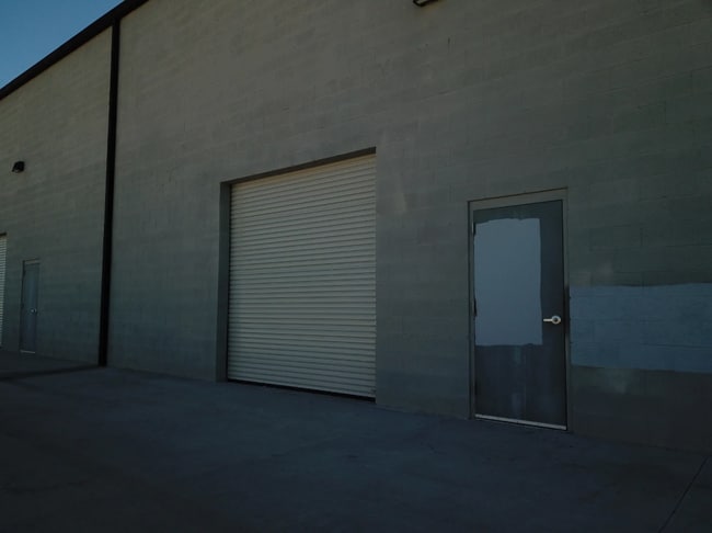
Property Detail
501 N Zaragoza Rd
El Paso, TX
501 N Zaragoza Subdivision
F367-999-0010-0120
BLK 1 501 N ZARAGOZA SUBDIVISION SELY PT OF 1 BEG 626.3 FT SE OF SWC (207.29 FT ON ST-188.13 FT ON NWLY-218.25 FT ON NELY-185.86 FT ON SELY) (40317.33 SQ FT)
Commercialnec
El Paso
X
Texas
4802140048C
1
2024
0.93 AC
2025
East
004104
El Paso
2,875 SF
DEMOGRAPHICS near 501 N Zaragoza Rd
1 Mile
3 Mile
5 Mile
2024 Total Population
14,525
71,569
193,223
2029 Population
14,660
72,239
195,026
Pop Growth 2024-2029
+ 0.93%
+ 0.94%
+ 0.93%
Average Age
39
39
38
2024 Total Households
5,198
24,654
66,838
HH Growth 2024-2029
+ 0.92%
+ 0.91%
+ 0.92%
Median Household Inc
$35,631
$41,875
$48,987
Avg Household Size
2.70
2.80
2.80
2024 Avg HH Vehicles
2.00
2.00
2.00
Median Home Value
$105,569
$121,953
$144,361
Median Year Built
1980
1981
1983
Nearby Places
Map Layers
Map Styles
 Street
 Aerial
- Restaurants
- Banks
- Shops
- Fitness
- Groceries
PUBLIC TRANSPORTATION
AIRPORT
El Paso International
DRIVE
WALK
Distance
El Paso International
26 min
12.3 mi
Nearby Properties
Address
Land Use
TOTAL SIZE
Lot Size
Zoning
Address
Land Use
TOTAL SIZE
Lot Size
Zoning
770,870 SF
44.65 AC
Address
Land Use
TOTAL SIZE
Lot Size
Zoning
463,000 SF
24.75 AC
C4
Address
Land Use
TOTAL SIZE
Lot Size
Zoning
123,306 SF
53.62 AC
M1
Address
Land Use
TOTAL SIZE
Lot Size
Zoning
89,251 SF
9.39 AC
AM
Address
Land Use
TOTAL SIZE
Lot Size
Zoning
400,929 SF
30.05 AC
Address
Land Use
TOTAL SIZE
Lot Size
Zoning
80,049 SF
8.90 AC
C4
Address
Land Use
TOTAL SIZE
Lot Size
Zoning
652,080 SF
32.64 AC
Address
Land Use
TOTAL SIZE
Lot Size
Zoning
118,114 SF
13.80 AC
C4S
Address
Land Use
TOTAL SIZE
Lot Size
Zoning
656,540 SF
36.94 AC
M1S
Address
Land Use
TOTAL SIZE
Lot Size
Zoning
166,671 SF
24.61 AC
C4S
Address
Land Use
TOTAL SIZE
Lot Size
Zoning
334,161 SF
20.28 AC
Address
Land Use
TOTAL SIZE
Lot Size
Zoning
230,263 SF
27.25 AC
C3S
Address
Land Use
TOTAL SIZE
Lot Size
Zoning
321,764 SF
18.61 AC
C4
Address
Land Use
TOTAL SIZE
Lot Size
Zoning
209,006 SF
18.18 AC
C4
Address
Land Use
TOTAL SIZE
Lot Size
Zoning
274,580 SF
13.86 AC
C4S
Address
Land Use
TOTAL SIZE
Lot Size
Zoning
230,152 SF
14.09 AC
C4S
Address
Land Use
TOTAL SIZE
Lot Size
Zoning
179,391 SF
8.23 AC
SD
Address
Land Use
TOTAL SIZE
Lot Size
Zoning
347,235 SF
33.50 AC
A2
Address
Land Use
TOTAL SIZE
Lot Size
Zoning
111,558 SF
16.25 AC
C4
Address
Land Use
TOTAL SIZE
Lot Size
Zoning
215,378 SF
9.60 AC
M1
Address
Land Use
TOTAL SIZE
Lot Size
Zoning
281,279 SF
14.74 AC
C4
Address
Land Use
TOTAL SIZE
Lot Size
Zoning
377,504 SF
24.32 AC
C4S
Address
Land Use
TOTAL SIZE
Lot Size
Zoning
197,105 SF
15.41 AC
C4S
Address
Land Use
TOTAL SIZE
Lot Size
Zoning
129,165 SF
13.17 AC
A2
Address
Land Use
TOTAL SIZE
Lot Size
Zoning
356,377 SF
25.46 AC
C4S
Address
Land Use
TOTAL SIZE
Lot Size
Zoning
357,090 SF
20 AC
C4
Address
Land Use
TOTAL SIZE
Lot Size
Zoning
300,000 SF
16.93 AC
C4S
Address
Land Use
TOTAL SIZE
Lot Size
Zoning
63,058 SF
21.40 AC
C4
Address
Land Use
TOTAL SIZE
Lot Size
Zoning
186,250 SF
11.72 AC
C4S
Address
Land Use
TOTAL SIZE
Lot Size
Zoning
144,211 SF
17.20 AC
C4
The World's #1 Commercial Real Estate Marketplace
Connect with us
© 2025 CoStar Group
The information above has been obtained from sources believed reliable. While we do not doubt its accuracy we have not verified it and make no guarantee, warranty or representation about it. It is your responsibility to independently confirm its accuracy and completeness. Any projections, opinions, assumptions, or estimates used are for example only and do not represent the current or future performance of the property. The value of this transaction to you depends on tax and other factors which should be evaluated by your tax, financial, and legal advisors. You and your advisors should conduct a careful, independent investigation of the property to determine to your satisfaction the suitability of the property for your needs.