Property Record
5010 Cass Ave, Evansville, IN 47715


NEARBY LISTINGS FOR SALE OR LEASE
-
-
View all Evansville listings for sale on LoopNet.com
Property Detail
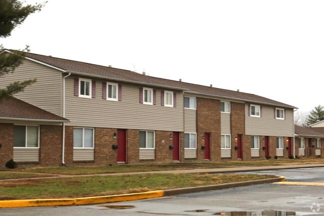
5010 Cass Ave
82-06-36-017-136.019-027
PT NW SW 36-6-10
Apartment
Vanderburgh
X
Indiana
21101C0105F
27.73 AC
2024
East Evansville
2024
Evansville
003805
Evansville, IN-KY
7,705 SF
DEMOGRAPHICS near 5010 Cass Ave
1 Mile
3 Mile
5 Mile
2024 Total Population
10,805
56,248
108,506
2029 Population
10,735
56,288
109,872
Pop Growth 2024-2029
(0.65%)
+ 0.07%
+ 1.26%
Average Age
40
40
40
2024 Total Households
5,097
24,569
47,458
HH Growth 2024-2029
(0.63%)
+ 0.02%
+ 1.21%
Median Household Inc
$49,670
$54,234
$51,317
Avg Household Size
2.00
2.20
2.20
2024 Avg HH Vehicles
2.00
2.00
2.00
Median Home Value
$145,641
$140,624
$135,977
Median Year Built
1974
1970
1969
Nearby Places
Map Layers
Map Styles
 Street
 Aerial
- Restaurants
- Banks
- Shops
- Fitness
- Groceries
PUBLIC TRANSPORTATION
AIRPORT
Evansville Regional
DRIVE
WALK
Distance
Evansville Regional
16 min
8.8 mi
Freight Ports
Port of Toledo
DRIVE
WALK
Distance
Port of Toledo
457 min
392.4 mi
Nearby Properties
Address
Land Use
TOTAL SIZE
Lot Size
Zoning
Address
Land Use
TOTAL SIZE
Lot Size
Zoning
43,824 SF
32.02 AC
Address
Land Use
TOTAL SIZE
Lot Size
Zoning
6,110 SF
28.46 AC
Address
Land Use
TOTAL SIZE
Lot Size
Zoning
109,983 SF
27.50 AC
Address
Land Use
TOTAL SIZE
Lot Size
Zoning
451,370 SF
23.93 AC
Address
Land Use
TOTAL SIZE
Lot Size
Zoning
169,860 SF
20.33 AC
Address
Land Use
TOTAL SIZE
Lot Size
Zoning
30,039 SF
6.67 AC
Address
Land Use
TOTAL SIZE
Lot Size
Zoning
132,150 SF
11.36 AC
Address
Land Use
TOTAL SIZE
Lot Size
Zoning
38,566 SF
14.66 AC
Address
Land Use
TOTAL SIZE
Lot Size
Zoning
3,405 SF
24.60 AC
Address
Land Use
TOTAL SIZE
Lot Size
Zoning
176,128 SF
18.79 AC
Address
Land Use
TOTAL SIZE
Lot Size
Zoning
37,199 SF
27.28 AC
Address
Land Use
TOTAL SIZE
Lot Size
Zoning
75,282 SF
7.56 AC
Address
Land Use
TOTAL SIZE
Lot Size
Zoning
114,160 SF
11 AC
Address
Land Use
TOTAL SIZE
Lot Size
Zoning
3,051 SF
14.65 AC
Address
Land Use
TOTAL SIZE
Lot Size
Zoning
5,000 SF
21.20 AC
Address
Land Use
TOTAL SIZE
Lot Size
Zoning
27,984 SF
10.28 AC
Address
Land Use
TOTAL SIZE
Lot Size
Zoning
153,640 SF
20.09 AC
Address
Land Use
TOTAL SIZE
Lot Size
Zoning
8,700 SF
22.09 AC
Address
Land Use
TOTAL SIZE
Lot Size
Zoning
16,918 SF
17.66 AC
Address
Land Use
TOTAL SIZE
Lot Size
Zoning
210,137 SF
18 AC
Address
Land Use
TOTAL SIZE
Lot Size
Zoning
130,978 SF
24.94 AC
Address
Land Use
TOTAL SIZE
Lot Size
Zoning
103,226 SF
10.64 AC
Address
Land Use
TOTAL SIZE
Lot Size
Zoning
45,500 SF
6.46 AC
Address
Land Use
TOTAL SIZE
Lot Size
Zoning
3,757 SF
18.83 AC
Address
Land Use
TOTAL SIZE
Lot Size
Zoning
143,846 SF
11.09 AC
Address
Land Use
TOTAL SIZE
Lot Size
Zoning
10,587 SF
11.69 AC
Address
Land Use
TOTAL SIZE
Lot Size
Zoning
75,433 SF
2.29 AC
Address
Land Use
TOTAL SIZE
Lot Size
Zoning
11,976 SF
14.20 AC
Address
Land Use
TOTAL SIZE
Lot Size
Zoning
15,670 SF
9.55 AC
The World's #1 Commercial Real Estate Marketplace
Connect with us
© 2026 CoStar Group
The information above has been obtained from sources believed reliable. While we do not doubt its accuracy we have not verified it and make no guarantee, warranty or representation about it. It is your responsibility to independently confirm its accuracy and completeness. Any projections, opinions, assumptions, or estimates used are for example only and do not represent the current or future performance of the property. The value of this transaction to you depends on tax and other factors which should be evaluated by your tax, financial, and legal advisors. You and your advisors should conduct a careful, independent investigation of the property to determine to your satisfaction the suitability of the property for your needs.