Property Record
5010 York Rd, Doylestown, PA 18902
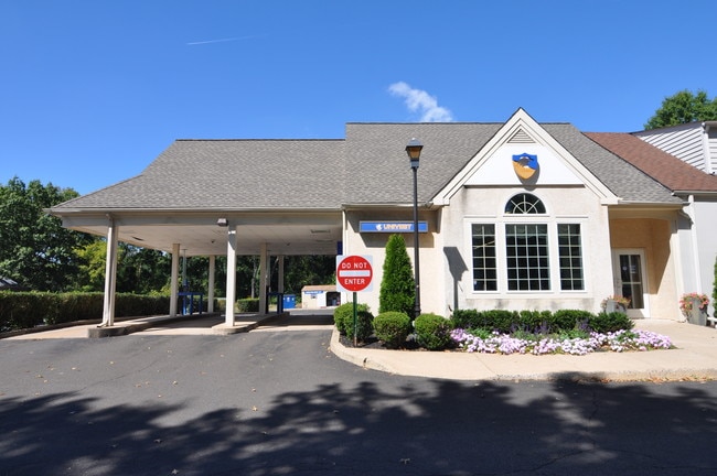

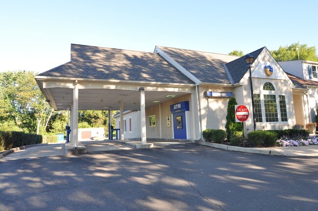
Property Detail
5010 York Rd
06-014-024
1.62A WS SR263 2092 FT S T386 YORK RD (US202)
Storebuilding
BUCKS
LC
Pennsylvania
B and X Area of moderate flood hazard, usually the area between the limits of the 100-year and 500-year floods.
1.62 AC
2024
Upper Bucks County
2025
Philadelphia
104505
Philadelphia-Camden-Wilmington, PA-NJ-DE-MD
6,266 SF
NEARBY LISTINGS FOR SALE OR LEASE
DEMOGRAPHICS near 5010 York Rd
1 mile
3 mile
5 mile
2025 Total Population
786
15,738
55,447
2030 Population
779
15,555
55,679
Pop Growth 2025-2030
(0.89%)
(1.16%)
+ 0.42%
Average Age
45
46
45
2025 Total Households
283
5,747
21,558
HH Growth 2025-2030
(1.06%)
(1.36%)
+ 0.73%
Median Household Inc
$171,825
$175,168
$144,703
Avg Household Size
2.80
2.70
2.50
2025 Avg HH Vehicles
2.00
2.00
2.00
Median Home Value
$826,388
$764,663
$709,139
Median Year Built
1979
1991
1986
Nearby Places
Map Layers
Map Styles
 Street
 Aerial
Layers
 Traffic
 Biking
Places
Listings with unknown addresses are not visible on the map
- Restaurants
- Banks
- Shops
- Fitness
- Groceries
PUBLIC TRANSPORTATION
AIRPORT
Lehigh Valley International
Drive
Walk
Distance
Lehigh Valley International
63 min
38.0 mi
SALE & LEASE HISTORY
LISTING DATE
SALE/LEASE

Nov 16, 2016
For Lease
Nearby Properties
Address
Land Use
TOTAL SIZE
Lot Size
Zoning
Address
Land Use
TOTAL SIZE
Lot Size
Zoning
25,043 SF
0.36 AC
LC
Address
Land Use
TOTAL SIZE
Lot Size
Zoning
45,479 SF
6.79 AC
LC
Address
Land Use
TOTAL SIZE
Lot Size
Zoning
4.41 AC
VC2
Address
Land Use
TOTAL SIZE
Lot Size
Zoning
12,212 SF
5.63 AC
VC2
Address
Land Use
TOTAL SIZE
Lot Size
Zoning
23,038 SF
149.20 AC
AG
Address
Land Use
TOTAL SIZE
Lot Size
Zoning
102,144 SF
14.15 AC
VC2
Address
Land Use
TOTAL SIZE
Lot Size
Zoning
82,623 SF
15.36 AC
VC2
Address
Land Use
TOTAL SIZE
Lot Size
Zoning
22,680 SF
3.49 AC
R5
Address
Land Use
TOTAL SIZE
Lot Size
Zoning
24,518 SF
2.15 AC
RC
Address
Land Use
TOTAL SIZE
Lot Size
Zoning
31,476 SF
5.38 AC
L1
Address
Land Use
TOTAL SIZE
Lot Size
Zoning
1,811 SF
3.10 AC
AG
Address
Land Use
TOTAL SIZE
Lot Size
Zoning
24,655 SF
2.21 AC
VC2
Address
Land Use
TOTAL SIZE
Lot Size
Zoning
2,100 SF
39.45 AC
AG
Address
Land Use
TOTAL SIZE
Lot Size
Zoning
10,242 SF
3.50 AC
R5
Address
Land Use
TOTAL SIZE
Lot Size
Zoning
17,137 SF
0.28 AC
NVO
Address
Land Use
TOTAL SIZE
Lot Size
Zoning
11,128 SF
8.04 AC
AG
Address
Land Use
TOTAL SIZE
Lot Size
Zoning
8,939 SF
0.11 AC
NVO
Address
Land Use
TOTAL SIZE
Lot Size
Zoning
11,741 SF
0.99 AC
LC
Address
Land Use
TOTAL SIZE
Lot Size
Zoning
10,997 SF
10.07 AC
VC1
Address
Land Use
TOTAL SIZE
Lot Size
Zoning
15,078 SF
5.15 AC
R2
Address
Land Use
TOTAL SIZE
Lot Size
Zoning
6,000 SF
1.55 AC
VC2
Address
Land Use
TOTAL SIZE
Lot Size
Zoning
8,252 SF
25.38 AC
AG
Address
Land Use
TOTAL SIZE
Lot Size
Zoning
17,850 SF
0.42 AC
VC2
Address
Land Use
TOTAL SIZE
Lot Size
Zoning
3,825 SF
2.34 AC
LC
Address
Land Use
TOTAL SIZE
Lot Size
Zoning
5,560 SF
2.26 AC
AG
Address
Land Use
TOTAL SIZE
Lot Size
Zoning
3,276 SF
1.07 AC
VC2
Address
Land Use
TOTAL SIZE
Lot Size
Zoning
1,830 SF
1.54 AC
VC2
Address
Land Use
TOTAL SIZE
Lot Size
Zoning
12,182 SF
0.15 AC
NVO
Address
Land Use
TOTAL SIZE
Lot Size
Zoning
4,702 SF
0.31 AC
VC2
The World's #1 Commercial Real Estate Marketplace
Connect with us
© 2026 CoStar Group
The information above has been obtained from sources believed reliable. While we do not doubt its accuracy we have not verified it and make no guarantee, warranty or representation about it. It is your responsibility to independently confirm its accuracy and completeness. Any projections, opinions, assumptions, or estimates used are for example only and do not represent the current or future performance of the property. The value of this transaction to you depends on tax and other factors which should be evaluated by your tax, financial, and legal advisors. You and your advisors should conduct a careful, independent investigation of the property to determine to your satisfaction the suitability of the property for your needs.