Property Record
5013 E Divide Ave, Bismarck, ND 58501
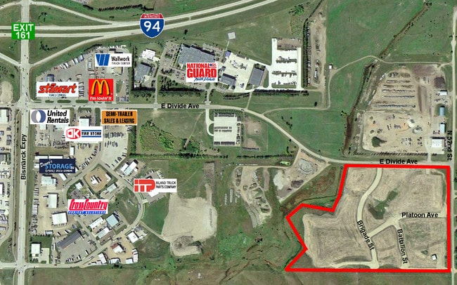

This Property Is For Sale
Property Detail
5013 E Divide Ave
Bismarck, ND
EAST DIVIDE IND PARK ADDITION LOT 3
2200-003-025
BURLEIGH
Commercialacreage
North Dakota
MA
3
B and X Area of moderate flood hazard, usually the area between the limits of the 100-year and 500-year floods.
1.61 AC
2025
East Bismarck
2025
Other Market Areas
010300
NEARBY LISTINGS FOR SALE OR LEASE
DEMOGRAPHICS near 5013 E Divide Ave
1 mile
3 mile
5 mile
2025 Total Population
3,637
33,412
82,224
2030 Population
3,730
34,489
84,864
Pop Growth 2025-2030
+ 2.56%
+ 3.22%
+ 3.21%
Average Age
39
41
40
2025 Total Households
1,472
14,052
34,363
HH Growth 2025-2030
+ 2.92%
+ 3.42%
+ 3.55%
Median Household Inc
$100,993
$78,942
$83,273
Avg Household Size
2.40
2.20
2.30
2025 Avg HH Vehicles
2.00
2.00
2.00
Median Home Value
$186,313
$282,396
$296,255
Median Year Built
1999
1987
1985
Nearby Places
Map Layers
Map Styles
 Street
 Aerial
Transit
 Traffic
 Biking
Places
Listings with unknown addresses are not visible on the map
- Restaurants
- Banks
- Shops
- Fitness
- Groceries
PUBLIC TRANSPORTATION
AIRPORT
Bismarck Municipal
Drive
Walk
Distance
Bismarck Municipal
17 min
5.8 mi
Freight Ports
Port Milwaukee
Drive
Walk
Distance
Port Milwaukee
820 min
762.3 mi
Nearby Properties
Address
Land Use
TOTAL SIZE
Lot Size
Zoning
Address
Land Use
TOTAL SIZE
Lot Size
Zoning
30.33 AC
MA
Address
Land Use
TOTAL SIZE
Lot Size
Zoning
35.42 AC
MA
Address
Land Use
TOTAL SIZE
Lot Size
Zoning
76,233 SF
14.71 AC
RM20
Address
Land Use
TOTAL SIZE
Lot Size
Zoning
70,182 SF
3.83 AC
PUD
Address
Land Use
TOTAL SIZE
Lot Size
Zoning
18.70 AC
RM15
Address
Land Use
TOTAL SIZE
Lot Size
Zoning
7.67 AC
CG
Address
Land Use
TOTAL SIZE
Lot Size
Zoning
7.83 AC
RM20
Address
Land Use
TOTAL SIZE
Lot Size
Zoning
38,275 SF
10.53 AC
RM30
Address
Land Use
TOTAL SIZE
Lot Size
Zoning
11.48 AC
CG
Address
Land Use
TOTAL SIZE
Lot Size
Zoning
14.70 AC
MA
Address
Land Use
TOTAL SIZE
Lot Size
Zoning
52,718 SF
2.67 AC
RM15
Address
Land Use
TOTAL SIZE
Lot Size
Zoning
52,710 SF
7.13 AC
RM30
Address
Land Use
TOTAL SIZE
Lot Size
Zoning
14.22 AC
MA
Address
Land Use
TOTAL SIZE
Lot Size
Zoning
84,342 SF
11.63 AC
MA
Address
Land Use
TOTAL SIZE
Lot Size
Zoning
6.86 AC
CG
Address
Land Use
TOTAL SIZE
Lot Size
Zoning
15,656 SF
8.98 AC
RM30
Address
Land Use
TOTAL SIZE
Lot Size
Zoning
7,288 SF
7.50 AC
CG
Address
Land Use
TOTAL SIZE
Lot Size
Zoning
64,008 SF
12.61 AC
MA
Address
Land Use
TOTAL SIZE
Lot Size
Zoning
79,200 SF
6.01 AC
MA
Address
Land Use
TOTAL SIZE
Lot Size
Zoning
8.16 AC
MA
Address
Land Use
TOTAL SIZE
Lot Size
Zoning
4.18 AC
RT
Address
Land Use
TOTAL SIZE
Lot Size
Zoning
22,438 SF
1.87 AC
CG
Address
Land Use
TOTAL SIZE
Lot Size
Zoning
7.65 AC
MA
Address
Land Use
TOTAL SIZE
Lot Size
Zoning
61,491 SF
4.87 AC
CG
Address
Land Use
TOTAL SIZE
Lot Size
Zoning
34,917 SF
2.34 AC
CG
Address
Land Use
TOTAL SIZE
Lot Size
Zoning
63,247 SF
6.80 AC
MA
Address
Land Use
TOTAL SIZE
Lot Size
Zoning
52,206 SF
3.73 AC
CG
Address
Land Use
TOTAL SIZE
Lot Size
Zoning
44,694 SF
5.76 AC
RM30
Address
Land Use
TOTAL SIZE
Lot Size
Zoning
11,915 SF
9.08 AC
MA
Address
Land Use
TOTAL SIZE
Lot Size
Zoning
25,336 SF
3.22 AC
RM15
The World's #1 Commercial Real Estate Marketplace
Connect with us
© 2026 CoStar Group
The information above has been obtained from sources believed reliable. While we do not doubt its accuracy we have not verified it and make no guarantee, warranty or representation about it. It is your responsibility to independently confirm its accuracy and completeness. Any projections, opinions, assumptions, or estimates used are for example only and do not represent the current or future performance of the property. The value of this transaction to you depends on tax and other factors which should be evaluated by your tax, financial, and legal advisors. You and your advisors should conduct a careful, independent investigation of the property to determine to your satisfaction the suitability of the property for your needs.