Property Record
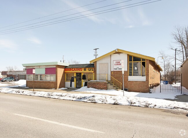
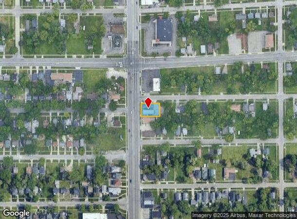
5014 N Saginaw St, Flint, MI 48505

NEARBY LISTINGS FOR SALE OR LEASE
Property Detail
5014 N Saginaw St
Flint, MI
Pierson Place
47-31-102-001
PIERSON PLACE LOTS 235 AND 236
Commercialnec
Genesee
X
Michigan
26049C0187D
235-236
0
0.20 AC
2025
Flint
002000
Detroit
3,933 SF
DEMOGRAPHICS near 5014 N Saginaw St
1 Mile
3 Mile
5 Mile
2024 Total Population
9,333
71,695
137,683
2029 Population
10,016
74,240
139,498
Pop Growth 2024-2029
+ 7.32%
+ 3.55%
+ 1.32%
Average Age
41
39
39
2024 Total Households
4,170
29,237
57,088
HH Growth 2024-2029
+ 7.29%
+ 3.58%
+ 1.29%
Median Household Inc
$29,310
$31,808
$36,731
Avg Household Size
2.10
2.30
2.30
2024 Avg HH Vehicles
1.00
1.00
1.00
Median Home Value
$52,557
$60,286
$73,284
Median Year Built
1961
1959
1959
Nearby Places
Map Layers
Map Styles
 Street
 Aerial
- Restaurants
- Banks
- Shops
- Fitness
- Groceries
PUBLIC TRANSPORTATION
COMMUTER RAIL
DRIVE
WALK
Distance
10 min
5.0 mi
AIRPORT
Bishop International
DRIVE
WALK
Distance
Bishop International
26 min
13.0 mi
MBS International
DRIVE
WALK
Distance
MBS International
68 min
49.0 mi
Nearby Properties
Address
Land Use
TOTAL SIZE
Lot Size
Zoning
Address
Land Use
TOTAL SIZE
Lot Size
Zoning
46,808 SF
32.06 AC
I-2 HVY IN
Address
Land Use
TOTAL SIZE
Lot Size
Zoning
329,849 SF
21.20 AC
CE
Address
Land Use
TOTAL SIZE
Lot Size
Zoning
156,250 SF
Address
Land Use
TOTAL SIZE
Lot Size
Zoning
10,212 SF
2.60 AC
UC
Address
Land Use
TOTAL SIZE
Lot Size
Zoning
114,888 SF
11.86 AC
I-2 HVY IN
Address
Land Use
TOTAL SIZE
Lot Size
Zoning
182,408 SF
Address
Land Use
TOTAL SIZE
Lot Size
Zoning
85,697 SF
0.30 AC
DC
Address
Land Use
TOTAL SIZE
Lot Size
Zoning
123,170 SF
3.41 AC
DE
Address
Land Use
TOTAL SIZE
Lot Size
Zoning
Address
Land Use
TOTAL SIZE
Lot Size
Zoning
Address
Land Use
TOTAL SIZE
Lot Size
Zoning
65,488 SF
0.30 AC
DC
Address
Land Use
TOTAL SIZE
Lot Size
Zoning
203,200 SF
0.92 AC
DE
Address
Land Use
TOTAL SIZE
Lot Size
Zoning
Address
Land Use
TOTAL SIZE
Lot Size
Zoning
242,560 SF
0.55 AC
DE
Address
Land Use
TOTAL SIZE
Lot Size
Zoning
66,800 SF
1.50 AC
MR-3
Address
Land Use
TOTAL SIZE
Lot Size
Zoning
224,263 SF
24.98 AC
CC
Address
Land Use
TOTAL SIZE
Lot Size
Zoning
173,312 SF
23.49 AC
CE
Address
Land Use
TOTAL SIZE
Lot Size
Zoning
61,800 SF
1.87 AC
CC
Address
Land Use
TOTAL SIZE
Lot Size
Zoning
101,744 SF
4.90 AC
TN-2
Address
Land Use
TOTAL SIZE
Lot Size
Zoning
33.39 AC
Address
Land Use
TOTAL SIZE
Lot Size
Zoning
726 SF
10.40 AC
R-4 MANUF
Address
Land Use
TOTAL SIZE
Lot Size
Zoning
33,471 SF
0.46 AC
DE
Address
Land Use
TOTAL SIZE
Lot Size
Zoning
2.45 AC
Address
Land Use
TOTAL SIZE
Lot Size
Zoning
52,434 SF
4.09 AC
CE
Address
Land Use
TOTAL SIZE
Lot Size
Zoning
53,928 SF
1.53 AC
DE
Address
Land Use
TOTAL SIZE
Lot Size
Zoning
114,221 SF
6.16 AC
CC
Address
Land Use
TOTAL SIZE
Lot Size
Zoning
9,934 SF
9.70 AC
I-2 HVY IN
Address
Land Use
TOTAL SIZE
Lot Size
Zoning
39,274 SF
20.76 AC
CE
Address
Land Use
TOTAL SIZE
Lot Size
Zoning
110,985 SF
11.25 AC
Address
Land Use
TOTAL SIZE
Lot Size
Zoning
80,999 SF
23.82 AC
CE
The World's #1 Commercial Real Estate Marketplace
Connect with us
© 2025 CoStar Group
The information above has been obtained from sources believed reliable. While we do not doubt its accuracy we have not verified it and make no guarantee, warranty or representation about it. It is your responsibility to independently confirm its accuracy and completeness. Any projections, opinions, assumptions, or estimates used are for example only and do not represent the current or future performance of the property. The value of this transaction to you depends on tax and other factors which should be evaluated by your tax, financial, and legal advisors. You and your advisors should conduct a careful, independent investigation of the property to determine to your satisfaction the suitability of the property for your needs.