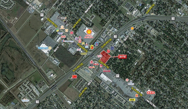
Property Record
5015 39Th St, Groves, TX 77619

Current Lease Availabilities
Property Detail
5015 39Th St
Beaumont-Port Arthur, TX
LT 1 FG GROVES ADDITION .733AC
020330-000-000300-00000
JEFFERSON
Commercialnec
Texas
2024
1
2025
1 AC
010400
Port Arthur
1,101 SF
Beaumont/Port Arthur
NEARBY LISTINGS FOR SALE OR LEASE
DEMOGRAPHICS near 5015 39Th St
1 mile
3 mile
5 mile
2025 Total Population
8,192
55,445
91,191
2030 Population
7,972
54,639
90,405
Pop Growth 2025-2030
(2.69%)
(1.45%)
(0.86%)
Average Age
37
37
38
2025 Total Households
2,994
20,236
34,677
HH Growth 2025-2030
(2.71%)
(1.55%)
(0.89%)
Median Household Inc
$53,854
$55,661
$57,723
Avg Household Size
2.70
2.70
2.60
2025 Avg HH Vehicles
2.00
2.00
2.00
Median Home Value
$159,736
$136,182
$152,404
Median Year Built
1967
1970
1971
Nearby Places
Map Layers
Map Styles
 Street
 Aerial
Transit
 Traffic
 Biking
Places
Listings with unknown addresses are not visible on the map
- Restaurants
- Banks
- Shops
- Fitness
- Groceries
Nearby Properties
Address
Land Use
TOTAL SIZE
Lot Size
Zoning
Address
Land Use
TOTAL SIZE
Lot Size
Zoning
279,375 SF
18.94 AC
Address
Land Use
TOTAL SIZE
Lot Size
Zoning
235,864 SF
12.21 AC
Address
Land Use
TOTAL SIZE
Lot Size
Zoning
157,411 SF
38.21 AC
Address
Land Use
TOTAL SIZE
Lot Size
Zoning
130,420 SF
6.78 AC
Address
Land Use
TOTAL SIZE
Lot Size
Zoning
79,096 SF
9.09 AC
Address
Land Use
TOTAL SIZE
Lot Size
Zoning
185,832 SF
10.08 AC
Address
Land Use
TOTAL SIZE
Lot Size
Zoning
157,188 SF
8.70 AC
Address
Land Use
TOTAL SIZE
Lot Size
Zoning
97,588 SF
2.81 AC
Address
Land Use
TOTAL SIZE
Lot Size
Zoning
183,963 SF
23.46 AC
Address
Land Use
TOTAL SIZE
Lot Size
Zoning
86,567 SF
5 AC
Address
Land Use
TOTAL SIZE
Lot Size
Zoning
135,891 SF
9.95 AC
Address
Land Use
TOTAL SIZE
Lot Size
Zoning
243,132 SF
21.67 AC
Address
Land Use
TOTAL SIZE
Lot Size
Zoning
155,734 SF
11.27 AC
Address
Land Use
TOTAL SIZE
Lot Size
Zoning
157,343 SF
9.09 AC
Address
Land Use
TOTAL SIZE
Lot Size
Zoning
151,121 SF
9.04 AC
Address
Land Use
TOTAL SIZE
Lot Size
Zoning
81,420 SF
7.16 AC
Address
Land Use
TOTAL SIZE
Lot Size
Zoning
146,251 SF
9.08 AC
Address
Land Use
TOTAL SIZE
Lot Size
Zoning
137,317 SF
3.64 AC
Address
Land Use
TOTAL SIZE
Lot Size
Zoning
86,911 SF
4.61 AC
Address
Land Use
TOTAL SIZE
Lot Size
Zoning
60,552 SF
15.22 AC
Address
Land Use
TOTAL SIZE
Lot Size
Zoning
39,290 SF
3.21 AC
Address
Land Use
TOTAL SIZE
Lot Size
Zoning
25,199 SF
14.75 AC
Address
Land Use
TOTAL SIZE
Lot Size
Zoning
77,552 SF
23.03 AC
Address
Land Use
TOTAL SIZE
Lot Size
Zoning
116,500 SF
11.82 AC
Address
Land Use
TOTAL SIZE
Lot Size
Zoning
48,452 SF
4.78 AC
Address
Land Use
TOTAL SIZE
Lot Size
Zoning
69,633 SF
5.29 AC
Address
Land Use
TOTAL SIZE
Lot Size
Zoning
173,069 SF
25.79 AC
Address
Land Use
TOTAL SIZE
Lot Size
Zoning
206,139 SF
14.36 AC
Address
Land Use
TOTAL SIZE
Lot Size
Zoning
16,098 SF
22.87 AC
Address
Land Use
TOTAL SIZE
Lot Size
Zoning
123,570 SF
6.91 AC
The World's #1 Commercial Real Estate Marketplace
Connect with us
© 2026 CoStar Group
The information above has been obtained from sources believed reliable. While we do not doubt its accuracy we have not verified it and make no guarantee, warranty or representation about it. It is your responsibility to independently confirm its accuracy and completeness. Any projections, opinions, assumptions, or estimates used are for example only and do not represent the current or future performance of the property. The value of this transaction to you depends on tax and other factors which should be evaluated by your tax, financial, and legal advisors. You and your advisors should conduct a careful, independent investigation of the property to determine to your satisfaction the suitability of the property for your needs.