Property Record
5015 Ava Way, Richland, WA 99352
Current Lease Availabilities
NEARBY LISTINGS FOR SALE OR LEASE
-
-
View all Richland listings for lease on LoopNet.com
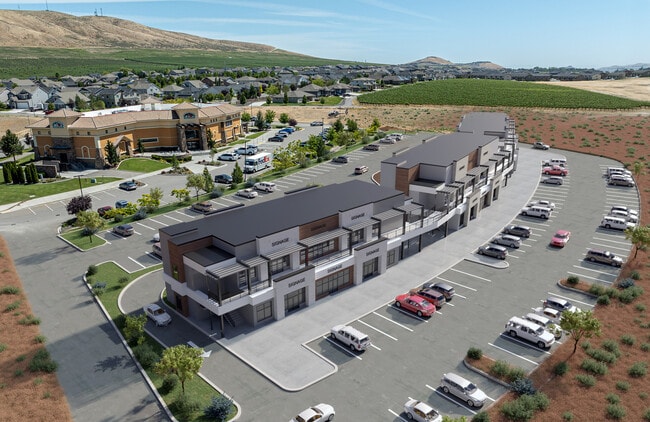
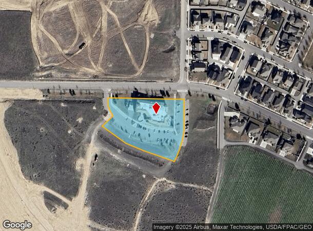
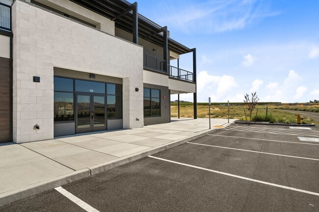
Property Detail
5015 Ava Way
Kennewick-Richland, WA
LOT 3 OF AMENDED BINDING SITE PLAN FILED FOR RECORD APRIL 18 2016 IN VOLUME 1 OF SURVEYS AT PAGE 4732 UNDER AUDITORS FILE NUMBER 2016-010252 RECORDS OF BENTON COUNTY WASHINGTON. TOGETHER WITH THAT PORTION OF TRACT A OF AMENDED BINDING SITE PLAN F
132982BP4732003
Benton
Storebuilding
Washington
2024
3
2024
2.43 AC
010811
Yakima/Kennewick
24,604 SF
Other Market Areas
DEMOGRAPHICS near 5015 Ava Way
1 Mile
3 Mile
5 Mile
2024 Total Population
2,140
16,716
68,250
2029 Population
2,297
18,043
73,593
Pop Growth 2024-2029
+ 7.34%
+ 7.94%
+ 7.83%
Average Age
38
39
39
2024 Total Households
709
5,653
25,359
HH Growth 2024-2029
+ 7.48%
+ 7.94%
+ 7.82%
Median Household Inc
$151,151
$157,265
$106,641
Avg Household Size
3.00
3.00
2.70
2024 Avg HH Vehicles
3.00
3.00
2.00
Median Home Value
$546,703
$556,248
$400,922
Median Year Built
2010
2007
1999
Nearby Places
- Restaurants
- Banks
- Shops
- Fitness
- Groceries
PUBLIC TRANSPORTATION
AIRPORT
Tri-Cities
DRIVE
WALK
Distance
Tri-Cities
22 min
16.2 mi
Freight Ports
Port of Tacoma
DRIVE
WALK
Distance
Port of Tacoma
260 min
226.8 mi
Nearby Properties
Address
Land Use
TOTAL SIZE
Lot Size
Zoning
Address
Land Use
TOTAL SIZE
Lot Size
Zoning
183,204 SF
14.94 AC
Address
Land Use
TOTAL SIZE
Lot Size
Zoning
82,226 SF
40 AC
G.M.A. AGR
Address
Land Use
TOTAL SIZE
Lot Size
Zoning
216,270 SF
22.32 AC
Address
Land Use
TOTAL SIZE
Lot Size
Zoning
113,052 SF
3.32 AC
Address
Land Use
TOTAL SIZE
Lot Size
Zoning
126,251 SF
7 AC
Address
Land Use
TOTAL SIZE
Lot Size
Zoning
127,195 SF
9.16 AC
Address
Land Use
TOTAL SIZE
Lot Size
Zoning
66,380 SF
2.98 AC
Address
Land Use
TOTAL SIZE
Lot Size
Zoning
65,207 SF
19.35 AC
RICHLAND -
Address
Land Use
TOTAL SIZE
Lot Size
Zoning
102,189 SF
12.57 AC
Address
Land Use
TOTAL SIZE
Lot Size
Zoning
56,700 SF
6.47 AC
Address
Land Use
TOTAL SIZE
Lot Size
Zoning
71,700 SF
9.33 AC
Address
Land Use
TOTAL SIZE
Lot Size
Zoning
49,048 SF
6.45 AC
Address
Land Use
TOTAL SIZE
Lot Size
Zoning
56,902 SF
3.69 AC
Address
Land Use
TOTAL SIZE
Lot Size
Zoning
36,011 SF
12.34 AC
Address
Land Use
TOTAL SIZE
Lot Size
Zoning
Address
Land Use
TOTAL SIZE
Lot Size
Zoning
19,610 SF
2.95 AC
Address
Land Use
TOTAL SIZE
Lot Size
Zoning
32.27 AC
Address
Land Use
TOTAL SIZE
Lot Size
Zoning
27,092 SF
2.05 AC
Address
Land Use
TOTAL SIZE
Lot Size
Zoning
19,264 SF
1.60 AC
Address
Land Use
TOTAL SIZE
Lot Size
Zoning
630 SF
3.66 AC
Address
Land Use
TOTAL SIZE
Lot Size
Zoning
14,488 SF
2 AC
Address
Land Use
TOTAL SIZE
Lot Size
Zoning
40,400 SF
2.28 AC
Address
Land Use
TOTAL SIZE
Lot Size
Zoning
15,496 SF
5.92 AC
Address
Land Use
TOTAL SIZE
Lot Size
Zoning
14,400 SF
1.56 AC
WEST RICHL
Address
Land Use
TOTAL SIZE
Lot Size
Zoning
9,990 SF
1.78 AC
Address
Land Use
TOTAL SIZE
Lot Size
Zoning
320 AC
G.M.A. AGR
Address
Land Use
TOTAL SIZE
Lot Size
Zoning
10,264 SF
3.82 AC
Address
Land Use
TOTAL SIZE
Lot Size
Zoning
12,040 SF
1.17 AC
Address
Land Use
TOTAL SIZE
Lot Size
Zoning
25,960 SF
6.03 AC
The World's #1 Commercial Real Estate Marketplace
Connect with us
© 2025 CoStar Group
The information above has been obtained from sources believed reliable. While we do not doubt its accuracy we have not verified it and make no guarantee, warranty or representation about it. It is your responsibility to independently confirm its accuracy and completeness. Any projections, opinions, assumptions, or estimates used are for example only and do not represent the current or future performance of the property. The value of this transaction to you depends on tax and other factors which should be evaluated by your tax, financial, and legal advisors. You and your advisors should conduct a careful, independent investigation of the property to determine to your satisfaction the suitability of the property for your needs.