Property Record
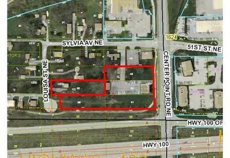
5015 Center Point Rd Ne, Cedar Rapids, IA 52402
NEARBY LISTINGS FOR SALE OR LEASE
Property Detail
5015 Center Point Rd Ne
Cedar Rapids, IA
Auditors Plat #169
14042-78007-00000
A.P. #169 LOTS 39, 49, 50 & EX RD STR/LB 51
Commercialnec
Linn
X
Iowa
19113C0295F
51
2024
1.97 AC
2025
Iowa City/Waterloo
000213
Other Market Areas
4,232 SF
DEMOGRAPHICS near 5015 Center Point Rd Ne
1 Mile
3 Mile
5 Mile
2024 Total Population
7,539
63,759
140,482
2029 Population
7,493
63,455
139,859
Pop Growth 2024-2029
(0.61%)
(0.48%)
(0.44%)
Average Age
38
40
40
2024 Total Households
3,415
27,282
58,816
HH Growth 2024-2029
(0.67%)
(0.52%)
(0.46%)
Median Household Inc
$59,138
$67,346
$67,504
Avg Household Size
2.20
2.20
2.30
2024 Avg HH Vehicles
2.00
2.00
2.00
Median Home Value
$164,122
$187,103
$182,509
Median Year Built
1972
1976
1972
Nearby Places
Map Layers
Map Styles
 Street
 Aerial
- Restaurants
- Banks
- Shops
- Fitness
- Groceries
PUBLIC TRANSPORTATION
AIRPORT
The Eastern Iowa
DRIVE
WALK
Distance
The Eastern Iowa
21 min
13.7 mi
Freight Ports
Port Milwaukee
DRIVE
WALK
Distance
Port Milwaukee
290 min
244.3 mi
SALE & LEASE HISTORY
LISTING DATE
SALE/LEASE

Sep 24, 2016
For Sale
Nearby Properties
Address
Land Use
TOTAL SIZE
Lot Size
Zoning
Address
Land Use
TOTAL SIZE
Lot Size
Zoning
218,747 SF
9.45 AC
Address
Land Use
TOTAL SIZE
Lot Size
Zoning
530,727 SF
28.94 AC
Address
Land Use
TOTAL SIZE
Lot Size
Zoning
276,234 SF
44.53 AC
Address
Land Use
TOTAL SIZE
Lot Size
Zoning
70,022 SF
8.27 AC
Address
Land Use
TOTAL SIZE
Lot Size
Zoning
97,940 SF
52.22 AC
Address
Land Use
TOTAL SIZE
Lot Size
Zoning
103,528 SF
18.54 AC
Address
Land Use
TOTAL SIZE
Lot Size
Zoning
140,672 SF
15.99 AC
Address
Land Use
TOTAL SIZE
Lot Size
Zoning
189,595 SF
19.12 AC
Address
Land Use
TOTAL SIZE
Lot Size
Zoning
1,156,491 SF
137 AC
Address
Land Use
TOTAL SIZE
Lot Size
Zoning
74,015 SF
6.59 AC
Address
Land Use
TOTAL SIZE
Lot Size
Zoning
406,933 SF
61.58 AC
Address
Land Use
TOTAL SIZE
Lot Size
Zoning
34,710 SF
3.30 AC
Address
Land Use
TOTAL SIZE
Lot Size
Zoning
69,683 SF
24.78 AC
Address
Land Use
TOTAL SIZE
Lot Size
Zoning
61,291 SF
35.88 AC
Address
Land Use
TOTAL SIZE
Lot Size
Zoning
44,972 SF
7.03 AC
Address
Land Use
TOTAL SIZE
Lot Size
Zoning
72,227 SF
18.86 AC
Address
Land Use
TOTAL SIZE
Lot Size
Zoning
90,345 SF
40 AC
Address
Land Use
TOTAL SIZE
Lot Size
Zoning
28,506 SF
5.30 AC
Address
Land Use
TOTAL SIZE
Lot Size
Zoning
67,108 SF
4.81 AC
Address
Land Use
TOTAL SIZE
Lot Size
Zoning
225,076 SF
17.04 AC
Address
Land Use
TOTAL SIZE
Lot Size
Zoning
70,158 SF
3.76 AC
Address
Land Use
TOTAL SIZE
Lot Size
Zoning
173,941 SF
15.45 AC
Address
Land Use
TOTAL SIZE
Lot Size
Zoning
63,234 SF
2.20 AC
Address
Land Use
TOTAL SIZE
Lot Size
Zoning
44,544 SF
7.11 AC
Address
Land Use
TOTAL SIZE
Lot Size
Zoning
60,616 SF
8.40 AC
Address
Land Use
TOTAL SIZE
Lot Size
Zoning
61,505 SF
28.08 AC
Address
Land Use
TOTAL SIZE
Lot Size
Zoning
2,041,280 SF
99 AC
Address
Land Use
TOTAL SIZE
Lot Size
Zoning
36,328 SF
4.40 AC
Address
Land Use
TOTAL SIZE
Lot Size
Zoning
98,080 SF
8.09 AC
Address
Land Use
TOTAL SIZE
Lot Size
Zoning
23,800 SF
65.76 AC
The World's #1 Commercial Real Estate Marketplace
Connect with us
© 2026 CoStar Group
The information above has been obtained from sources believed reliable. While we do not doubt its accuracy we have not verified it and make no guarantee, warranty or representation about it. It is your responsibility to independently confirm its accuracy and completeness. Any projections, opinions, assumptions, or estimates used are for example only and do not represent the current or future performance of the property. The value of this transaction to you depends on tax and other factors which should be evaluated by your tax, financial, and legal advisors. You and your advisors should conduct a careful, independent investigation of the property to determine to your satisfaction the suitability of the property for your needs.