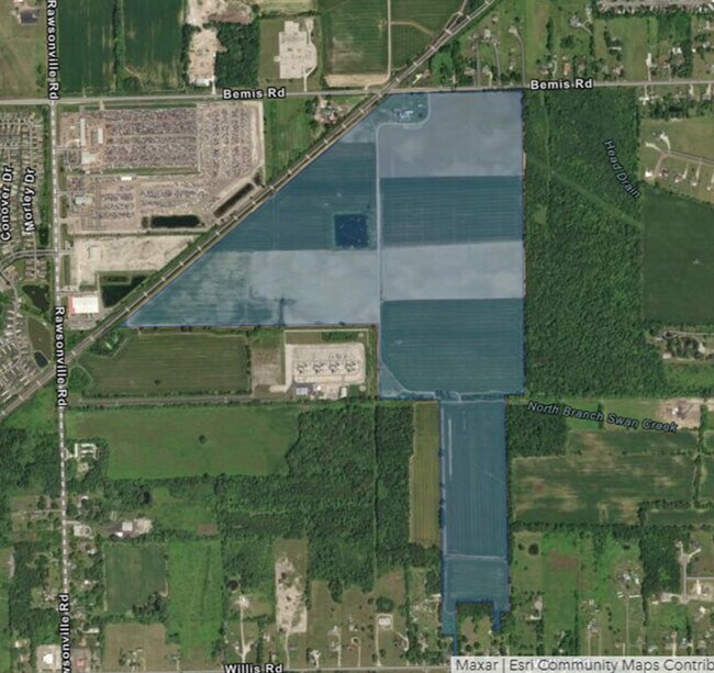
Property Record
50155 Bemis Rd, Belleville, MI 48111
Property Detail
50155 Bemis Rd
Detroit-Warren-Dearborn, MI
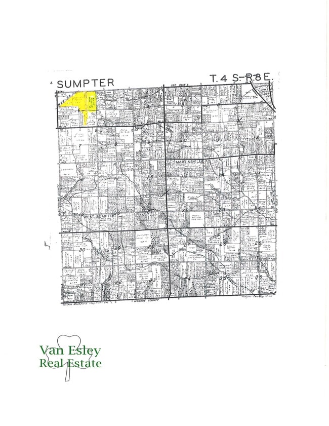
06F THAT PART OF THE NW 1/4 OF SEC 6 DESCRIBED AS BEGINNING AT A POINT ON THE N AND S 1/4 LINE OF SAID SECTION DISTANT S 0D 05M 04SEC W 198.93 FT FROM THE N 1/4 COR OF SEC 6 AND PROC TH S 0D 05M 04SEC W ALONG SAID LINE 2150.11 FT TH N 89D 23M 56SEC W
81-021-99-0003-000
WAYNE
Agriculturalland
Michigan
AE The base floodplain where base flood elevations are provided. AE Zones are now used on new format FIRMs instead of A1-A30 Zones.
0002
2025
79.80 AC
2025
Airport District
587000
Detroit
1,452 SF
NEARBY LISTINGS FOR SALE OR LEASE
DEMOGRAPHICS near 50155 Bemis Rd
1 mile
3 mile
5 mile
2025 Total Population
1,660
21,499
63,504
2030 Population
1,687
21,839
63,550
Pop Growth 2025-2030
+ 1.63%
+ 1.58%
+ 0.07%
Average Age
43
42
40
2025 Total Households
652
8,719
26,073
HH Growth 2025-2030
+ 1.69%
+ 1.47%
+ 0.02%
Median Household Inc
$85,393
$74,927
$78,758
Avg Household Size
2.50
2.40
2.40
2025 Avg HH Vehicles
2.00
2.00
2.00
Median Home Value
$187,765
$247,464
$256,030
Median Year Built
1973
1988
1982
Nearby Places
Map Layers
Map Styles
 Street
 Aerial
Layers
 Traffic
 Biking
Places
Listings with unknown addresses are not visible on the map
- Restaurants
- Banks
- Shops
- Fitness
- Groceries
PUBLIC TRANSPORTATION
AIRPORT
Detroit Metro Wayne County
Drive
Walk
Distance
Detroit Metro Wayne County
22 min
16.0 mi
Freight Ports
Port of Toledo
Drive
Walk
Distance
Port of Toledo
72 min
57.7 mi
Nearby Properties
Address
Land Use
TOTAL SIZE
Lot Size
Zoning
Address
Land Use
TOTAL SIZE
Lot Size
Zoning
432.42 AC
M2 GEN
Address
Land Use
TOTAL SIZE
Lot Size
Zoning
11,847 SF
91.35 AC
II
Address
Land Use
TOTAL SIZE
Lot Size
Zoning
97.69 AC
Address
Land Use
TOTAL SIZE
Lot Size
Zoning
630,828 SF
62.51 AC
R1B
Address
Land Use
TOTAL SIZE
Lot Size
Zoning
196,044 SF
18.67 AC
RM MULT
Address
Land Use
TOTAL SIZE
Lot Size
Zoning
1,960 SF
59.97 AC
Address
Land Use
TOTAL SIZE
Lot Size
Zoning
3,184 SF
41.02 AC
Address
Land Use
TOTAL SIZE
Lot Size
Zoning
161,042 SF
26.29 AC
II
Address
Land Use
TOTAL SIZE
Lot Size
Zoning
134,499 SF
6.20 AC
BA
Address
Land Use
TOTAL SIZE
Lot Size
Zoning
500 SF
37.70 AC
Address
Land Use
TOTAL SIZE
Lot Size
Zoning
1,744 SF
41.75 AC
BI
Address
Land Use
TOTAL SIZE
Lot Size
Zoning
72,834 SF
4.97 AC
RM MULT
Address
Land Use
TOTAL SIZE
Lot Size
Zoning
1,680 SF
20 AC
II
Address
Land Use
TOTAL SIZE
Lot Size
Zoning
73,239 SF
6.18 AC
RM MULT
Address
Land Use
TOTAL SIZE
Lot Size
Zoning
107,235 SF
7.37 AC
Address
Land Use
TOTAL SIZE
Lot Size
Zoning
54.32 AC
RMH MOB
Address
Land Use
TOTAL SIZE
Lot Size
Zoning
80.11 AC
Address
Land Use
TOTAL SIZE
Lot Size
Zoning
57,174 SF
4.50 AC
Address
Land Use
TOTAL SIZE
Lot Size
Zoning
36,200 SF
15.23 AC
Address
Land Use
TOTAL SIZE
Lot Size
Zoning
4,442 SF
42.38 AC
RMH MOB
Address
Land Use
TOTAL SIZE
Lot Size
Zoning
224,938 SF
19.42 AC
C1 GEN
Address
Land Use
TOTAL SIZE
Lot Size
Zoning
86,406 SF
2.75 AC
Address
Land Use
TOTAL SIZE
Lot Size
Zoning
52,644 SF
5.59 AC
RM MULT
Address
Land Use
TOTAL SIZE
Lot Size
Zoning
6,000 SF
15 AC
DI
Address
Land Use
TOTAL SIZE
Lot Size
Zoning
71.97 AC
R1B
Address
Land Use
TOTAL SIZE
Lot Size
Zoning
124,562 SF
5.25 AC
AP
Address
Land Use
TOTAL SIZE
Lot Size
Zoning
35.89 AC
RMH MOB
Address
Land Use
TOTAL SIZE
Lot Size
Zoning
20 AC
DI
Address
Land Use
TOTAL SIZE
Lot Size
Zoning
8,580 SF
28.50 AC
Address
Land Use
TOTAL SIZE
Lot Size
Zoning
5,515 SF
89.67 AC
BLANK
The World's #1 Commercial Real Estate Marketplace
Connect with us
© 2026 CoStar Group
The information above has been obtained from sources believed reliable. While we do not doubt its accuracy we have not verified it and make no guarantee, warranty or representation about it. It is your responsibility to independently confirm its accuracy and completeness. Any projections, opinions, assumptions, or estimates used are for example only and do not represent the current or future performance of the property. The value of this transaction to you depends on tax and other factors which should be evaluated by your tax, financial, and legal advisors. You and your advisors should conduct a careful, independent investigation of the property to determine to your satisfaction the suitability of the property for your needs.