Property Record
5017 Bennett Rd, Toledo, OH 43612
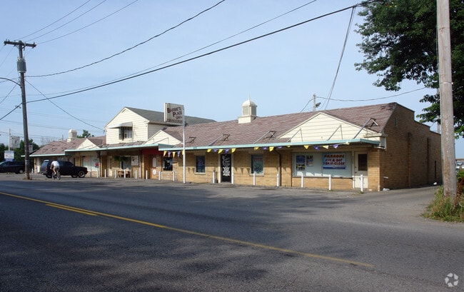


Property Detail
5017 Bennett Rd
18-85074
7 9 11 SW 1/4 N 219.12 FT AS MEAS ON W LINE E 184 FT PT S OF
Storebuilding
Lucas
10-MX
Ohio
B and X Area of moderate flood hazard, usually the area between the limits of the 100-year and 500-year floods.
0.80 AC
0
North Toledo
2025
Toledo
005704
Toledo, OH
9,048 SF
NEARBY LISTINGS FOR SALE OR LEASE
DEMOGRAPHICS near 5017 Bennett Rd
1 mile
3 mile
5 mile
2025 Total Population
12,298
82,360
198,972
2030 Population
12,076
82,228
198,924
Pop Growth 2025-2030
(1.81%)
(0.16%)
(0.02%)
Average Age
38
38
39
2025 Total Households
5,185
34,590
84,087
HH Growth 2025-2030
(1.85%)
(0.22%)
(0.04%)
Median Household Inc
$48,380
$50,198
$50,800
Avg Household Size
2.30
2.30
2.20
2025 Avg HH Vehicles
2.00
2.00
2.00
Median Home Value
$80,334
$99,844
$129,128
Median Year Built
1951
1951
1954
Nearby Places
Map Layers
Map Styles
 Street
 Aerial
Transit
 Traffic
 Biking
Places
Listings with unknown addresses are not visible on the map
- Restaurants
- Banks
- Shops
- Fitness
- Groceries
PUBLIC TRANSPORTATION
COMMUTER RAIL
Drive
Walk
Distance
12 min
6.0 mi
AIRPORT
Eugene F Kranz Toledo Express
Drive
Walk
Distance
Eugene F Kranz Toledo Express
43 min
24.4 mi
Detroit Metro Wayne County
Drive
Walk
Distance
Detroit Metro Wayne County
56 min
43.6 mi
Freight Ports
Drive
Walk
Distance
21 min
9.5 mi
SALE & LEASE HISTORY
LISTING DATE
SALE/LEASE

Oct 12, 2022
For Sale
Nov 09, 2023
For Sale
Nearby Properties
Address
Land Use
TOTAL SIZE
Lot Size
Zoning
Address
Land Use
TOTAL SIZE
Lot Size
Zoning
1,046,727 SF
0.41 AC
10-IC
Address
Land Use
TOTAL SIZE
Lot Size
Zoning
169.42 AC
10-IG
Address
Land Use
TOTAL SIZE
Lot Size
Zoning
1,972,579 SF
76.32 AC
10-IG
Address
Land Use
TOTAL SIZE
Lot Size
Zoning
304,593 SF
24.13 AC
10-IC
Address
Land Use
TOTAL SIZE
Lot Size
Zoning
693,900 SF
76.32 AC
10-IG
Address
Land Use
TOTAL SIZE
Lot Size
Zoning
448,269 SF
29.52 AC
10-IC
Address
Land Use
TOTAL SIZE
Lot Size
Zoning
171,946 SF
0.17 AC
10-IC
Address
Land Use
TOTAL SIZE
Lot Size
Zoning
Address
Land Use
TOTAL SIZE
Lot Size
Zoning
76.32 AC
10-IG
Address
Land Use
TOTAL SIZE
Lot Size
Zoning
169.42 AC
10-IG
Address
Land Use
TOTAL SIZE
Lot Size
Zoning
375,323 SF
10-IC
Address
Land Use
TOTAL SIZE
Lot Size
Zoning
72,306 SF
0.09 AC
10-IC
Address
Land Use
TOTAL SIZE
Lot Size
Zoning
317,139 SF
25.80 AC
10-IC
Address
Land Use
TOTAL SIZE
Lot Size
Zoning
172,044 SF
12.78 AC
10-MX
Address
Land Use
TOTAL SIZE
Lot Size
Zoning
228,692 SF
10.45 AC
10-RM36
Address
Land Use
TOTAL SIZE
Lot Size
Zoning
163,962 SF
10.13 AC
Address
Land Use
TOTAL SIZE
Lot Size
Zoning
293,770 SF
13.95 AC
10-RS6
Address
Land Use
TOTAL SIZE
Lot Size
Zoning
90,113 SF
11.83 AC
10-RS6
Address
Land Use
TOTAL SIZE
Lot Size
Zoning
28.51 AC
10-IG
Address
Land Use
TOTAL SIZE
Lot Size
Zoning
450,000 SF
37.30 AC
Address
Land Use
TOTAL SIZE
Lot Size
Zoning
18.70 AC
Address
Land Use
TOTAL SIZE
Lot Size
Zoning
230,400 SF
18 AC
10-CR
Address
Land Use
TOTAL SIZE
Lot Size
Zoning
34.13 AC
10-IG
Address
Land Use
TOTAL SIZE
Lot Size
Zoning
Address
Land Use
TOTAL SIZE
Lot Size
Zoning
20.67 AC
10-MX
Address
Land Use
TOTAL SIZE
Lot Size
Zoning
84,527 SF
7.79 AC
10-RS6
Address
Land Use
TOTAL SIZE
Lot Size
Zoning
47,600 SF
5.04 AC
Address
Land Use
TOTAL SIZE
Lot Size
Zoning
282,124 SF
9.71 AC
10-IC
Address
Land Use
TOTAL SIZE
Lot Size
Zoning
71,918 SF
7 AC
10-RS6
Address
Land Use
TOTAL SIZE
Lot Size
Zoning
328,898 SF
13.67 AC
10-IG
The World's #1 Commercial Real Estate Marketplace
Connect with us
© 2026 CoStar Group
The information above has been obtained from sources believed reliable. While we do not doubt its accuracy we have not verified it and make no guarantee, warranty or representation about it. It is your responsibility to independently confirm its accuracy and completeness. Any projections, opinions, assumptions, or estimates used are for example only and do not represent the current or future performance of the property. The value of this transaction to you depends on tax and other factors which should be evaluated by your tax, financial, and legal advisors. You and your advisors should conduct a careful, independent investigation of the property to determine to your satisfaction the suitability of the property for your needs.