Property Record
5017 Bowden Rd, Jacksonville, FL 32216
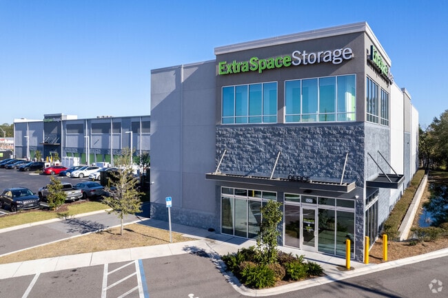


Property Detail
5017 Bowden Rd
152997-0010
6-91 56-3S-27E 1.78 BOWDEN FARMS S/D PT FARM 11 RECD O/R 19493-1890
Warehouse
Duval
PUD
Florida
B and X Area of moderate flood hazard, usually the area between the limits of the 100-year and 500-year floods.
1.76 AC
2025
San Marco
2026
Jacksonville (Florida)
016605
Jacksonville, FL
67,845 SF
NEARBY LISTINGS FOR SALE OR LEASE
DEMOGRAPHICS near 5017 Bowden Rd
1 mile
3 mile
5 mile
2025 Total Population
8,111
74,591
188,802
2030 Population
8,666
79,290
200,886
Pop Growth 2025-2030
+ 6.84%
+ 6.30%
+ 6.40%
Average Age
40
40
39
2025 Total Households
3,337
30,972
81,490
HH Growth 2025-2030
+ 7.13%
+ 6.59%
+ 6.78%
Median Household Inc
$49,137
$64,897
$66,142
Avg Household Size
2.30
2.30
2.20
2025 Avg HH Vehicles
1.00
2.00
1.00
Median Home Value
$223,657
$309,018
$312,402
Median Year Built
1973
1972
1981
Nearby Places
Map Layers
Map Styles
 Street
 Aerial
Layers
 Traffic
 Biking
Places
Listings with unknown addresses are not visible on the map
- Restaurants
- Banks
- Shops
- Fitness
- Groceries
PUBLIC TRANSPORTATION
AIRPORT
Jacksonville International
Drive
Walk
Distance
Jacksonville International
31 min
20.8 mi
Freight Ports
Jacksonville Port
Drive
Walk
Distance
Jacksonville Port
16 min
9.3 mi
Nearby Properties
Address
Land Use
TOTAL SIZE
Lot Size
Zoning
Address
Land Use
TOTAL SIZE
Lot Size
Zoning
875,866 SF
22.33 AC
PBF-3
Address
Land Use
TOTAL SIZE
Lot Size
Zoning
371,466 SF
49.16 AC
PBF-2
Address
Land Use
TOTAL SIZE
Lot Size
Zoning
273,196 SF
16.57 AC
PUD
Address
Land Use
TOTAL SIZE
Lot Size
Zoning
316,705 SF
15.44 AC
PUD
Address
Land Use
TOTAL SIZE
Lot Size
Zoning
250,989 SF
19.48 AC
PUD
Address
Land Use
TOTAL SIZE
Lot Size
Zoning
203,763 SF
9.97 AC
PUD
Address
Land Use
TOTAL SIZE
Lot Size
Zoning
193,941 SF
7.35 AC
PUD
Address
Land Use
TOTAL SIZE
Lot Size
Zoning
181,522 SF
6.56 AC
PUD
Address
Land Use
TOTAL SIZE
Lot Size
Zoning
313,009 SF
22.50 AC
RMD-D
Address
Land Use
TOTAL SIZE
Lot Size
Zoning
415,146 SF
19.27 AC
RMD-D
Address
Land Use
TOTAL SIZE
Lot Size
Zoning
286,223 SF
28.01 AC
PBF-2
Address
Land Use
TOTAL SIZE
Lot Size
Zoning
93,059 SF
8.54 AC
CCG-2
Address
Land Use
TOTAL SIZE
Lot Size
Zoning
379,026 SF
24.02 AC
PUD
Address
Land Use
TOTAL SIZE
Lot Size
Zoning
169,086 SF
10.01 AC
PUD
Address
Land Use
TOTAL SIZE
Lot Size
Zoning
259,291 SF
15.01 AC
RMD-D
Address
Land Use
TOTAL SIZE
Lot Size
Zoning
242,630 SF
22.85 AC
PUD
Address
Land Use
TOTAL SIZE
Lot Size
Zoning
129,587 SF
16.91 AC
PUD
Address
Land Use
TOTAL SIZE
Lot Size
Zoning
372,759 SF
25.01 AC
RMD-D
Address
Land Use
TOTAL SIZE
Lot Size
Zoning
191,207 SF
23.44 AC
IBP
Address
Land Use
TOTAL SIZE
Lot Size
Zoning
225,282 SF
15.36 AC
RMD-D
Address
Land Use
TOTAL SIZE
Lot Size
Zoning
266,156 SF
11.54 AC
RMD-D
Address
Land Use
TOTAL SIZE
Lot Size
Zoning
223,067 SF
14.74 AC
IBP
Address
Land Use
TOTAL SIZE
Lot Size
Zoning
72,315 SF
7.15 AC
CCG-1
Address
Land Use
TOTAL SIZE
Lot Size
Zoning
150,073 SF
11.23 AC
CCG-1
Address
Land Use
TOTAL SIZE
Lot Size
Zoning
213,028 SF
24.21 AC
CRO
Address
Land Use
TOTAL SIZE
Lot Size
Zoning
213,078 SF
25.32 AC
IBP
Address
Land Use
TOTAL SIZE
Lot Size
Zoning
178,954 SF
11.22 AC
RMD-D
Address
Land Use
TOTAL SIZE
Lot Size
Zoning
106,415 SF
20.53 AC
PUD
Address
Land Use
TOTAL SIZE
Lot Size
Zoning
182,393 SF
8.60 AC
RMD-D
Address
Land Use
TOTAL SIZE
Lot Size
Zoning
98,540 SF
15.10 AC
PUD
The World's #1 Commercial Real Estate Marketplace
Connect with us
© 2026 CoStar Group
The information above has been obtained from sources believed reliable. While we do not doubt its accuracy we have not verified it and make no guarantee, warranty or representation about it. It is your responsibility to independently confirm its accuracy and completeness. Any projections, opinions, assumptions, or estimates used are for example only and do not represent the current or future performance of the property. The value of this transaction to you depends on tax and other factors which should be evaluated by your tax, financial, and legal advisors. You and your advisors should conduct a careful, independent investigation of the property to determine to your satisfaction the suitability of the property for your needs.