Property Record
5017 E 5Th St, Katy, TX 77493
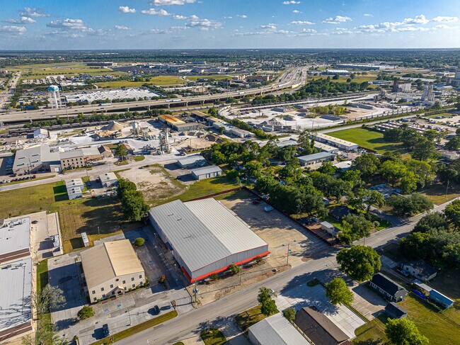


Property Detail
5017 E 5Th St
0740740010001
RES A BLK 1 MOTHERAL SEC 2 R/P
Lightindustrial
HARRIS
B and X Area of moderate flood hazard, usually the area between the limits of the 100-year and 500-year floods.
Texas
2024
1.91 AC
2025
Far Katy North
542700
Houston
32,615 SF
Houston-Pasadena-The Woodlands, TX
NEARBY LISTINGS FOR SALE OR LEASE
DEMOGRAPHICS near 5017 E 5Th St
1 mile
3 mile
5 mile
2024 Total Population
13,103
98,677
272,292
2029 Population
14,422
108,625
300,271
Pop Growth 2024-2029
+ 10.07%
+ 10.08%
+ 10.28%
Average Age
37
37
36
2024 Total Households
4,798
33,912
88,644
HH Growth 2024-2029
+ 10.19%
+ 10.19%
+ 10.40%
Median Household Inc
$87,570
$101,994
$112,326
Avg Household Size
2.70
2.90
3.00
2024 Avg HH Vehicles
2.00
2.00
2.00
Median Home Value
$304,530
$347,536
$376,972
Median Year Built
2010
2010
2009
Nearby Places
Map Layers
Map Styles
 Street
 Aerial
Transit
 Traffic
 Biking
Places
Listings with unknown addresses are not visible on the map
- Restaurants
- Banks
- Shops
- Fitness
- Groceries
SALE & LEASE HISTORY
LISTING DATE
SALE/LEASE

Jul 18, 2022
For Sale
Nearby Properties
Address
Land Use
TOTAL SIZE
Lot Size
Zoning
Address
Land Use
TOTAL SIZE
Lot Size
Zoning
1,655,920 SF
121.35 AC
Address
Land Use
TOTAL SIZE
Lot Size
Zoning
720,217 SF
65.17 AC
Address
Land Use
TOTAL SIZE
Lot Size
Zoning
765,465 SF
63.65 AC
Address
Land Use
TOTAL SIZE
Lot Size
Zoning
614,847 SF
42 AC
Address
Land Use
TOTAL SIZE
Lot Size
Zoning
329,918 SF
19.18 AC
Address
Land Use
TOTAL SIZE
Lot Size
Zoning
185,815 SF
30.28 AC
Address
Land Use
TOTAL SIZE
Lot Size
Zoning
380,278 SF
12.61 AC
Address
Land Use
TOTAL SIZE
Lot Size
Zoning
346,736 SF
14.28 AC
Address
Land Use
TOTAL SIZE
Lot Size
Zoning
352,733 SF
13.66 AC
Address
Land Use
TOTAL SIZE
Lot Size
Zoning
455,592 SF
27.53 AC
Address
Land Use
TOTAL SIZE
Lot Size
Zoning
455,592 SF
20.95 AC
Address
Land Use
TOTAL SIZE
Lot Size
Zoning
41,083 SF
23.66 AC
Address
Land Use
TOTAL SIZE
Lot Size
Zoning
339,835 SF
12.09 AC
Address
Land Use
TOTAL SIZE
Lot Size
Zoning
278,212 SF
8.15 AC
Address
Land Use
TOTAL SIZE
Lot Size
Zoning
351,758 SF
18.23 AC
Address
Land Use
TOTAL SIZE
Lot Size
Zoning
361,382 SF
14.60 AC
Address
Land Use
TOTAL SIZE
Lot Size
Zoning
375,757 SF
18.37 AC
Address
Land Use
TOTAL SIZE
Lot Size
Zoning
297,040 SF
11.64 AC
Address
Land Use
TOTAL SIZE
Lot Size
Zoning
363,173 SF
13.57 AC
Address
Land Use
TOTAL SIZE
Lot Size
Zoning
327,699 SF
11.64 AC
Address
Land Use
TOTAL SIZE
Lot Size
Zoning
6.13 AC
Address
Land Use
TOTAL SIZE
Lot Size
Zoning
12.50 AC
Address
Land Use
TOTAL SIZE
Lot Size
Zoning
348,199 SF
16.69 AC
Address
Land Use
TOTAL SIZE
Lot Size
Zoning
440,214 SF
23.66 AC
Address
Land Use
TOTAL SIZE
Lot Size
Zoning
261,803 SF
12.51 AC
Address
Land Use
TOTAL SIZE
Lot Size
Zoning
319,341 SF
14.88 AC
Address
Land Use
TOTAL SIZE
Lot Size
Zoning
324,201 SF
12.39 AC
Address
Land Use
TOTAL SIZE
Lot Size
Zoning
290,973 SF
15 AC
Address
Land Use
TOTAL SIZE
Lot Size
Zoning
Address
Land Use
TOTAL SIZE
Lot Size
Zoning
327,793 SF
10.86 AC
The World's #1 Commercial Real Estate Marketplace
Connect with us
© 2026 CoStar Group
The information above has been obtained from sources believed reliable. While we do not doubt its accuracy we have not verified it and make no guarantee, warranty or representation about it. It is your responsibility to independently confirm its accuracy and completeness. Any projections, opinions, assumptions, or estimates used are for example only and do not represent the current or future performance of the property. The value of this transaction to you depends on tax and other factors which should be evaluated by your tax, financial, and legal advisors. You and your advisors should conduct a careful, independent investigation of the property to determine to your satisfaction the suitability of the property for your needs.