Property Record
5018 Euclid Rd, Virginia Beach, VA 23462


NEARBY LISTINGS FOR SALE OR LEASE
Property Detail
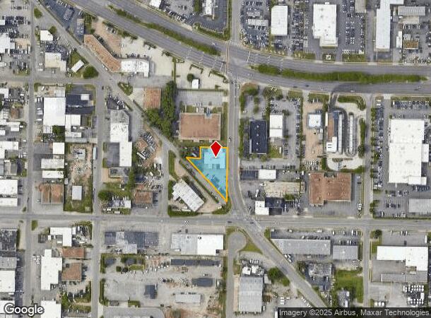
5018 Euclid Rd
Virginia Beach-Norfolk-Newport News, VA-NC
Euclid Place
1467-94-8851
EUCLID PLACE LOT 13 32 - 39 BLK 42
Servicestation
Virginia Beach
X
Virginia
5155310084G
13
2024
0.52 AC
2025
Cleveland
041002
Hampton Roads
6,512 SF
DEMOGRAPHICS near 5018 Euclid Rd
1 Mile
3 Mile
5 Mile
2024 Total Population
16,906
123,692
297,148
2029 Population
16,938
122,493
294,349
Pop Growth 2024-2029
+ 0.19%
(0.97%)
(0.94%)
Average Age
37
39
39
2024 Total Households
6,590
49,412
114,724
HH Growth 2024-2029
0.00%
(1.12%)
(1.12%)
Median Household Inc
$68,423
$71,481
$74,472
Avg Household Size
2.50
2.40
2.50
2024 Avg HH Vehicles
2.00
2.00
2.00
Median Home Value
$229,610
$273,329
$274,493
Median Year Built
1981
1979
1979
Nearby Places
Map Layers
Map Styles
 Street
 Aerial
- Restaurants
- Banks
- Shops
- Fitness
- Groceries
PUBLIC TRANSPORTATION
COMMUTER RAIL
DRIVE
WALK
Distance
11 min
7.4 mi
AIRPORT
Norfolk International
DRIVE
WALK
Distance
Norfolk International
15 min
7.4 mi
Newport News/Williamsburg International
DRIVE
WALK
Distance
Newport News/Williamsburg International
50 min
33.3 mi
Freight Ports
Virginia Port Authority - Portsmouth
DRIVE
WALK
Distance
Virginia Port Authority - Portsmouth
23 min
12.8 mi
SALE & LEASE HISTORY
LISTING DATE
SALE/LEASE

Jan 30, 2025
For Lease
Nearby Properties
Address
Land Use
TOTAL SIZE
Lot Size
Zoning
Address
Land Use
TOTAL SIZE
Lot Size
Zoning
281,816 SF
11.72 AC
Address
Land Use
TOTAL SIZE
Lot Size
Zoning
697,880 SF
200.35 AC
R15
Address
Land Use
TOTAL SIZE
Lot Size
Zoning
1 SF
42.35 AC
A18
Address
Land Use
TOTAL SIZE
Lot Size
Zoning
1 SF
24.56 AC
A18
Address
Land Use
TOTAL SIZE
Lot Size
Zoning
197,812 SF
8.21 AC
Address
Land Use
TOTAL SIZE
Lot Size
Zoning
4 SF
19.85 AC
A12
Address
Land Use
TOTAL SIZE
Lot Size
Zoning
15.92 AC
A18
Address
Land Use
TOTAL SIZE
Lot Size
Zoning
9.62 AC
A36
Address
Land Use
TOTAL SIZE
Lot Size
Zoning
226,775 SF
13.14 AC
B2
Address
Land Use
TOTAL SIZE
Lot Size
Zoning
7.45 AC
B4
Address
Land Use
TOTAL SIZE
Lot Size
Zoning
287,520 SF
13.10 AC
A18
Address
Land Use
TOTAL SIZE
Lot Size
Zoning
18.61 AC
PDH2
Address
Land Use
TOTAL SIZE
Lot Size
Zoning
Address
Land Use
TOTAL SIZE
Lot Size
Zoning
23.96 AC
IN2
Address
Land Use
TOTAL SIZE
Lot Size
Zoning
301,631 SF
31.91 AC
I1
Address
Land Use
TOTAL SIZE
Lot Size
Zoning
210,872 SF
2.13 AC
B4
Address
Land Use
TOTAL SIZE
Lot Size
Zoning
246,500 SF
B3A
Address
Land Use
TOTAL SIZE
Lot Size
Zoning
12.85 AC
A24
Address
Land Use
TOTAL SIZE
Lot Size
Zoning
86,497 SF
1.56 AC
B3A
Address
Land Use
TOTAL SIZE
Lot Size
Zoning
3,858 SF
17.85 AC
Address
Land Use
TOTAL SIZE
Lot Size
Zoning
490,047 SF
6.97 AC
A36
Address
Land Use
TOTAL SIZE
Lot Size
Zoning
242,732 SF
12.35 AC
B3
Address
Land Use
TOTAL SIZE
Lot Size
Zoning
210,987 SF
B3A
Address
Land Use
TOTAL SIZE
Lot Size
Zoning
318,496 SF
13.79 AC
A18
Address
Land Use
TOTAL SIZE
Lot Size
Zoning
73,244 SF
11.60 AC
B4C
Address
Land Use
TOTAL SIZE
Lot Size
Zoning
Address
Land Use
TOTAL SIZE
Lot Size
Zoning
1 SF
17.48 AC
A18
Address
Land Use
TOTAL SIZE
Lot Size
Zoning
1 SF
12.01 AC
PDH1
Address
Land Use
TOTAL SIZE
Lot Size
Zoning
7.46 AC
Address
Land Use
TOTAL SIZE
Lot Size
Zoning
1 SF
5.95 AC
B4
The World's #1 Commercial Real Estate Marketplace
Connect with us
© 2025 CoStar Group
The information above has been obtained from sources believed reliable. While we do not doubt its accuracy we have not verified it and make no guarantee, warranty or representation about it. It is your responsibility to independently confirm its accuracy and completeness. Any projections, opinions, assumptions, or estimates used are for example only and do not represent the current or future performance of the property. The value of this transaction to you depends on tax and other factors which should be evaluated by your tax, financial, and legal advisors. You and your advisors should conduct a careful, independent investigation of the property to determine to your satisfaction the suitability of the property for your needs.