Property Record
502 Glengary Rd, Holland, OH 43528
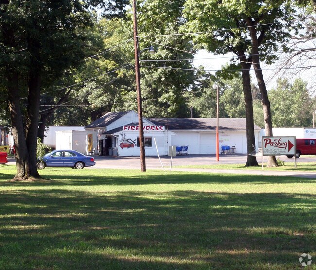

Property Detail
502 Glengary Rd
65-04167
2 6 SW 1/4 NE1/4 EXC PT N OF FRANKFORT RD & W OF GLENGARY
Officebuilding
LUCAS
19-MX
Ohio
B and X Area of moderate flood hazard, usually the area between the limits of the 100-year and 500-year floods.
100
0
36.74 AC
2025
West/Sylvania
009104
Toledo
6,512 SF
Toledo, OH
NEARBY LISTINGS FOR SALE OR LEASE
DEMOGRAPHICS near 502 Glengary Rd
1 mile
3 mile
5 mile
2025 Total Population
1,855
22,981
79,552
2030 Population
1,818
22,699
78,679
Pop Growth 2025-2030
(1.99%)
(1.23%)
(1.10%)
Average Age
46
42
42
2025 Total Households
720
9,025
33,039
HH Growth 2025-2030
(2.08%)
(1.11%)
(1.03%)
Median Household Inc
$141,379
$98,319
$88,115
Avg Household Size
2.50
2.50
2.30
2025 Avg HH Vehicles
2.00
2.00
2.00
Median Home Value
$415,267
$309,591
$265,027
Median Year Built
1993
1989
1983
Nearby Places
Map Layers
Map Styles
 Street
 Aerial
Layers
 Traffic
 Biking
Places
Listings with unknown addresses are not visible on the map
- Restaurants
- Banks
- Shops
- Fitness
- Groceries
PUBLIC TRANSPORTATION
AIRPORT
Eugene F Kranz Toledo Express
Drive
Walk
Distance
Eugene F Kranz Toledo Express
22 min
10.1 mi
Freight Ports
Port of Toledo
Drive
Walk
Distance
Port of Toledo
36 min
21.0 mi
Nearby Properties
Address
Land Use
TOTAL SIZE
Lot Size
Zoning
Address
Land Use
TOTAL SIZE
Lot Size
Zoning
217,992 SF
39.78 AC
20-C2
Address
Land Use
TOTAL SIZE
Lot Size
Zoning
140,008 SF
10 AC
19-R3
Address
Land Use
TOTAL SIZE
Lot Size
Zoning
122,154 SF
10.62 AC
20-MX
Address
Land Use
TOTAL SIZE
Lot Size
Zoning
65,182 SF
8.40 AC
19-PO
Address
Land Use
TOTAL SIZE
Lot Size
Zoning
121,446 SF
8.87 AC
20-MX
Address
Land Use
TOTAL SIZE
Lot Size
Zoning
587,559 SF
45 AC
30-M1
Address
Land Use
TOTAL SIZE
Lot Size
Zoning
135,296 SF
27.36 AC
19-M1
Address
Land Use
TOTAL SIZE
Lot Size
Zoning
128,825 SF
10.18 AC
19-M1
Address
Land Use
TOTAL SIZE
Lot Size
Zoning
161,280 SF
12.20 AC
19-R3
Address
Land Use
TOTAL SIZE
Lot Size
Zoning
45.57 AC
30-M1
Address
Land Use
TOTAL SIZE
Lot Size
Zoning
148,680 SF
8.50 AC
19-M3
Address
Land Use
TOTAL SIZE
Lot Size
Zoning
167,800 SF
17.30 AC
19-MX
Address
Land Use
TOTAL SIZE
Lot Size
Zoning
92,576 SF
8.42 AC
19-R3
Address
Land Use
TOTAL SIZE
Lot Size
Zoning
69,061 SF
7.50 AC
19-RA3
Address
Land Use
TOTAL SIZE
Lot Size
Zoning
100,452 SF
11.80 AC
20-MX
Address
Land Use
TOTAL SIZE
Lot Size
Zoning
65,576 SF
4.35 AC
19-M1
Address
Land Use
TOTAL SIZE
Lot Size
Zoning
30,120 SF
6.99 AC
19-C2
Address
Land Use
TOTAL SIZE
Lot Size
Zoning
60,771 SF
2.87 AC
24-SUP
Address
Land Use
TOTAL SIZE
Lot Size
Zoning
152,659 SF
4.89 AC
20-M1
Address
Land Use
TOTAL SIZE
Lot Size
Zoning
82,770 SF
4.19 AC
19-R3
Address
Land Use
TOTAL SIZE
Lot Size
Zoning
52,636 SF
6.18 AC
19-M1
Address
Land Use
TOTAL SIZE
Lot Size
Zoning
5,744 SF
5.57 AC
19-C2
Address
Land Use
TOTAL SIZE
Lot Size
Zoning
35,520 SF
122 AC
19-RA4
Address
Land Use
TOTAL SIZE
Lot Size
Zoning
47,887 SF
12.27 AC
19-PO
Address
Land Use
TOTAL SIZE
Lot Size
Zoning
92,955 SF
9.95 AC
19-MX
Address
Land Use
TOTAL SIZE
Lot Size
Zoning
58,536 SF
4.02 AC
19-R3
Address
Land Use
TOTAL SIZE
Lot Size
Zoning
112,200 SF
8.06 AC
19-M1
Address
Land Use
TOTAL SIZE
Lot Size
Zoning
59,821 SF
3 AC
19-PO
Address
Land Use
TOTAL SIZE
Lot Size
Zoning
57,902 SF
4 AC
19-R3
Address
Land Use
TOTAL SIZE
Lot Size
Zoning
64,222 SF
4.01 AC
19-R3
The World's #1 Commercial Real Estate Marketplace
Connect with us
© 2026 CoStar Group
The information above has been obtained from sources believed reliable. While we do not doubt its accuracy we have not verified it and make no guarantee, warranty or representation about it. It is your responsibility to independently confirm its accuracy and completeness. Any projections, opinions, assumptions, or estimates used are for example only and do not represent the current or future performance of the property. The value of this transaction to you depends on tax and other factors which should be evaluated by your tax, financial, and legal advisors. You and your advisors should conduct a careful, independent investigation of the property to determine to your satisfaction the suitability of the property for your needs.