Property Record
502 Howland Blvd, Deltona, FL 32738

NEARBY LISTINGS FOR SALE OR LEASE
Property Detail
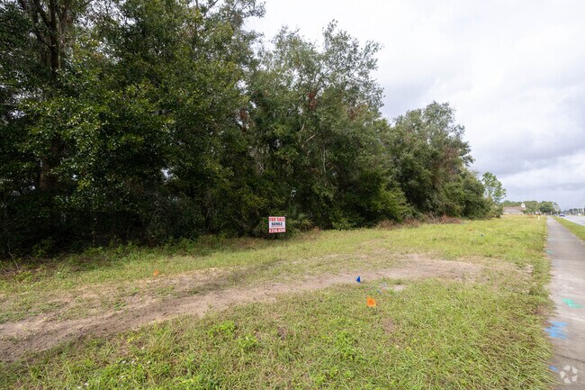
502 Howland Blvd
Deltona-Daytona Beach-Ormond Beach, FL
Deltona Lakes
8130-62-00-0050
TRACT E DELTONA LAKES UNIT 62 MB 28 PGS 95-98 INC EXC IRREG PARCEL MEAS 209.37 FT ON S/L & MEAS 24.02 FT ON W/L PER OR 3774 PG 1647 PER OR 6528 PG 2100 PER OR 8085 PG 0730 PER OR 8138 PG 1338 PER OR 8483 PG 2388
Commercialacreage
Volusia
X
Florida
12127C0645K
3.73 AC
2025
Deltona
2026
Deltona/Daytona Beach
091035
DEMOGRAPHICS near 502 Howland Blvd
1 Mile
3 Mile
5 Mile
2024 Total Population
4,285
27,307
62,181
2029 Population
4,749
29,737
67,224
Pop Growth 2024-2029
+ 10.83%
+ 8.90%
+ 8.11%
Average Age
39
40
40
2024 Total Households
1,448
9,415
21,823
HH Growth 2024-2029
+ 10.77%
+ 8.85%
+ 8.09%
Median Household Inc
$70,456
$69,028
$65,654
Avg Household Size
2.90
2.80
2.80
2024 Avg HH Vehicles
2.00
2.00
2.00
Median Home Value
$227,562
$219,316
$215,548
Median Year Built
1991
1989
1988
Nearby Places
Map Layers
Map Styles
 Street
 Aerial
- Restaurants
- Banks
- Shops
- Fitness
- Groceries
PUBLIC TRANSPORTATION
AIRPORT
Orlando Sanford International
DRIVE
WALK
Distance
Orlando Sanford International
21 min
13.1 mi
Daytona Beach International
DRIVE
WALK
Distance
Daytona Beach International
40 min
29.8 mi
Freight Ports
Port Canaveral
DRIVE
WALK
Distance
Port Canaveral
89 min
73.6 mi
Nearby Properties
Address
Land Use
TOTAL SIZE
Lot Size
Zoning
Address
Land Use
TOTAL SIZE
Lot Size
Zoning
318,438 SF
78.41 AC
A1
Address
Land Use
TOTAL SIZE
Lot Size
Zoning
174,085 SF
40.50 AC
01R
Address
Land Use
TOTAL SIZE
Lot Size
Zoning
224,577 SF
24.64 AC
RR
Address
Land Use
TOTAL SIZE
Lot Size
Zoning
104,514 SF
33.32 AC
P
Address
Land Use
TOTAL SIZE
Lot Size
Zoning
103,615 SF
27.75 AC
01A1
Address
Land Use
TOTAL SIZE
Lot Size
Zoning
105,535 SF
13.05 AC
P
Address
Land Use
TOTAL SIZE
Lot Size
Zoning
206.27 AC
A1
Address
Land Use
TOTAL SIZE
Lot Size
Zoning
294.11 AC
FR
Address
Land Use
TOTAL SIZE
Lot Size
Zoning
56,243 SF
7.57 AC
C1
Address
Land Use
TOTAL SIZE
Lot Size
Zoning
56,243 SF
6.56 AC
01B
Address
Land Use
TOTAL SIZE
Lot Size
Zoning
38,144 SF
52 AC
A3
Address
Land Use
TOTAL SIZE
Lot Size
Zoning
25,531 SF
14.76 AC
01A3
Address
Land Use
TOTAL SIZE
Lot Size
Zoning
48 AC
A2
Address
Land Use
TOTAL SIZE
Lot Size
Zoning
55,317 SF
4.29 AC
01B
Address
Land Use
TOTAL SIZE
Lot Size
Zoning
64.81 AC
FR
Address
Land Use
TOTAL SIZE
Lot Size
Zoning
516 AC
FR
Address
Land Use
TOTAL SIZE
Lot Size
Zoning
64.81 AC
FR
Address
Land Use
TOTAL SIZE
Lot Size
Zoning
12,136 SF
118.54 AC
RR
Address
Land Use
TOTAL SIZE
Lot Size
Zoning
19,846 SF
5.07 AC
Address
Land Use
TOTAL SIZE
Lot Size
Zoning
2,088 SF
334.30 AC
RC
Address
Land Use
TOTAL SIZE
Lot Size
Zoning
13,581 SF
5.41 AC
01A1
Address
Land Use
TOTAL SIZE
Lot Size
Zoning
12,500 SF
6.43 AC
01A3
Address
Land Use
TOTAL SIZE
Lot Size
Zoning
31,970 SF
7.58 AC
A3
Address
Land Use
TOTAL SIZE
Lot Size
Zoning
11.59 AC
01A1
Address
Land Use
TOTAL SIZE
Lot Size
Zoning
16,162 SF
1.76 AC
C1
Address
Land Use
TOTAL SIZE
Lot Size
Zoning
9,313 SF
5.35 AC
01R
Address
Land Use
TOTAL SIZE
Lot Size
Zoning
6,272 SF
1.64 AC
C1
Address
Land Use
TOTAL SIZE
Lot Size
Zoning
13.62 AC
Address
Land Use
TOTAL SIZE
Lot Size
Zoning
8,866 SF
0.98 AC
BPUD
Address
Land Use
TOTAL SIZE
Lot Size
Zoning
9,235 SF
2.17 AC
01B
The World's #1 Commercial Real Estate Marketplace
Connect with us
© 2026 CoStar Group
The information above has been obtained from sources believed reliable. While we do not doubt its accuracy we have not verified it and make no guarantee, warranty or representation about it. It is your responsibility to independently confirm its accuracy and completeness. Any projections, opinions, assumptions, or estimates used are for example only and do not represent the current or future performance of the property. The value of this transaction to you depends on tax and other factors which should be evaluated by your tax, financial, and legal advisors. You and your advisors should conduct a careful, independent investigation of the property to determine to your satisfaction the suitability of the property for your needs.