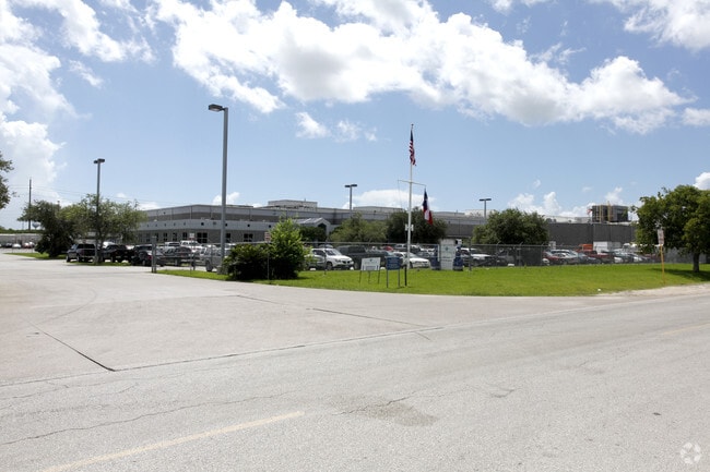
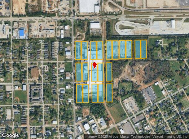
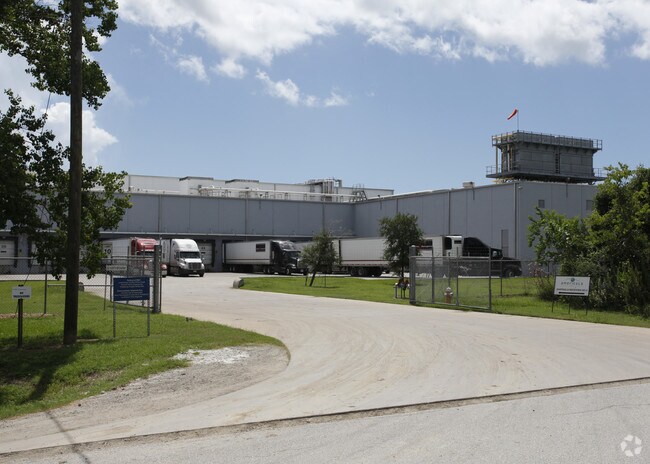
Property Record
502 N Broadway St, La Porte, TX 77571
NEARBY LISTINGS FOR SALE OR LEASE
Property Detail
502 N Broadway St
0240520350026
La Porte
Shipyard
BLKS 416-419 432-435 980 & PT BLKS 415 420 & 438 (IMPS ONLY) TAX ABATEMENT EXPIRED 12-31-97 LA PORTE
X
Harris
48201C0945M
Texas
2024
22.96 AC
2025
East-Southeast Far
343602
Houston
306,482 SF
Houston-The Woodlands-Sugar Land, TX
DEMOGRAPHICS near 502 N Broadway St
1 Mile
3 Mile
5 Mile
2024 Total Population
5,548
16,185
47,208
2029 Population
5,733
16,672
48,330
Pop Growth 2024-2029
+ 3.33%
+ 3.01%
+ 2.38%
Average Age
39
39
39
2024 Total Households
2,078
5,929
16,713
HH Growth 2024-2029
+ 2.98%
+ 2.80%
+ 2.27%
Median Household Inc
$63,588
$74,626
$73,806
Avg Household Size
2.60
2.70
2.80
2024 Avg HH Vehicles
2.00
2.00
2.00
Median Home Value
$160,114
$205,612
$191,302
Median Year Built
1978
1986
1981
Nearby Places
Map Layers
Map Styles
 Street
 Aerial
- Restaurants
- Banks
- Shops
- Fitness
- Groceries
PUBLIC TRANSPORTATION
AIRPORT
William P Hobby
DRIVE
WALK
Distance
William P Hobby
36 min
18.7 mi
George Bush Intcntl/Houston
DRIVE
WALK
Distance
George Bush Intcntl/Houston
47 min
36.5 mi
Freight Ports
Port of Houston
DRIVE
WALK
Distance
Port of Houston
29 min
19.4 mi
Nearby Properties
Address
Land Use
TOTAL SIZE
Lot Size
Zoning
Address
Land Use
TOTAL SIZE
Lot Size
Zoning
45.75 AC
Address
Land Use
TOTAL SIZE
Lot Size
Zoning
45.78 AC
Address
Land Use
TOTAL SIZE
Lot Size
Zoning
38.27 AC
Address
Land Use
TOTAL SIZE
Lot Size
Zoning
Address
Land Use
TOTAL SIZE
Lot Size
Zoning
61.40 AC
Address
Land Use
TOTAL SIZE
Lot Size
Zoning
748,500 SF
42.13 AC
Address
Land Use
TOTAL SIZE
Lot Size
Zoning
610,402 SF
34.69 AC
Address
Land Use
TOTAL SIZE
Lot Size
Zoning
602,060 SF
34.15 AC
Address
Land Use
TOTAL SIZE
Lot Size
Zoning
348,294 SF
18.02 AC
Address
Land Use
TOTAL SIZE
Lot Size
Zoning
102.68 AC
Address
Land Use
TOTAL SIZE
Lot Size
Zoning
287,729 SF
20 AC
Address
Land Use
TOTAL SIZE
Lot Size
Zoning
416,005 SF
21.47 AC
Address
Land Use
TOTAL SIZE
Lot Size
Zoning
415,662 SF
21.49 AC
Address
Land Use
TOTAL SIZE
Lot Size
Zoning
297,698 SF
19.14 AC
Address
Land Use
TOTAL SIZE
Lot Size
Zoning
289,475 SF
14.83 AC
Address
Land Use
TOTAL SIZE
Lot Size
Zoning
40.46 AC
Address
Land Use
TOTAL SIZE
Lot Size
Zoning
260,411 SF
12.11 AC
Address
Land Use
TOTAL SIZE
Lot Size
Zoning
297,671 SF
20.07 AC
Address
Land Use
TOTAL SIZE
Lot Size
Zoning
253,487 SF
14.40 AC
Address
Land Use
TOTAL SIZE
Lot Size
Zoning
251,516 SF
12.34 AC
Address
Land Use
TOTAL SIZE
Lot Size
Zoning
250,300 SF
11.38 AC
Address
Land Use
TOTAL SIZE
Lot Size
Zoning
258,486 SF
34.76 AC
Address
Land Use
TOTAL SIZE
Lot Size
Zoning
194,000 SF
12.32 AC
Address
Land Use
TOTAL SIZE
Lot Size
Zoning
425.97 AC
Address
Land Use
TOTAL SIZE
Lot Size
Zoning
267,540 SF
15.78 AC
Address
Land Use
TOTAL SIZE
Lot Size
Zoning
Address
Land Use
TOTAL SIZE
Lot Size
Zoning
6,000 SF
278.69 AC
Address
Land Use
TOTAL SIZE
Lot Size
Zoning
90,000 SF
12.45 AC
Address
Land Use
TOTAL SIZE
Lot Size
Zoning
161,447 SF
8.55 AC
The World's #1 Commercial Real Estate Marketplace
Connect with us
© 2025 CoStar Group
The information above has been obtained from sources believed reliable. While we do not doubt its accuracy we have not verified it and make no guarantee, warranty or representation about it. It is your responsibility to independently confirm its accuracy and completeness. Any projections, opinions, assumptions, or estimates used are for example only and do not represent the current or future performance of the property. The value of this transaction to you depends on tax and other factors which should be evaluated by your tax, financial, and legal advisors. You and your advisors should conduct a careful, independent investigation of the property to determine to your satisfaction the suitability of the property for your needs.