Property Record
502 Ne Loop 289, Lubbock, TX 79403
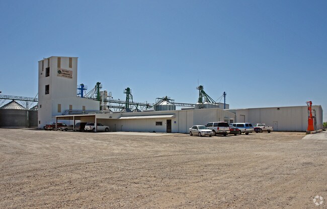

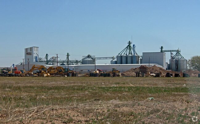
Property Detail
502 Ne Loop 289
Lubbock, TX
NORTH LOOP IND PK BLK A L 2
R41485
LUBBOCK
Industrialgeneral
Texas
B and X Area of moderate flood hazard, usually the area between the limits of the 100-year and 500-year floods.
2
2024
6.26 AC
2025
North Inner Loop
010203
Lubbock
29,450 SF
NEARBY LISTINGS FOR SALE OR LEASE
DEMOGRAPHICS near 502 Ne Loop 289
1 mile
3 mile
5 mile
2025 Total Population
2,680
25,385
80,847
2030 Population
2,858
26,615
84,153
Pop Growth 2025-2030
+ 6.64%
+ 4.85%
+ 4.09%
Average Age
39
36
34
2025 Total Households
1,021
9,479
29,143
HH Growth 2025-2030
+ 6.95%
+ 5.08%
+ 4.85%
Median Household Inc
$39,381
$35,045
$39,222
Avg Household Size
2.50
2.40
2.40
2025 Avg HH Vehicles
2.00
2.00
2.00
Median Home Value
$95,962
$80,239
$97,172
Median Year Built
1979
1982
1973
Nearby Places
Map Layers
Map Styles
 Street
 Aerial
Transit
 Traffic
 Biking
Places
Listings with unknown addresses are not visible on the map
- Restaurants
- Banks
- Shops
- Fitness
- Groceries
PUBLIC TRANSPORTATION
AIRPORT
Lubbock Preston Smith International
Drive
Walk
Distance
Lubbock Preston Smith International
21 min
9.4 mi
Freight Ports
Tulsa Port Of Catoosa
Drive
Walk
Distance
Tulsa Port Of Catoosa
503 min
466.7 mi
Nearby Properties
Address
Land Use
TOTAL SIZE
Lot Size
Zoning
Address
Land Use
TOTAL SIZE
Lot Size
Zoning
281,000 SF
6.19 AC
Address
Land Use
TOTAL SIZE
Lot Size
Zoning
378,274 SF
53.07 AC
Address
Land Use
TOTAL SIZE
Lot Size
Zoning
79,376 SF
11.25 AC
Address
Land Use
TOTAL SIZE
Lot Size
Zoning
15,506 SF
18.67 AC
Address
Land Use
TOTAL SIZE
Lot Size
Zoning
353,616 SF
5.24 AC
Address
Land Use
TOTAL SIZE
Lot Size
Zoning
351,150 SF
3.65 AC
Address
Land Use
TOTAL SIZE
Lot Size
Zoning
21,110 SF
13.02 AC
Address
Land Use
TOTAL SIZE
Lot Size
Zoning
342,611 SF
12.21 AC
Address
Land Use
TOTAL SIZE
Lot Size
Zoning
321,540 SF
10.87 AC
Address
Land Use
TOTAL SIZE
Lot Size
Zoning
286,541 SF
4.25 AC
Address
Land Use
TOTAL SIZE
Lot Size
Zoning
179,627 SF
2.66 AC
Address
Land Use
TOTAL SIZE
Lot Size
Zoning
120,867 SF
3.41 AC
Address
Land Use
TOTAL SIZE
Lot Size
Zoning
281,520 SF
37.21 AC
Address
Land Use
TOTAL SIZE
Lot Size
Zoning
14.37 AC
Address
Land Use
TOTAL SIZE
Lot Size
Zoning
230,286 SF
8.01 AC
Address
Land Use
TOTAL SIZE
Lot Size
Zoning
122,016 SF
1.13 AC
Address
Land Use
TOTAL SIZE
Lot Size
Zoning
201,700 SF
16.98 AC
Address
Land Use
TOTAL SIZE
Lot Size
Zoning
152,857 SF
7.87 AC
Address
Land Use
TOTAL SIZE
Lot Size
Zoning
92,624 SF
2.77 AC
Address
Land Use
TOTAL SIZE
Lot Size
Zoning
202,925 SF
25.10 AC
Address
Land Use
TOTAL SIZE
Lot Size
Zoning
202,206 SF
18.86 AC
Address
Land Use
TOTAL SIZE
Lot Size
Zoning
324.17 AC
Address
Land Use
TOTAL SIZE
Lot Size
Zoning
64,317 SF
4.50 AC
Address
Land Use
TOTAL SIZE
Lot Size
Zoning
77,404 SF
1.84 AC
Address
Land Use
TOTAL SIZE
Lot Size
Zoning
160,000 SF
10.90 AC
Address
Land Use
TOTAL SIZE
Lot Size
Zoning
115,670 SF
2.28 AC
Address
Land Use
TOTAL SIZE
Lot Size
Zoning
36,684 SF
2.06 AC
Address
Land Use
TOTAL SIZE
Lot Size
Zoning
126,457 SF
6.96 AC
Address
Land Use
TOTAL SIZE
Lot Size
Zoning
105,097 SF
20.99 AC
Address
Land Use
TOTAL SIZE
Lot Size
Zoning
126,881 SF
17.07 AC
The World's #1 Commercial Real Estate Marketplace
Connect with us
© 2026 CoStar Group
The information above has been obtained from sources believed reliable. While we do not doubt its accuracy we have not verified it and make no guarantee, warranty or representation about it. It is your responsibility to independently confirm its accuracy and completeness. Any projections, opinions, assumptions, or estimates used are for example only and do not represent the current or future performance of the property. The value of this transaction to you depends on tax and other factors which should be evaluated by your tax, financial, and legal advisors. You and your advisors should conduct a careful, independent investigation of the property to determine to your satisfaction the suitability of the property for your needs.