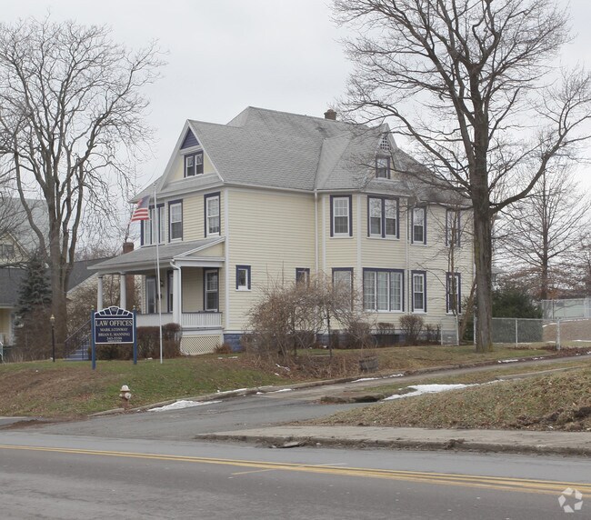
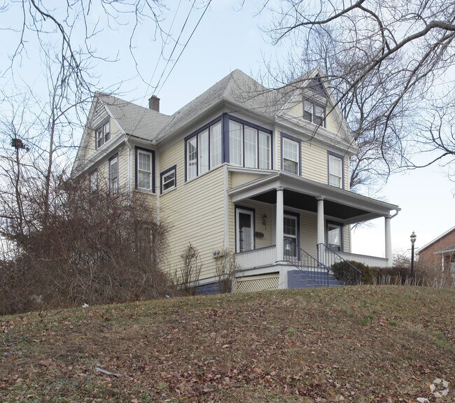
Property Record
502 S Block St, Scranton, PA 18508

NEARBY LISTINGS FOR SALE OR LEASE
Property Detail
502 S Block St
Scranton--Wilkes-Barre, PA
85X163 BLDG & LAND W-06 B-0260 L-0180 P-00300
14657010001
Lackawanna
Quadruplex
Pennsylvania
X
180
42069C0217D
0.32 AC
2025
I-81 Corridor
2025
Philadelphia
101300
DEMOGRAPHICS near 502 S Block St
1 mile
3 mile
5 mile
2024 Total Population
18,673
84,804
117,276
2029 Population
18,405
84,134
116,205
Pop Growth 2024-2029
(1.44%)
(0.79%)
(0.91%)
Average Age
41
40
41
2024 Total Households
7,305
33,983
47,998
HH Growth 2024-2029
(1.66%)
(0.83%)
(0.95%)
Median Household Inc
$64,965
$50,646
$54,285
Avg Household Size
2.30
2.20
2.20
2024 Avg HH Vehicles
2.00
1.00
2.00
Median Home Value
$162,853
$138,430
$148,197
Median Year Built
1947
1947
1948
Nearby Places
Map Layers
Map Styles
 Street
 Aerial
Transit
 Traffic
 Biking
Places
Listings with unknown addresses are not visible on the map
- Restaurants
- Banks
- Shops
- Fitness
- Groceries
PUBLIC TRANSPORTATION
AIRPORT
Wilkes-Barre/Scranton International
Drive
Walk
Distance
Wilkes-Barre/Scranton International
16 min
9.7 mi
Freight Ports
Maher Terminal
Drive
Walk
Distance
Maher Terminal
141 min
112.9 mi
Nearby Properties
Address
Land Use
TOTAL SIZE
Lot Size
Zoning
Address
Land Use
TOTAL SIZE
Lot Size
Zoning
2.62 AC
Address
Land Use
TOTAL SIZE
Lot Size
Zoning
Address
Land Use
TOTAL SIZE
Lot Size
Zoning
Address
Land Use
TOTAL SIZE
Lot Size
Zoning
43.66 AC
Address
Land Use
TOTAL SIZE
Lot Size
Zoning
Address
Land Use
TOTAL SIZE
Lot Size
Zoning
2.40 AC
Address
Land Use
TOTAL SIZE
Lot Size
Zoning
2.30 AC
Address
Land Use
TOTAL SIZE
Lot Size
Zoning
4.20 AC
Address
Land Use
TOTAL SIZE
Lot Size
Zoning
15.50 AC
Address
Land Use
TOTAL SIZE
Lot Size
Zoning
3.86 AC
Address
Land Use
TOTAL SIZE
Lot Size
Zoning
0.99 AC
Address
Land Use
TOTAL SIZE
Lot Size
Zoning
12.88 AC
Address
Land Use
TOTAL SIZE
Lot Size
Zoning
7.81 AC
Address
Land Use
TOTAL SIZE
Lot Size
Zoning
Address
Land Use
TOTAL SIZE
Lot Size
Zoning
4.85 AC
Address
Land Use
TOTAL SIZE
Lot Size
Zoning
Address
Land Use
TOTAL SIZE
Lot Size
Zoning
Address
Land Use
TOTAL SIZE
Lot Size
Zoning
25.62 AC
Address
Land Use
TOTAL SIZE
Lot Size
Zoning
2.65 AC
Address
Land Use
TOTAL SIZE
Lot Size
Zoning
0.27 AC
Address
Land Use
TOTAL SIZE
Lot Size
Zoning
97.16 AC
Address
Land Use
TOTAL SIZE
Lot Size
Zoning
Address
Land Use
TOTAL SIZE
Lot Size
Zoning
5.35 AC
Address
Land Use
TOTAL SIZE
Lot Size
Zoning
Address
Land Use
TOTAL SIZE
Lot Size
Zoning
3.86 AC
Address
Land Use
TOTAL SIZE
Lot Size
Zoning
Address
Land Use
TOTAL SIZE
Lot Size
Zoning
Address
Land Use
TOTAL SIZE
Lot Size
Zoning
3.11 AC
Address
Land Use
TOTAL SIZE
Lot Size
Zoning
9.55 AC
Address
Land Use
TOTAL SIZE
Lot Size
Zoning
The World's #1 Commercial Real Estate Marketplace
Connect with us
© 2026 CoStar Group
The information above has been obtained from sources believed reliable. While we do not doubt its accuracy we have not verified it and make no guarantee, warranty or representation about it. It is your responsibility to independently confirm its accuracy and completeness. Any projections, opinions, assumptions, or estimates used are for example only and do not represent the current or future performance of the property. The value of this transaction to you depends on tax and other factors which should be evaluated by your tax, financial, and legal advisors. You and your advisors should conduct a careful, independent investigation of the property to determine to your satisfaction the suitability of the property for your needs.