Property Record
502 Sawmill Rd, West Haven, CT 06516
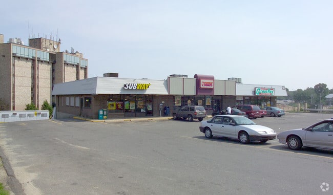


Property Detail
502 Sawmill Rd
Departmentstore
South Central Ct
CD
Connecticut
B and X Area of moderate flood hazard, usually the area between the limits of the 100-year and 500-year floods.
1 AC
2025
West Haven
2025
Westchester/So Connecticut
154200
New Haven, CT
9,720 SF
WHAV-000032-000066
NEARBY LISTINGS FOR SALE OR LEASE
DEMOGRAPHICS near 502 Sawmill Rd
1 mile
3 mile
5 mile
2025 Total Population
11,086
80,113
202,849
2030 Population
11,295
80,874
204,515
Pop Growth 2025-2030
+ 1.89%
+ 0.95%
+ 0.82%
Average Age
40
40
38
2025 Total Households
4,325
30,392
78,945
HH Growth 2025-2030
+ 1.87%
+ 0.98%
+ 0.90%
Median Household Inc
$69,480
$71,874
$69,862
Avg Household Size
2.50
2.40
2.30
2025 Avg HH Vehicles
2.00
2.00
1.00
Median Home Value
$274,923
$302,005
$333,863
Median Year Built
1970
1959
1957
Nearby Places
Map Layers
Map Styles
 Street
 Aerial
Layers
 Traffic
 Biking
Places
Listings with unknown addresses are not visible on the map
- Restaurants
- Banks
- Shops
- Fitness
- Groceries
PUBLIC TRANSPORTATION
COMMUTER RAIL
Drive
Walk
Distance
2 min
20 min
1.0 mi
Drive
Walk
Distance
7 min
3.8 mi
AIRPORT
Tweed/New Haven
Drive
Walk
Distance
Tweed/New Haven
17 min
8.4 mi
Long Island MacArthur
Drive
Walk
Distance
Long Island MacArthur
129 min
49.1 mi
Freight Ports
Port of New Haven
Drive
Walk
Distance
Port of New Haven
12 min
5.5 mi
SALE & LEASE HISTORY
LISTING DATE
SALE/LEASE

Sep 22, 2017
For Lease
Nearby Properties
Address
Land Use
TOTAL SIZE
Lot Size
Zoning
Address
Land Use
TOTAL SIZE
Lot Size
Zoning
56,359 SF
17.09 AC
RCPD
Address
Land Use
TOTAL SIZE
Lot Size
Zoning
50.14 AC
PRD
Address
Land Use
TOTAL SIZE
Lot Size
Zoning
81,870 SF
3.86 AC
RM2
Address
Land Use
TOTAL SIZE
Lot Size
Zoning
42.52 AC
PF
Address
Land Use
TOTAL SIZE
Lot Size
Zoning
287,844 SF
2.11 AC
IL
Address
Land Use
TOTAL SIZE
Lot Size
Zoning
29.78 AC
PRD
Address
Land Use
TOTAL SIZE
Lot Size
Zoning
76,945 SF
8.52 AC
RM2
Address
Land Use
TOTAL SIZE
Lot Size
Zoning
35.05 AC
LI-2
Address
Land Use
TOTAL SIZE
Lot Size
Zoning
287.63 AC
OS
Address
Land Use
TOTAL SIZE
Lot Size
Zoning
125,676 SF
22.12 AC
BOP
Address
Land Use
TOTAL SIZE
Lot Size
Zoning
63,304 SF
4.62 AC
RCPD
Address
Land Use
TOTAL SIZE
Lot Size
Zoning
161,426 SF
4.79 AC
EFD
Address
Land Use
TOTAL SIZE
Lot Size
Zoning
84,689 SF
0.39 AC
BA/RM2
Address
Land Use
TOTAL SIZE
Lot Size
Zoning
154,315 SF
4.29 AC
SCR
Address
Land Use
TOTAL SIZE
Lot Size
Zoning
9 AC
LI-4
Address
Land Use
TOTAL SIZE
Lot Size
Zoning
162,464 SF
7.51 AC
SLD
Address
Land Use
TOTAL SIZE
Lot Size
Zoning
98,422 SF
1.78 AC
PDU 93
Address
Land Use
TOTAL SIZE
Lot Size
Zoning
140,962 SF
72.93 AC
IPD
Address
Land Use
TOTAL SIZE
Lot Size
Zoning
53,974 SF
4.02 AC
RM1/RS
Address
Land Use
TOTAL SIZE
Lot Size
Zoning
8,060 SF
27.12 AC
RPD
Address
Land Use
TOTAL SIZE
Lot Size
Zoning
20.33 AC
LI-3
Address
Land Use
TOTAL SIZE
Lot Size
Zoning
75,670 SF
34.18 AC
R2
Address
Land Use
TOTAL SIZE
Lot Size
Zoning
90,749 SF
1.41 AC
RM2
Address
Land Use
TOTAL SIZE
Lot Size
Zoning
6.01 AC
LI-2
Address
Land Use
TOTAL SIZE
Lot Size
Zoning
150,714 SF
5.23 AC
IL
Address
Land Use
TOTAL SIZE
Lot Size
Zoning
2,432 SF
84 AC
CEM
Address
Land Use
TOTAL SIZE
Lot Size
Zoning
6,941 SF
8.02 AC
TOD
Address
Land Use
TOTAL SIZE
Lot Size
Zoning
119 AC
PARK
Address
Land Use
TOTAL SIZE
Lot Size
Zoning
3.50 AC
SRR
Address
Land Use
TOTAL SIZE
Lot Size
Zoning
63,103 SF
2.65 AC
BA/RM2
The World's #1 Commercial Real Estate Marketplace
Connect with us
© 2026 CoStar Group
The information above has been obtained from sources believed reliable. While we do not doubt its accuracy we have not verified it and make no guarantee, warranty or representation about it. It is your responsibility to independently confirm its accuracy and completeness. Any projections, opinions, assumptions, or estimates used are for example only and do not represent the current or future performance of the property. The value of this transaction to you depends on tax and other factors which should be evaluated by your tax, financial, and legal advisors. You and your advisors should conduct a careful, independent investigation of the property to determine to your satisfaction the suitability of the property for your needs.