Property Record
502 Vinton Rd, Anthony, TX 79821


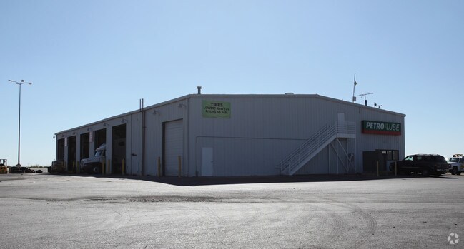
Property Detail
502 Vinton Rd
El Paso, TX
LAURA E MUNDY SURV 233 ABS 10053 6-H (8.5190 AC) & 6-N (0.7750 AC) & 6-L-1 (6.8590 AC) (16.1530 ACRES)
X233-000-0000-0019
EL PASO
Commercialnec
Texas
C2
1
2024
16.15 AC
2025
Outlying El Paso County
010203
El Paso
11,900 SF
NEARBY LISTINGS FOR SALE OR LEASE
-
-
View all Anthony listings for sale on LoopNet.com
DEMOGRAPHICS near 502 Vinton Rd
1 mile
3 mile
5 mile
2025 Total Population
4,927
17,440
40,744
2030 Population
4,985
17,786
41,529
Pop Growth 2025-2030
+ 1.18%
+ 1.98%
+ 1.93%
Average Age
37
37
36
2025 Total Households
1,429
5,191
12,969
HH Growth 2025-2030
+ 1.12%
+ 2.04%
+ 2.03%
Median Household Inc
$39,772
$61,085
$60,388
Avg Household Size
3.10
3.10
3.00
2025 Avg HH Vehicles
2.00
2.00
2.00
Median Home Value
$107,756
$213,814
$215,978
Median Year Built
1989
1996
1997
Nearby Places
Map Layers
Map Styles
 Street
 Aerial
Layers
 Traffic
 Biking
Places
Listings with unknown addresses are not visible on the map
- Restaurants
- Banks
- Shops
- Fitness
- Groceries
PUBLIC TRANSPORTATION
AIRPORT
El Paso International
Drive
Walk
Distance
El Paso International
44 min
26.5 mi
Nearby Properties
Address
Land Use
TOTAL SIZE
Lot Size
Zoning
Address
Land Use
TOTAL SIZE
Lot Size
Zoning
409,742 SF
37.76 AC
C4
Address
Land Use
TOTAL SIZE
Lot Size
Zoning
241,312 SF
108.16 AC
Address
Land Use
TOTAL SIZE
Lot Size
Zoning
79,722 SF
11 AC
C3
Address
Land Use
TOTAL SIZE
Lot Size
Zoning
308,798 SF
44.59 AC
C1
Address
Land Use
TOTAL SIZE
Lot Size
Zoning
1 SF
2.39 AC
M1
Address
Land Use
TOTAL SIZE
Lot Size
Zoning
102,192 SF
5.11 AC
C3C
Address
Land Use
TOTAL SIZE
Lot Size
Zoning
11,911 SF
13.67 AC
C1
Address
Land Use
TOTAL SIZE
Lot Size
Zoning
128,261 SF
52.29 AC
M2
Address
Land Use
TOTAL SIZE
Lot Size
Zoning
28,213 SF
1.77 AC
Address
Land Use
TOTAL SIZE
Lot Size
Zoning
21,356 SF
23.42 AC
C1
Address
Land Use
TOTAL SIZE
Lot Size
Zoning
142,786 SF
54.77 AC
Address
Land Use
TOTAL SIZE
Lot Size
Zoning
25.54 AC
C4C
Address
Land Use
TOTAL SIZE
Lot Size
Zoning
17,780 SF
7.45 AC
C1
Address
Land Use
TOTAL SIZE
Lot Size
Zoning
58,250 SF
5.13 AC
C4
Address
Land Use
TOTAL SIZE
Lot Size
Zoning
14,735 SF
1.85 AC
C1
Address
Land Use
TOTAL SIZE
Lot Size
Zoning
38,488 SF
37.19 AC
C1
Address
Land Use
TOTAL SIZE
Lot Size
Zoning
118,655 SF
14.53 AC
Address
Land Use
TOTAL SIZE
Lot Size
Zoning
1 SF
Address
Land Use
TOTAL SIZE
Lot Size
Zoning
15,368 SF
12.45 AC
Address
Land Use
TOTAL SIZE
Lot Size
Zoning
18,020 SF
10 AC
Address
Land Use
TOTAL SIZE
Lot Size
Zoning
261 AC
PMD
Address
Land Use
TOTAL SIZE
Lot Size
Zoning
15,488 SF
3.98 AC
Address
Land Use
TOTAL SIZE
Lot Size
Zoning
4,586 SF
1.27 AC
C4
Address
Land Use
TOTAL SIZE
Lot Size
Zoning
42,836 SF
4.12 AC
C1
Address
Land Use
TOTAL SIZE
Lot Size
Zoning
5,052 SF
1.20 AC
C4
Address
Land Use
TOTAL SIZE
Lot Size
Zoning
Address
Land Use
TOTAL SIZE
Lot Size
Zoning
10,128 SF
1.30 AC
C3
Address
Land Use
TOTAL SIZE
Lot Size
Zoning
38,958 SF
6.30 AC
Address
Land Use
TOTAL SIZE
Lot Size
Zoning
52,954 SF
5.20 AC
Address
Land Use
TOTAL SIZE
Lot Size
Zoning
21,607 SF
1.25 AC
The World's #1 Commercial Real Estate Marketplace
Connect with us
© 2026 CoStar Group
The information above has been obtained from sources believed reliable. While we do not doubt its accuracy we have not verified it and make no guarantee, warranty or representation about it. It is your responsibility to independently confirm its accuracy and completeness. Any projections, opinions, assumptions, or estimates used are for example only and do not represent the current or future performance of the property. The value of this transaction to you depends on tax and other factors which should be evaluated by your tax, financial, and legal advisors. You and your advisors should conduct a careful, independent investigation of the property to determine to your satisfaction the suitability of the property for your needs.