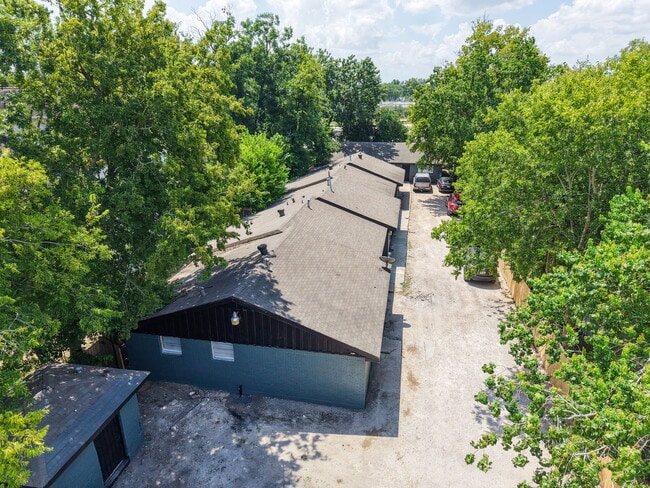
Property Record
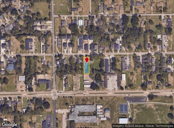
5022 Mallow St, Houston, TX 77033
This Property Is For Sale
NEARBY LISTINGS FOR SALE OR LEASE
Property Detail
5022 Mallow St
Houston-The Woodlands-Sugar Land, TX
Sunnyside Gardens
0751990190006
LT 6 BLK 19 SUNNYSIDE GARDENS
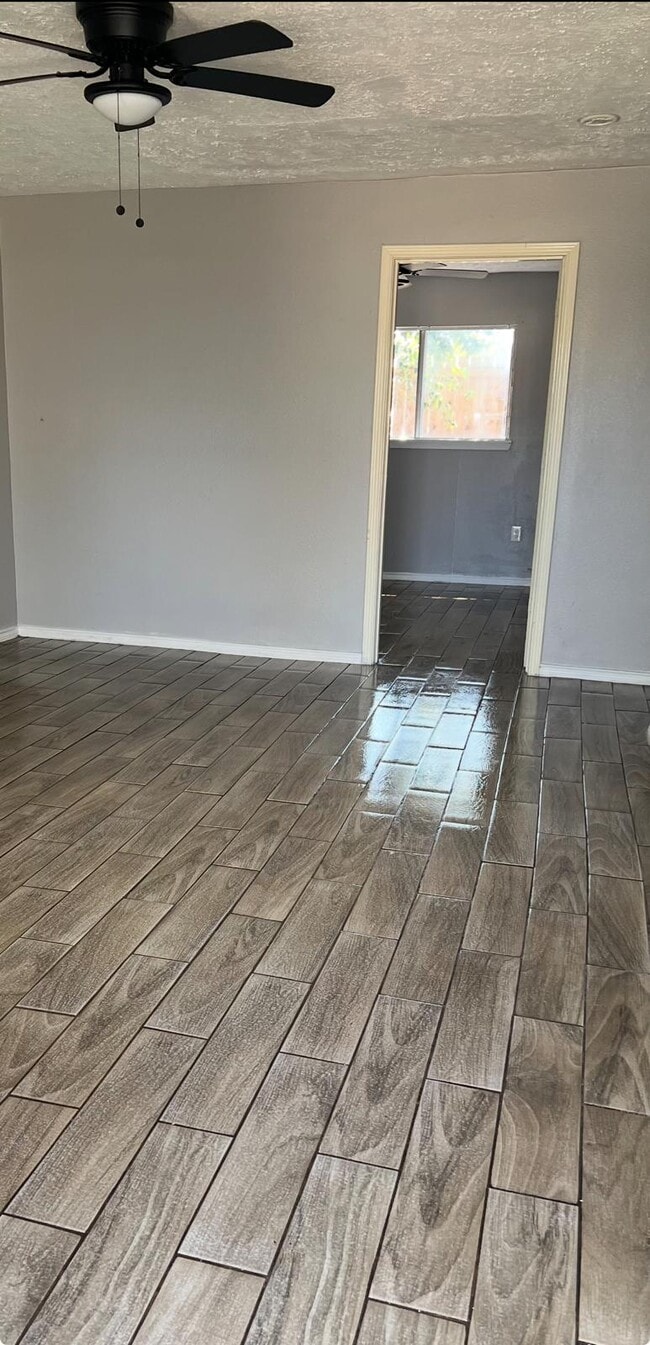
Apartment
Harris
X
Texas
48201C0890M
6
2024
0.29 AC
2025
Sunnyside
331900
Houston
5,332 SF
DEMOGRAPHICS near 5022 Mallow St
1 Mile
3 Mile
5 Mile
2024 Total Population
16,454
105,729
299,853
2029 Population
16,977
109,139
309,345
Pop Growth 2024-2029
+ 3.18%
+ 3.23%
+ 3.17%
Average Age
39
38
36
2024 Total Households
5,846
38,089
111,736
HH Growth 2024-2029
+ 3.11%
+ 3.26%
+ 3.31%
Median Household Inc
$33,299
$37,758
$47,052
Avg Household Size
2.70
2.70
2.50
2024 Avg HH Vehicles
1.00
2.00
2.00
Median Home Value
$79,633
$112,707
$168,332
Median Year Built
1959
1967
1978
Nearby Places
- Restaurants
- Banks
- Shops
- Fitness
- Groceries
PUBLIC TRANSPORTATION
COMMUTER RAIL
Houston (Sunset Limited - Amtrak)
DRIVE
WALK
Distance
Houston (Sunset Limited - Amtrak)
18 min
9.5 mi
AIRPORT
William P Hobby
DRIVE
WALK
Distance
William P Hobby
18 min
7.5 mi
George Bush Intcntl/Houston
DRIVE
WALK
Distance
George Bush Intcntl/Houston
39 min
27.4 mi
Freight Ports
Port of Houston
DRIVE
WALK
Distance
Port of Houston
19 min
10.1 mi
Nearby Properties
Address
Land Use
TOTAL SIZE
Lot Size
Zoning
Address
Land Use
TOTAL SIZE
Lot Size
Zoning
651,551 SF
52.18 AC
Address
Land Use
TOTAL SIZE
Lot Size
Zoning
643,698 SF
6.57 AC
Address
Land Use
TOTAL SIZE
Lot Size
Zoning
413,336 SF
24.57 AC
Address
Land Use
TOTAL SIZE
Lot Size
Zoning
389,108 SF
37.39 AC
Address
Land Use
TOTAL SIZE
Lot Size
Zoning
270,803 SF
8.26 AC
Address
Land Use
TOTAL SIZE
Lot Size
Zoning
419,760 SF
15.27 AC
Address
Land Use
TOTAL SIZE
Lot Size
Zoning
268,425 SF
17.47 AC
Address
Land Use
TOTAL SIZE
Lot Size
Zoning
295,210 SF
13.68 AC
Address
Land Use
TOTAL SIZE
Lot Size
Zoning
190,172 SF
14.71 AC
Address
Land Use
TOTAL SIZE
Lot Size
Zoning
239,458 SF
15.57 AC
Address
Land Use
TOTAL SIZE
Lot Size
Zoning
210,476 SF
9.60 AC
Address
Land Use
TOTAL SIZE
Lot Size
Zoning
193,500 SF
9.46 AC
Address
Land Use
TOTAL SIZE
Lot Size
Zoning
157,387 SF
6.38 AC
Address
Land Use
TOTAL SIZE
Lot Size
Zoning
367,096 SF
15.76 AC
Address
Land Use
TOTAL SIZE
Lot Size
Zoning
10.43 AC
Address
Land Use
TOTAL SIZE
Lot Size
Zoning
114,520 SF
2.19 AC
Address
Land Use
TOTAL SIZE
Lot Size
Zoning
168,937 SF
5.92 AC
Address
Land Use
TOTAL SIZE
Lot Size
Zoning
433,760 SF
52.70 AC
Address
Land Use
TOTAL SIZE
Lot Size
Zoning
210,870 SF
13.07 AC
Address
Land Use
TOTAL SIZE
Lot Size
Zoning
109,807 SF
10.28 AC
Address
Land Use
TOTAL SIZE
Lot Size
Zoning
100,458 SF
8.54 AC
Address
Land Use
TOTAL SIZE
Lot Size
Zoning
277,616 SF
14.91 AC
Address
Land Use
TOTAL SIZE
Lot Size
Zoning
172,436 SF
33.98 AC
Address
Land Use
TOTAL SIZE
Lot Size
Zoning
233,608 SF
13.45 AC
Address
Land Use
TOTAL SIZE
Lot Size
Zoning
133,475 SF
11.52 AC
Address
Land Use
TOTAL SIZE
Lot Size
Zoning
304,806 SF
15.60 AC
Address
Land Use
TOTAL SIZE
Lot Size
Zoning
45,038 SF
79.61 AC
Address
Land Use
TOTAL SIZE
Lot Size
Zoning
203,250 SF
8.24 AC
Address
Land Use
TOTAL SIZE
Lot Size
Zoning
128,632 SF
6.66 AC
Address
Land Use
TOTAL SIZE
Lot Size
Zoning
155,977 SF
8.52 AC
The World's #1 Commercial Real Estate Marketplace
Connect with us
© 2025 CoStar Group
The information above has been obtained from sources believed reliable. While we do not doubt its accuracy we have not verified it and make no guarantee, warranty or representation about it. It is your responsibility to independently confirm its accuracy and completeness. Any projections, opinions, assumptions, or estimates used are for example only and do not represent the current or future performance of the property. The value of this transaction to you depends on tax and other factors which should be evaluated by your tax, financial, and legal advisors. You and your advisors should conduct a careful, independent investigation of the property to determine to your satisfaction the suitability of the property for your needs.