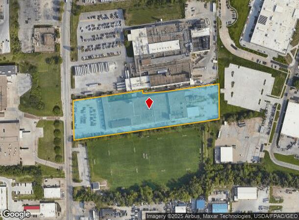
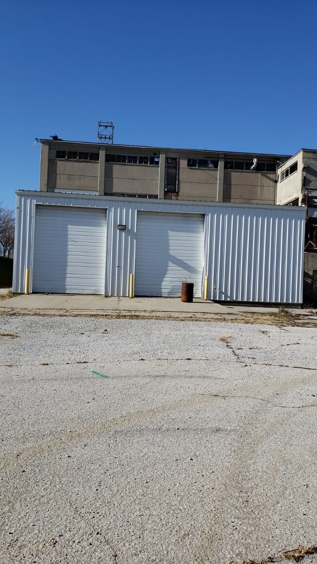
Property Record
5025 S 33Rd St, Omaha, NE 68107
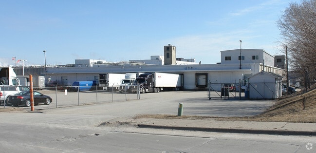
This Property Is For Sale
NEARBY LISTINGS FOR SALE OR LEASE
Property Detail
5025 S 33Rd St
Omaha-Council Bluffs, NE-IA
Mcc-Cio Addition
1725-6810-02
MCC-CIO ADDITION LOT 2 BLOCK 0 LOT 2 196127 SQFT
Warehouse
Douglas
X
Nebraska
31153C0080G
2
2024
4.50 AC
2025
Southeast Omaha
003100
Omaha/Council Bluffs
239,480 SF
DEMOGRAPHICS near 5025 S 33Rd St
1 Mile
3 Mile
5 Mile
2024 Total Population
15,384
93,970
238,143
2029 Population
15,505
95,952
245,752
Pop Growth 2024-2029
+ 0.79%
+ 2.11%
+ 3.20%
Average Age
33
36
37
2024 Total Households
4,804
33,060
95,781
HH Growth 2024-2029
+ 0.77%
+ 2.20%
+ 3.35%
Median Household Inc
$43,407
$54,989
$57,999
Avg Household Size
3.10
2.70
2.30
2024 Avg HH Vehicles
2.00
2.00
2.00
Median Home Value
$127,213
$153,262
$185,005
Median Year Built
1948
1954
1964
Nearby Places
- Restaurants
- Banks
- Shops
- Fitness
- Groceries
PUBLIC TRANSPORTATION
COMMUTER RAIL
DRIVE
WALK
Distance
9 min
5.1 mi
DRIVE
WALK
Distance
10 min
5.2 mi
AIRPORT
Eppley Airfield
DRIVE
WALK
Distance
Eppley Airfield
18 min
9.1 mi
Nearby Properties
Address
Land Use
TOTAL SIZE
Lot Size
Zoning
Address
Land Use
TOTAL SIZE
Lot Size
Zoning
97,617 SF
49.05 AC
Address
Land Use
TOTAL SIZE
Lot Size
Zoning
12.71 AC
Address
Land Use
TOTAL SIZE
Lot Size
Zoning
1,850 SF
8.14 AC
Address
Land Use
TOTAL SIZE
Lot Size
Zoning
193,967 SF
7.27 AC
Address
Land Use
TOTAL SIZE
Lot Size
Zoning
236,067 SF
10.12 AC
HI
Address
Land Use
TOTAL SIZE
Lot Size
Zoning
33,713 SF
14.39 AC
Address
Land Use
TOTAL SIZE
Lot Size
Zoning
4.53 AC
Address
Land Use
TOTAL SIZE
Lot Size
Zoning
270,446 SF
13.68 AC
R7
Address
Land Use
TOTAL SIZE
Lot Size
Zoning
126,910 SF
13.49 AC
Address
Land Use
TOTAL SIZE
Lot Size
Zoning
257,234 SF
17.88 AC
Address
Land Use
TOTAL SIZE
Lot Size
Zoning
173,616 SF
9.30 AC
Address
Land Use
TOTAL SIZE
Lot Size
Zoning
178,600 SF
8.27 AC
R6PUD
Address
Land Use
TOTAL SIZE
Lot Size
Zoning
230,995 SF
11.29 AC
HI
Address
Land Use
TOTAL SIZE
Lot Size
Zoning
252,694 SF
17.74 AC
HI
Address
Land Use
TOTAL SIZE
Lot Size
Zoning
148,963 SF
9.80 AC
Address
Land Use
TOTAL SIZE
Lot Size
Zoning
116,718 SF
8.28 AC
Address
Land Use
TOTAL SIZE
Lot Size
Zoning
161,765 SF
18.32 AC
Address
Land Use
TOTAL SIZE
Lot Size
Zoning
38,595 SF
2.07 AC
Address
Land Use
TOTAL SIZE
Lot Size
Zoning
85,320 SF
6.60 AC
HI
Address
Land Use
TOTAL SIZE
Lot Size
Zoning
81,172 SF
4 AC
Address
Land Use
TOTAL SIZE
Lot Size
Zoning
1,768 SF
14.80 AC
Address
Land Use
TOTAL SIZE
Lot Size
Zoning
100,350 SF
4.77 AC
CC
Address
Land Use
TOTAL SIZE
Lot Size
Zoning
139,236 SF
8.19 AC
Address
Land Use
TOTAL SIZE
Lot Size
Zoning
273,738 SF
16.07 AC
Address
Land Use
TOTAL SIZE
Lot Size
Zoning
102,750 SF
4.49 AC
R7
Address
Land Use
TOTAL SIZE
Lot Size
Zoning
252,050 SF
10.62 AC
Address
Land Use
TOTAL SIZE
Lot Size
Zoning
107,896 SF
5 AC
GI
Address
Land Use
TOTAL SIZE
Lot Size
Zoning
98,600 SF
1 AC
GI
Address
Land Use
TOTAL SIZE
Lot Size
Zoning
131,035 SF
7.74 AC
Address
Land Use
TOTAL SIZE
Lot Size
Zoning
88,518 SF
7.65 AC
The World's #1 Commercial Real Estate Marketplace
Connect with us
© 2025 CoStar Group
The information above has been obtained from sources believed reliable. While we do not doubt its accuracy we have not verified it and make no guarantee, warranty or representation about it. It is your responsibility to independently confirm its accuracy and completeness. Any projections, opinions, assumptions, or estimates used are for example only and do not represent the current or future performance of the property. The value of this transaction to you depends on tax and other factors which should be evaluated by your tax, financial, and legal advisors. You and your advisors should conduct a careful, independent investigation of the property to determine to your satisfaction the suitability of the property for your needs.