Property Record
5028 State Route 260, Clay Springs, AZ 85923

NEARBY LISTINGS FOR SALE OR LEASE
-
-
View all Clay Springs listings for sale on LoopNet.com
Property Detail
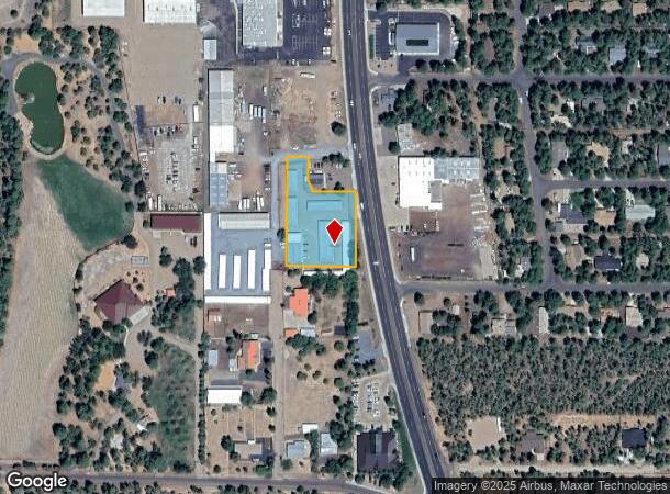
5028 State Route 260
212-07-033C
SECTION 9, T9N, R22E:BEG S4 COR SEC 9;TH N 600'TPOB; TH N 346.5';TH W 235';TH S 346.5';TH E 235'TPOB EXCEPT: BEG S4 COR SEC 9;TH NLY 814.5'TPOB;TH NLY 97'; TH WLY 139';TH SLY 62.5';TH SELY 37.62'M/L TO PT WHICH LIES WLY 124' FROM TPOB;TH ELY 124'TPOB
Shipyard
Navajo
X
Arizona
04017C4717F
1.57 AC
2024
Arizona Northeast & Holbrook Area
2026
Other Market Areas
964202
Show Low, AZ
19,849 SF
DEMOGRAPHICS near 5028 State Route 260
1 Mile
3 Mile
5 Mile
2024 Total Population
1,971
8,902
19,103
2029 Population
2,174
9,673
20,647
Pop Growth 2024-2029
+ 10.30%
+ 8.66%
+ 8.08%
Average Age
45
45
44
2024 Total Households
782
3,536
7,802
HH Growth 2024-2029
+ 10.10%
+ 8.51%
+ 7.92%
Median Household Inc
$44,102
$51,771
$53,851
Avg Household Size
2.40
2.40
2.40
2024 Avg HH Vehicles
2.00
2.00
2.00
Median Home Value
$237,634
$228,109
$218,635
Median Year Built
1997
1994
1992
Nearby Places
Map Layers
Map Styles
 Street
 Aerial
- Restaurants
- Banks
- Shops
- Fitness
- Groceries
SALE & LEASE HISTORY
LISTING DATE
SALE/LEASE

Feb 13, 2017
For Sale
Nearby Properties
Address
Land Use
TOTAL SIZE
Lot Size
Zoning
Address
Land Use
TOTAL SIZE
Lot Size
Zoning
203,623 SF
14 AC
MUNICIPAL
Address
Land Use
TOTAL SIZE
Lot Size
Zoning
138,315 SF
13.91 AC
MUNICIPAL
Address
Land Use
TOTAL SIZE
Lot Size
Zoning
55,688 SF
1.50 AC
C-R
Address
Land Use
TOTAL SIZE
Lot Size
Zoning
83,087 SF
5.08 AC
MUNICIPAL
Address
Land Use
TOTAL SIZE
Lot Size
Zoning
56,096 SF
1.48 AC
C-R
Address
Land Use
TOTAL SIZE
Lot Size
Zoning
56,331 SF
16.30 AC
MUNICIPAL
Address
Land Use
TOTAL SIZE
Lot Size
Zoning
44,764 SF
1.51 AC
MUNICIPAL
Address
Land Use
TOTAL SIZE
Lot Size
Zoning
97,790 SF
4.80 AC
MUNICIPAL
Address
Land Use
TOTAL SIZE
Lot Size
Zoning
86,443 SF
6.85 AC
MUNICIPAL
Address
Land Use
TOTAL SIZE
Lot Size
Zoning
26,530 SF
3.88 AC
C-R
Address
Land Use
TOTAL SIZE
Lot Size
Zoning
22,680 SF
1.65 AC
C-R
Address
Land Use
TOTAL SIZE
Lot Size
Zoning
42,868 SF
2.45 AC
MUNICIPAL
Address
Land Use
TOTAL SIZE
Lot Size
Zoning
48,320 SF
5 AC
C-R
Address
Land Use
TOTAL SIZE
Lot Size
Zoning
47,586 SF
3.50 AC
MUNICIPAL
Address
Land Use
TOTAL SIZE
Lot Size
Zoning
22,400 SF
2.55 AC
MUNICIPAL
Address
Land Use
TOTAL SIZE
Lot Size
Zoning
35,090 SF
3.40 AC
MUNICIPAL
Address
Land Use
TOTAL SIZE
Lot Size
Zoning
20,088 SF
2 AC
R-2
Address
Land Use
TOTAL SIZE
Lot Size
Zoning
16,157 SF
4.56 AC
R1-10
Address
Land Use
TOTAL SIZE
Lot Size
Zoning
46,318 SF
20 AC
MUNICIPAL
Address
Land Use
TOTAL SIZE
Lot Size
Zoning
18,000 SF
2.09 AC
MUNICIPAL
Address
Land Use
TOTAL SIZE
Lot Size
Zoning
25,882 SF
21.67 AC
MUNICIPAL
Address
Land Use
TOTAL SIZE
Lot Size
Zoning
28,700 SF
2.76 AC
MUNICIPAL
Address
Land Use
TOTAL SIZE
Lot Size
Zoning
46,480 SF
4.35 AC
C-R
Address
Land Use
TOTAL SIZE
Lot Size
Zoning
22,705 SF
3.74 AC
MUNICIPAL
Address
Land Use
TOTAL SIZE
Lot Size
Zoning
15,073 SF
3.36 AC
MUNICIPAL
Address
Land Use
TOTAL SIZE
Lot Size
Zoning
21,333 SF
2.14 AC
C-R
Address
Land Use
TOTAL SIZE
Lot Size
Zoning
22,400 SF
2.01 AC
MUNICIPAL
Address
Land Use
TOTAL SIZE
Lot Size
Zoning
7,328 SF
1.82 AC
MUNICIPAL
Address
Land Use
TOTAL SIZE
Lot Size
Zoning
16,689 SF
1 AC
MUNICIPAL
The World's #1 Commercial Real Estate Marketplace
Connect with us
© 2025 CoStar Group
The information above has been obtained from sources believed reliable. While we do not doubt its accuracy we have not verified it and make no guarantee, warranty or representation about it. It is your responsibility to independently confirm its accuracy and completeness. Any projections, opinions, assumptions, or estimates used are for example only and do not represent the current or future performance of the property. The value of this transaction to you depends on tax and other factors which should be evaluated by your tax, financial, and legal advisors. You and your advisors should conduct a careful, independent investigation of the property to determine to your satisfaction the suitability of the property for your needs.