Property Record
5030 E State Highway 29, Georgetown, TX 78626

Property Detail
5030 E State Highway 29
Austin-Round Rock-San Marcos, TX
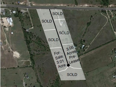
S11390 - SH29E PARK SUB, LOT 1, ACRES 2.23
R557969
WILLIAMSON
Taxexempt
Texas
B and X Area of moderate flood hazard, usually the area between the limits of the 100-year and 500-year floods.
1
2023
2.23 AC
2025
Georgetown
020822
Austin
8,190 SF
NEARBY LISTINGS FOR SALE OR LEASE
DEMOGRAPHICS near 5030 E State Highway 29
1 mile
3 mile
5 mile
2025 Total Population
607
17,368
58,441
2030 Population
715
20,247
68,061
Pop Growth 2025-2030
+ 17.79%
+ 16.58%
+ 16.46%
Average Age
39
38
37
2025 Total Households
231
6,038
21,113
HH Growth 2025-2030
+ 18.18%
+ 17.22%
+ 17.05%
Median Household Inc
$87,884
$104,468
$95,987
Avg Household Size
2.50
2.80
2.60
2025 Avg HH Vehicles
2.00
2.00
2.00
Median Home Value
$308,750
$387,222
$412,123
Median Year Built
2010
2009
2010
Nearby Places
Map Layers
Map Styles
 Street
 Aerial
Transit
 Traffic
 Biking
Places
Listings with unknown addresses are not visible on the map
- Restaurants
- Banks
- Shops
- Fitness
- Groceries
SALE & LEASE HISTORY
LISTING DATE
SALE/LEASE

Sep 24, 2016
For Sale
Nearby Properties
Address
Land Use
TOTAL SIZE
Lot Size
Zoning
Address
Land Use
TOTAL SIZE
Lot Size
Zoning
228,685 SF
10.32 AC
Address
Land Use
TOTAL SIZE
Lot Size
Zoning
252,492 SF
15.35 AC
Address
Land Use
TOTAL SIZE
Lot Size
Zoning
314,240 SF
16.03 AC
Address
Land Use
TOTAL SIZE
Lot Size
Zoning
49.39 AC
Address
Land Use
TOTAL SIZE
Lot Size
Zoning
116,641 SF
5.93 AC
Address
Land Use
TOTAL SIZE
Lot Size
Zoning
168,572 SF
10.73 AC
Address
Land Use
TOTAL SIZE
Lot Size
Zoning
27.61 AC
Address
Land Use
TOTAL SIZE
Lot Size
Zoning
131.22 AC
Address
Land Use
TOTAL SIZE
Lot Size
Zoning
124,742 SF
8.64 AC
Address
Land Use
TOTAL SIZE
Lot Size
Zoning
87,071 SF
60.32 AC
Address
Land Use
TOTAL SIZE
Lot Size
Zoning
182,592 SF
11.20 AC
Address
Land Use
TOTAL SIZE
Lot Size
Zoning
2,400 SF
56.17 AC
Address
Land Use
TOTAL SIZE
Lot Size
Zoning
39.97 AC
Address
Land Use
TOTAL SIZE
Lot Size
Zoning
98,099 SF
5.13 AC
Address
Land Use
TOTAL SIZE
Lot Size
Zoning
111 SF
54.28 AC
Address
Land Use
TOTAL SIZE
Lot Size
Zoning
82.14 AC
Address
Land Use
TOTAL SIZE
Lot Size
Zoning
63,232 SF
15 AC
Address
Land Use
TOTAL SIZE
Lot Size
Zoning
25.57 AC
Address
Land Use
TOTAL SIZE
Lot Size
Zoning
120,582 SF
3.36 AC
Address
Land Use
TOTAL SIZE
Lot Size
Zoning
76,433 SF
4.50 AC
Address
Land Use
TOTAL SIZE
Lot Size
Zoning
82,484 SF
7.32 AC
Address
Land Use
TOTAL SIZE
Lot Size
Zoning
3,489 SF
11.16 AC
Address
Land Use
TOTAL SIZE
Lot Size
Zoning
130.98 AC
Address
Land Use
TOTAL SIZE
Lot Size
Zoning
34,780 SF
9.79 AC
Address
Land Use
TOTAL SIZE
Lot Size
Zoning
53,794 SF
19.77 AC
Address
Land Use
TOTAL SIZE
Lot Size
Zoning
36,000 SF
2.46 AC
Address
Land Use
TOTAL SIZE
Lot Size
Zoning
864 SF
33.25 AC
Address
Land Use
TOTAL SIZE
Lot Size
Zoning
2,881 SF
5.61 AC
1-RS
Address
Land Use
TOTAL SIZE
Lot Size
Zoning
19,292 SF
8.32 AC
Address
Land Use
TOTAL SIZE
Lot Size
Zoning
34.31 AC
The World's #1 Commercial Real Estate Marketplace
Connect with us
© 2026 CoStar Group
The information above has been obtained from sources believed reliable. While we do not doubt its accuracy we have not verified it and make no guarantee, warranty or representation about it. It is your responsibility to independently confirm its accuracy and completeness. Any projections, opinions, assumptions, or estimates used are for example only and do not represent the current or future performance of the property. The value of this transaction to you depends on tax and other factors which should be evaluated by your tax, financial, and legal advisors. You and your advisors should conduct a careful, independent investigation of the property to determine to your satisfaction the suitability of the property for your needs.