Property Record
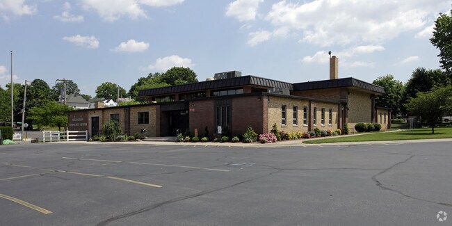
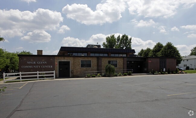
332 Watchogue Rd, Staten Island, NY 10314

Property Detail
332 Watchogue Rd
00472-0164
STATEN ISLAND
Religious
New York
R2
164
B and X Area of moderate flood hazard, usually the area between the limits of the 100-year and 500-year floods.
0.75 AC
0
Staten Island
2026
Long Island (New York)
018902
New York-Jersey City-White Plains, NY-NJ
16,396 SF
NEARBY LISTINGS FOR SALE OR LEASE
DEMOGRAPHICS near 332 Watchogue Rd
1 mile
3 mile
5 mile
2025 Total Population
42,260
230,340
537,009
2030 Population
42,397
231,867
544,753
Pop Growth 2025-2030
+ 0.32%
+ 0.66%
+ 1.44%
Average Age
41
41
40
2025 Total Households
14,523
79,242
187,052
HH Growth 2025-2030
+ 0.29%
+ 0.70%
+ 1.59%
Median Household Inc
$113,807
$95,058
$87,059
Avg Household Size
2.80
2.80
2.80
2025 Avg HH Vehicles
2.00
1.00
1.00
Median Home Value
$716,395
$704,932
$686,889
Median Year Built
1965
1968
1968
Nearby Places
Map Layers
Map Styles
 Street
 Aerial
Layers
 Traffic
 Biking
Places
Listings with unknown addresses are not visible on the map
- Restaurants
- Banks
- Shops
- Fitness
- Groceries
PUBLIC TRANSPORTATION
COMMUTER RAIL
Grasmere (Staten Island Railway - New York MTA Subway (The Subway))
Drive
Walk
Distance
Grasmere (Staten Island Railway - New York MTA Subway (The Subway))
9 min
3.9 mi
Dongan Hills (Staten Island Railway - New York MTA Subway (The Subway))
Drive
Walk
Distance
Dongan Hills (Staten Island Railway - New York MTA Subway (The Subway))
12 min
4.0 mi
AIRPORT
Newark Liberty International
Drive
Walk
Distance
Newark Liberty International
20 min
11.7 mi
LaGuardia
Drive
Walk
Distance
LaGuardia
41 min
23.8 mi
John F Kennedy International
Drive
Walk
Distance
John F Kennedy International
44 min
26.3 mi
Freight Ports
New York Container Terminal
Drive
Walk
Distance
New York Container Terminal
7 min
3.2 mi
Nearby Properties
Address
Land Use
TOTAL SIZE
Lot Size
Zoning
Address
Land Use
TOTAL SIZE
Lot Size
Zoning
3,600 SF
731.18 AC
PARK
Address
Land Use
TOTAL SIZE
Lot Size
Zoning
633,280 SF
202.90 AC
R3-2
Address
Land Use
TOTAL SIZE
Lot Size
Zoning
22.49 AC
HC
Address
Land Use
TOTAL SIZE
Lot Size
Zoning
738,600 SF
189.62 AC
R3-2
Address
Land Use
TOTAL SIZE
Lot Size
Zoning
1.01 AC
Address
Land Use
TOTAL SIZE
Lot Size
Zoning
1,258,042 SF
14.47 AC
C4-1
Address
Land Use
TOTAL SIZE
Lot Size
Zoning
91,760 SF
210.43 AC
M3-1
Address
Land Use
TOTAL SIZE
Lot Size
Zoning
566,000 SF
103.31 AC
R3-2
Address
Land Use
TOTAL SIZE
Lot Size
Zoning
855,000 SF
48.74 AC
M3-1
Address
Land Use
TOTAL SIZE
Lot Size
Zoning
1,502 SF
0.69 AC
C-1
Address
Land Use
TOTAL SIZE
Lot Size
Zoning
131.25 AC
PARK
Address
Land Use
TOTAL SIZE
Lot Size
Zoning
538,240 SF
12.08 AC
R2
Address
Land Use
TOTAL SIZE
Lot Size
Zoning
494,840 SF
34.77 AC
R3-2
Address
Land Use
TOTAL SIZE
Lot Size
Zoning
970,000 SF
55.25 AC
M3-1
Address
Land Use
TOTAL SIZE
Lot Size
Zoning
195,395 SF
12.04 AC
R3-2
Address
Land Use
TOTAL SIZE
Lot Size
Zoning
521,405 SF
52.79 AC
R3-1
Address
Land Use
TOTAL SIZE
Lot Size
Zoning
975,000 SF
58.52 AC
M3-1
Address
Land Use
TOTAL SIZE
Lot Size
Zoning
418,012 SF
6.74 AC
R3-1
Address
Land Use
TOTAL SIZE
Lot Size
Zoning
111,000 SF
186.03 AC
PARK
Address
Land Use
TOTAL SIZE
Lot Size
Zoning
16.30 AC
Address
Land Use
TOTAL SIZE
Lot Size
Zoning
10.76 AC
Address
Land Use
TOTAL SIZE
Lot Size
Zoning
450,000 SF
33.26 AC
M3-1
Address
Land Use
TOTAL SIZE
Lot Size
Zoning
183,839 SF
9.74 AC
PARK
Address
Land Use
TOTAL SIZE
Lot Size
Zoning
453,700 SF
11.16 AC
Address
Land Use
TOTAL SIZE
Lot Size
Zoning
3,179 SF
0.13 AC
Address
Land Use
TOTAL SIZE
Lot Size
Zoning
Address
Land Use
TOTAL SIZE
Lot Size
Zoning
81,046 SF
3.43 AC
R3A
Address
Land Use
TOTAL SIZE
Lot Size
Zoning
240 SF
47.41 AC
R3-2
Address
Land Use
TOTAL SIZE
Lot Size
Zoning
328,319 SF
8.58 AC
M1-1
Address
Land Use
TOTAL SIZE
Lot Size
Zoning
48,500 SF
61.98 AC
R3-2
The World's #1 Commercial Real Estate Marketplace
Connect with us
© 2026 CoStar Group
The information above has been obtained from sources believed reliable. While we do not doubt its accuracy we have not verified it and make no guarantee, warranty or representation about it. It is your responsibility to independently confirm its accuracy and completeness. Any projections, opinions, assumptions, or estimates used are for example only and do not represent the current or future performance of the property. The value of this transaction to you depends on tax and other factors which should be evaluated by your tax, financial, and legal advisors. You and your advisors should conduct a careful, independent investigation of the property to determine to your satisfaction the suitability of the property for your needs.