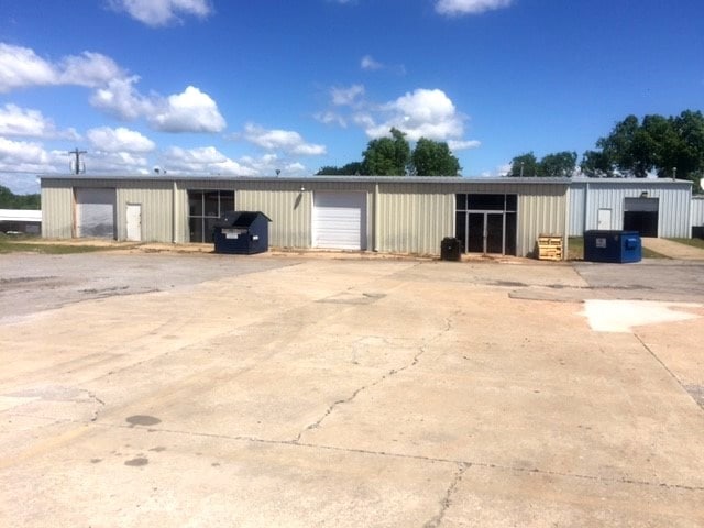
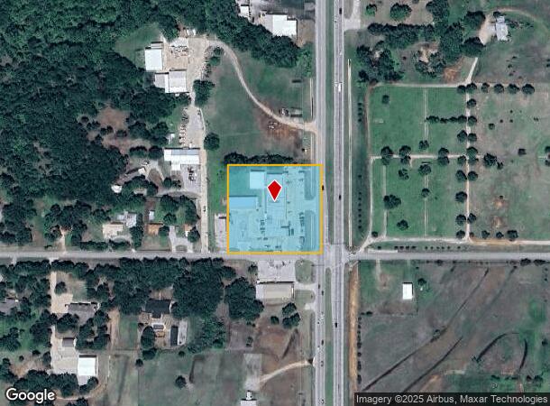
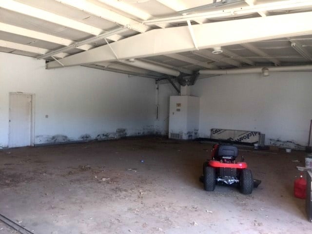
Property Record
5031 N Highway 81, Duncan, OK 73533
NEARBY LISTINGS FOR SALE OR LEASE
-
-
View all Duncan listings for sale on LoopNet.com
Property Detail
5031 N Highway 81
Duncan, OK
N/A
1999-18-01N-07W-4-008-00
18-1N-7 ADD BEG SE/C OF SEC W400 N330 E400 S330 TO BEG LESS E65 FOR HWY SOUTH MARK MANAGE CORP (CAR WASH)
Conveniencestore
Stephens
X
Oklahoma
40137C0215F
7w
2024
2.54 AC
2025
Oklahoma West Area
000800
Other Market Areas
3,000 SF
DEMOGRAPHICS near 5031 N Highway 81
1 Mile
3 Mile
5 Mile
2024 Total Population
2,043
12,839
25,478
2029 Population
2,119
13,181
26,511
Pop Growth 2024-2029
+ 3.72%
+ 2.66%
+ 4.05%
Average Age
46
43
42
2024 Total Households
891
5,334
10,392
HH Growth 2024-2029
+ 3.59%
+ 2.53%
+ 3.91%
Median Household Inc
$83,505
$64,049
$51,580
Avg Household Size
2.30
2.30
2.40
2024 Avg HH Vehicles
2.00
2.00
2.00
Median Home Value
$194,778
$163,470
$134,025
Median Year Built
1982
1974
1971
Nearby Places
Map Layers
Map Styles
 Street
 Aerial
- Restaurants
- Banks
- Shops
- Fitness
- Groceries
Nearby Properties
Address
Land Use
TOTAL SIZE
Lot Size
Zoning
Address
Land Use
TOTAL SIZE
Lot Size
Zoning
4,064 SF
43.23 AC
Address
Land Use
TOTAL SIZE
Lot Size
Zoning
127,660 SF
20 AC
Address
Land Use
TOTAL SIZE
Lot Size
Zoning
9,694 SF
5.12 AC
C2
Address
Land Use
TOTAL SIZE
Lot Size
Zoning
61,546 SF
22.70 AC
Address
Land Use
TOTAL SIZE
Lot Size
Zoning
82,956 SF
11.54 AC
C1
Address
Land Use
TOTAL SIZE
Lot Size
Zoning
32,998 SF
2.64 AC
C2
Address
Land Use
TOTAL SIZE
Lot Size
Zoning
816 SF
8 AC
C2
Address
Land Use
TOTAL SIZE
Lot Size
Zoning
154 SF
14 AC
Address
Land Use
TOTAL SIZE
Lot Size
Zoning
160 SF
43.16 AC
Address
Land Use
TOTAL SIZE
Lot Size
Zoning
1,500 SF
5 AC
C2
Address
Land Use
TOTAL SIZE
Lot Size
Zoning
9,014 SF
1.77 AC
C1
Address
Land Use
TOTAL SIZE
Lot Size
Zoning
33,953 SF
5.94 AC
R1
Address
Land Use
TOTAL SIZE
Lot Size
Zoning
5,037 SF
13.41 AC
Address
Land Use
TOTAL SIZE
Lot Size
Zoning
14,352 SF
10 AC
R1
Address
Land Use
TOTAL SIZE
Lot Size
Zoning
2,989 SF
13.49 AC
C2
Address
Land Use
TOTAL SIZE
Lot Size
Zoning
20,966 SF
5 AC
R1
Address
Land Use
TOTAL SIZE
Lot Size
Zoning
4,000 SF
76.61 AC
C1
Address
Land Use
TOTAL SIZE
Lot Size
Zoning
1,099 SF
6 AC
R1
Address
Land Use
TOTAL SIZE
Lot Size
Zoning
8,137 SF
7.57 AC
R1
Address
Land Use
TOTAL SIZE
Lot Size
Zoning
28,165 SF
2.68 AC
C2
Address
Land Use
TOTAL SIZE
Lot Size
Zoning
41,942 SF
3.39 AC
R1
Address
Land Use
TOTAL SIZE
Lot Size
Zoning
300 SF
2.75 AC
R1
Address
Land Use
TOTAL SIZE
Lot Size
Zoning
10,418 SF
3.39 AC
R1
Address
Land Use
TOTAL SIZE
Lot Size
Zoning
160 SF
6.70 AC
C2
Address
Land Use
TOTAL SIZE
Lot Size
Zoning
14,530 SF
0.91 AC
R1
Address
Land Use
TOTAL SIZE
Lot Size
Zoning
3,016 SF
1.64 AC
C1
Address
Land Use
TOTAL SIZE
Lot Size
Zoning
6,170 SF
0.61 AC
Address
Land Use
TOTAL SIZE
Lot Size
Zoning
8,218 SF
0.94 AC
R1
Address
Land Use
TOTAL SIZE
Lot Size
Zoning
4,141 SF
1.29 AC
The World's #1 Commercial Real Estate Marketplace
Connect with us
© 2026 CoStar Group
The information above has been obtained from sources believed reliable. While we do not doubt its accuracy we have not verified it and make no guarantee, warranty or representation about it. It is your responsibility to independently confirm its accuracy and completeness. Any projections, opinions, assumptions, or estimates used are for example only and do not represent the current or future performance of the property. The value of this transaction to you depends on tax and other factors which should be evaluated by your tax, financial, and legal advisors. You and your advisors should conduct a careful, independent investigation of the property to determine to your satisfaction the suitability of the property for your needs.