Property Record
5031 University Way Ne, Seattle, WA 98105

NEARBY LISTINGS FOR SALE OR LEASE
-
-
View all Seattle listings for sale on LoopNet.com
Property Detail
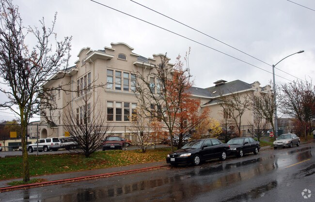
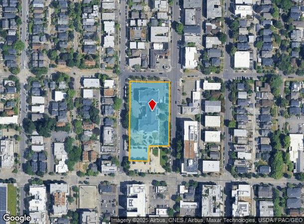
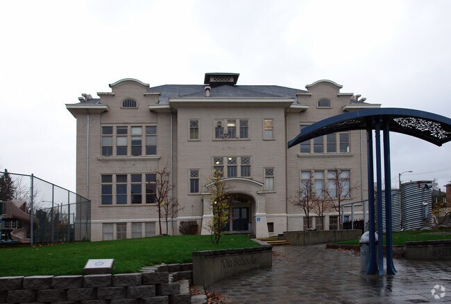
5031 University Way Ne
Seattle-Tacoma-Bellevue, WA
University Heights Add
881640-0900
UNIVERSITY HEIGHTS ADD LOTS 1 THRU 9 & 16 THRU 26 TGW TGW VAC ALLEY ADJ LESS POR SD ALLEY ADJ TO LOTS 16-17 LESS E 10 FT SD LOTS 1 THRU 9 FOR RD PER SEA ORD #55773
Publicschool
King
X
Washington
53033C0340G
1-9
2021
1.83 AC
2024
Ballard/U Dist
004402
Seattle/Puget Sound
55,653 SF
DEMOGRAPHICS near 5031 University Way Ne
1 Mile
3 Mile
5 Mile
2024 Total Population
54,347
248,309
569,657
2029 Population
55,443
251,163
578,558
Pop Growth 2024-2029
+ 2.02%
+ 1.15%
+ 1.56%
Average Age
31
37
38
2024 Total Households
22,813
112,337
280,411
HH Growth 2024-2029
+ 2.48%
+ 1.20%
+ 1.66%
Median Household Inc
$69,445
$122,672
$114,300
Avg Household Size
1.90
2.00
1.90
2024 Avg HH Vehicles
1.00
1.00
1.00
Median Home Value
$1,015,586
$1,012,371
$956,626
Median Year Built
1982
1968
1979
Nearby Places
Map Layers
Map Styles
 Street
 Aerial
- Restaurants
- Banks
- Shops
- Fitness
- Groceries
PUBLIC TRANSPORTATION
COMMUTER RAIL
King Street (Seattle) Station (Sounder South Line - Central Puget Sound Regional Transit Authority Rail (Link Light Rail/Sounder))
DRIVE
WALK
Distance
King Street (Seattle) Station (Sounder South Line - Central Puget Sound Regional Transit Authority Rail (Link Light Rail/Sounder))
11 min
5.6 mi
AIRPORT
Seattle-Tacoma International
DRIVE
WALK
Distance
Seattle-Tacoma International
30 min
18.8 mi
Seattle Paine Field International
DRIVE
WALK
Distance
Seattle Paine Field International
31 min
20.0 mi
Freight Ports
Port of Seattle
DRIVE
WALK
Distance
Port of Seattle
18 min
9.4 mi
Nearby Properties
Address
Land Use
TOTAL SIZE
Lot Size
Zoning
Address
Land Use
TOTAL SIZE
Lot Size
Zoning
471.20 AC
MIO-37-LR1
Address
Land Use
TOTAL SIZE
Lot Size
Zoning
26,850 SF
194.66 AC
NR2
Address
Land Use
TOTAL SIZE
Lot Size
Zoning
107.86 AC
NR2
Address
Land Use
TOTAL SIZE
Lot Size
Zoning
50,060 SF
96.12 AC
NR2
Address
Land Use
TOTAL SIZE
Lot Size
Zoning
7,549 SF
59.34 AC
MIO-105-LR
Address
Land Use
TOTAL SIZE
Lot Size
Zoning
612,844 SF
0.09 AC
SM-U/R 75-
Address
Land Use
TOTAL SIZE
Lot Size
Zoning
90,184 SF
16.66 AC
C1-75 (M)
Address
Land Use
TOTAL SIZE
Lot Size
Zoning
107.93 AC
NR3
Address
Land Use
TOTAL SIZE
Lot Size
Zoning
42,500 SF
90.92 AC
NR3
Address
Land Use
TOTAL SIZE
Lot Size
Zoning
444,757 SF
0.30 AC
SM-SLU 145
Address
Land Use
TOTAL SIZE
Lot Size
Zoning
310,584 SF
1.18 AC
C1-55 (M)
Address
Land Use
TOTAL SIZE
Lot Size
Zoning
241,955 SF
12.81 AC
LR2 (M)
Address
Land Use
TOTAL SIZE
Lot Size
Zoning
301,245 SF
22.34 AC
LR3 (M)
Address
Land Use
TOTAL SIZE
Lot Size
Zoning
25,735 SF
1.56 AC
C1-75 (M)
Address
Land Use
TOTAL SIZE
Lot Size
Zoning
198,256 SF
0.47 AC
SM-SLU 145
Address
Land Use
TOTAL SIZE
Lot Size
Zoning
226,265 SF
1.58 AC
NC3P-75 (M
Address
Land Use
TOTAL SIZE
Lot Size
Zoning
513,816 SF
0.77 AC
SM-SLU 100
Address
Land Use
TOTAL SIZE
Lot Size
Zoning
20,289 SF
10.76 AC
MIO-50-LR3
Address
Land Use
TOTAL SIZE
Lot Size
Zoning
210,103 SF
1.03 AC
NC3P-95 (M
Address
Land Use
TOTAL SIZE
Lot Size
Zoning
285,140 SF
0.90 AC
NC2-75 (M1
Address
Land Use
TOTAL SIZE
Lot Size
Zoning
131,790 SF
0.37 AC
SM-U 75-24
Address
Land Use
TOTAL SIZE
Lot Size
Zoning
349,530 SF
0.37 AC
SM-SLU 145
Address
Land Use
TOTAL SIZE
Lot Size
Zoning
6.87 AC
MIO-200-C1
Address
Land Use
TOTAL SIZE
Lot Size
Zoning
126,394 SF
8.80 AC
C2-75 (M)
Address
Land Use
TOTAL SIZE
Lot Size
Zoning
232,656 SF
0.89 AC
SM-SLU 100
Address
Land Use
TOTAL SIZE
Lot Size
Zoning
223,047 SF
0.18 AC
NC2P-75 (M
Address
Land Use
TOTAL SIZE
Lot Size
Zoning
382,762 SF
7.14 AC
NR3
Address
Land Use
TOTAL SIZE
Lot Size
Zoning
172,297 SF
4.21 AC
NC3-95 (M)
The World's #1 Commercial Real Estate Marketplace
Connect with us
© 2025 CoStar Group
The information above has been obtained from sources believed reliable. While we do not doubt its accuracy we have not verified it and make no guarantee, warranty or representation about it. It is your responsibility to independently confirm its accuracy and completeness. Any projections, opinions, assumptions, or estimates used are for example only and do not represent the current or future performance of the property. The value of this transaction to you depends on tax and other factors which should be evaluated by your tax, financial, and legal advisors. You and your advisors should conduct a careful, independent investigation of the property to determine to your satisfaction the suitability of the property for your needs.